25th Annual Black Diamond Fall Fundraising Party
Thursday, September 13; 6:00-10:00 PM; Black Diamond Parking Lot
25th Annual Black Diamond Fall Fundraising Party
Thursday, September 13; 6:00-10:00 PM; Black Diamond Parking Lot
| Advisory: Salt Lake Area Mountains | Issued by Mark Staples for Tuesday - February 14, 2017 - 6:18am |
|---|

|
bottom line Today the avalanche danger is MODERATE with loose wet avalanche possible on southerly slopes and loose dry snow avalanches possible on the northerly slopes. Fortunately these slides are generally predictable and small.
|
 |
special announcement Thursday, Feb 16 - The Utah Adventure Journal Speaker Series presents Brendan Leonard with a presentation at Snowbird's Wildflower Lounge at 6 p.m. about his new book Sixty Meters to Anywhere. The presentation is free, but a donation for the Utah Avalanche Center enters you into a drawing for great prizes. Wasatch Backcountry Skiing Weather: Friends of the UAC President Steve Achelis has done it again: check out his one-stop-shop page here. |
 |
current conditions Happy Valentines Day. This morning mountain temperatures are mostly in the mid 20's F. Below 8000 feet, temperatures are in the teens F. Winds remain light at 5-10 mph from the NE. Mid and upper elevation slopes not receiving direct sunshine still have dry powder. Warm days and clear cold cold nights have weakened this powder as it loses bonds between individual snow crystals, a process called dinurnal recrystallization. The snow isn't becoming drier, it's simply changing into small faceted crystals that don't bond to each other. Continue your education about avalanches and read more about this process HERE. |
 |
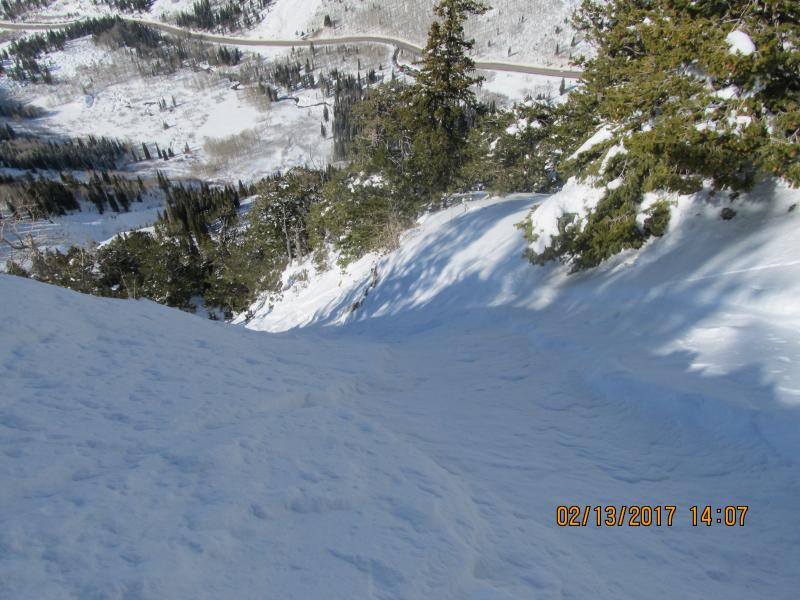
recent activity Yesterday air temperatures mostly reached the mid 30's F with temperatures in the 40's at lower elevations. These air temperatures combined with clear skies (which take heat out of the snowpack due to radiation exchange) prevented widespread loose, wet avalanches. Loose, dry snow avalanches or sluffs continued to occur. A solo skier just west of Snowbird's boundary and within sight of the Little Cottonwood Canyon road was caught and carried in a sluff yesterday. It carried him further than it would have otherwise as it ran on top of a hard ice crust. He was pushed into trees, was injured and had to call 911 for help. More photos and info HERE. Photo - Snowbird Ski Patrol
|
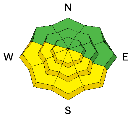
| type | aspect/elevation | characteristics |
|---|

|
|
LIKELIHOOD
 LIKELY
UNLIKELY
SIZE
 LARGE
SMALL
TREND
 INCREASING DANGER
SAME
DECREASING DANGER
|
|
description
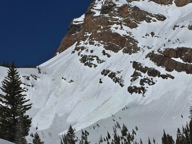
Today should be just a little warmer than yesterday causing a few more loose wet avalanches. They will most likely occur near rock outcrops and cliffs that get especially warm as the day progresses. The photo below (S. Zimmeram-Wall) is a good example of places where these slides will occur. Glide avalanches can be large and unpredictable. These can occur any time, and have been most active in Broads Fork.
|
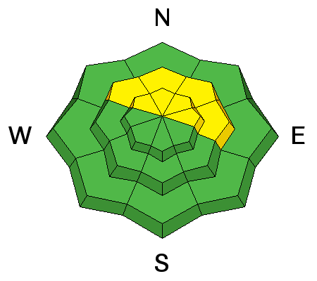
| type | aspect/elevation | characteristics |
|---|

|
|
LIKELIHOOD
LIKELY
UNLIKELY
SIZE
LARGE
SMALL
TREND
INCREASING DANGER
SAME
DECREASING DANGER
|
|
description
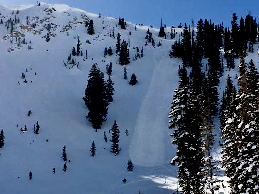
Loose, dry snow avalanches remain a concern mainly if they push you over rocks or into trees. Below is a photo of a well chosen ski line that avoids trees or rocks in the run out zone. A few lingering wind slabs from Sunday morning's SE winds could be triggered. MASSIVE cornices litter ridgelines. Avoid being near or under these monsters which can break in surprising places and times. Photo - S. Zimmerman-Wall
|
 |
weather Today will be a repeat of yesterday with light winds, sunny skies, and temperatuers warming to near 40 degrees F. |
general announcements
|