Observation Date
2/13/2017
Observer Name
Zimmerman Wall
Region
Salt Lake » Little Cottonwood Canyon » Snowbird periphery
Location Name or Route
Snowbird Periphery/Mary Ellen Gulch
Weather
Sky
Clear
Wind Direction
Northeast
Wind Speed
Light
Weather Comments
Cold morning with temps below freezing and light winds along the highest ridges. Warming was not as rapid as expected and the wind seemed to keep some windward surfaces cooler than imagined. However, the difference between sun and shade was noticeable, especially at the mid elevations.
Snow Characteristics
New Snow Depth
10"
New Snow Density
Low
Snow Surface Conditions
Powder
Faceted Loose
Wind Crust
Melt-Freeze Crust
Snow Characteristics Comments
I am still poking around in a variety of terrain to see exactly what this previous storm laid down. It is interesting to see the patterns developing across the range. Great settled powder is still in abundance on sheltered northerly terrain, although some very minor wind skins were found in open bowls where the wind had done its work.
Red Flags
Red Flags
Recent Avalanches
Rapid Warming
Red Flags Comments
I will say that everywhere you looked today you could see avalanches of some sort an every aspect and elevation. Wet loose seemed to be the order of the day yesterday as many solars went off. North facing was also very active. Cornices are still a prime concern and they have grown to gargantuan proportions in certain areas. Warming temps and wind loading are tipping the scales on this issue and I have seen several sizable pieces break off in the last week. This problem is easy to manage, stay off and out from underneath these behemoths.
Avalanche Problem #1
Problem
New Snow
Trend
Same
Problem #1 Comments
Given my terrain selection for the day, this was public enemy number one. The poorly bonded new snow is very reactive to skier input and sluffs run a very long way and begin to entrain a respectable amount of snow before they come to rest. Consequential terrain such as hanging snow fields, tight chutes, or rocky outcroppings were avoided. These avalanches would start in the upper 4" of lighter density and make their way down to the semi frozen old snow surface which had a minute layer of graupel sitting on top. Slippery, slow moving sluffs were easily managed and localized to the steepest high northerly terrain. Although I expect you cold find this problem on high elevation solars that would then move to a lower elevation and turn into more wet like avalanches.
Avalanche Problem #2
Problem
Wet Snow
Trend
Same
Problem #2 Comments
This problem is developing, and it is only February. We have a semi saturated snow pack on low and mid elevations and with continued warming, I would speculate that the freewater in the snowpack is beginning to percolate down to some previously buried storm density changes/graupel/etc and weaking the structure. I saw evidence of wet loose from yesterday, some of which started as roller balls, turned into fan shaped point releases, and then pulled out mini slabs that were of the D2 variety, damaging small timber and piling up like concrete.
Comments
Photos:
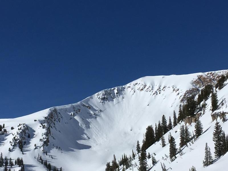
1. Evidence of natural slide in upper Mary Ellen Gulch (likely during storm). Crown is partially filled in (center of frame), but some new cornice fall is observed on left side.
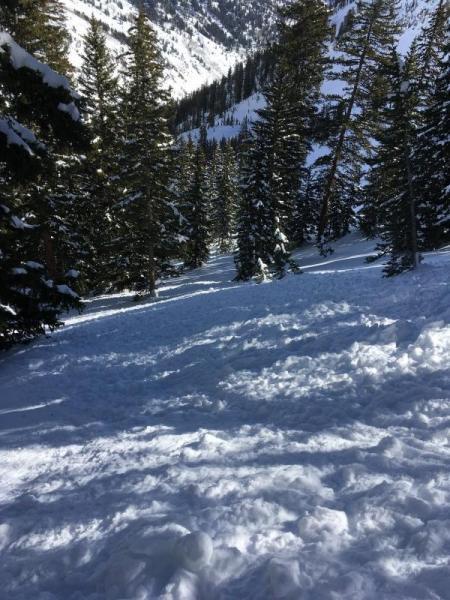
2 Loose dry in steep North facing terrain. Sluffs moved slowly but kept going, and going, and going. They put some decent piles into the trees below.
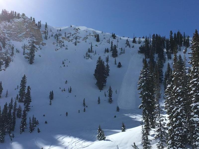
3. Skier triggered sluffs in open terrain were not as much of a problem.
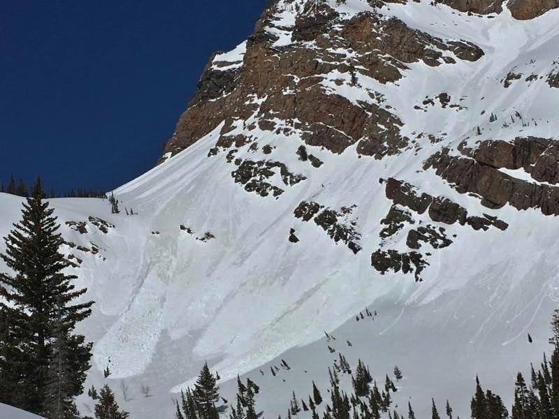
4. Wet loose, turning to wet slab
Today's Observed Danger Rating
Moderate
Tomorrows Estimated Danger Rating
Moderate