| Please join us at the 23rd annual Black Diamond Fall Fundraiser Party Thursday Sept 15. Tickets are on sale now here, at the Black Diamond store & at REI. Special bonus raffle for online ticket purchasers! |
| Please join us at the 23rd annual Black Diamond Fall Fundraiser Party Thursday Sept 15. Tickets are on sale now here, at the Black Diamond store & at REI. Special bonus raffle for online ticket purchasers! |
| Advisory: Salt Lake Area Mountains | Issued by Drew Hardesty for Monday - February 1, 2016 - 6:02am |
|---|

|
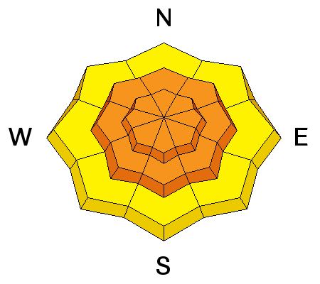
bottom line The danger is CONSIDERABLE in steep wind drifted terrain and more pronounced on the north to west to south facing slopes. The easterly winds result in unusual loading patterns and those that travel by rote may be surprised today. Sensitive wind drifts and long running natural sluffs should be prevalent in the steeper terrain of the mid and upper elevations. Deep slab avalanches up to 3-5' deep remain low probability/high consequence issues on a variety of aspects at the mid and upper elevations.
|
 |
special announcement Yard Sale! Stop by our facebook page and check out some goods we have for sale, donated by our many supporters. Gear includes skis, clothes, bindings, boots, 2 nights at the Talking Mountain Yurts in the LaSal mountains, and more. This helps to support avalanche forecasting and education. Every bit helps - thanks! Park City Mountain Resort has a new uphill policy. Check here for more details for PCMR and the other resorts. A couple great events coming up this week -
|
 |
current conditions A monster of a storm, but not for us. The blockbuster is not far from Vegas and golf games in St George are being postponed for the next day or two (for all those without a day-glow golf ball anyway). If you have friends down in southwest Utah, let them know we've issued an Avalanche Warning for the mountains in their backyard. We're getting some spillover wrap-around moisture on an east to northeast flow as the upper Low tracks to the south of us. Can't complain too much with overnight snowfall totals so far of 4"/.39" in LCC, 5"/.4" in mid-BCC and 10"/.65" in upper BCC and along the Park City Ridgeline. Ogden and Provo have earned 2" and 8"/.46"; respectively. I say "earned" because the snow is being ushered in by very cold temperatures (single digits) and dastardly east winds. Anemometers are reading wind speeds 15-20mph; though I suspect these southeast-backing-to-northeast winds are underdone. My sense is that they are and will blow 25-30+. Wind chill is twenty below. |
 |
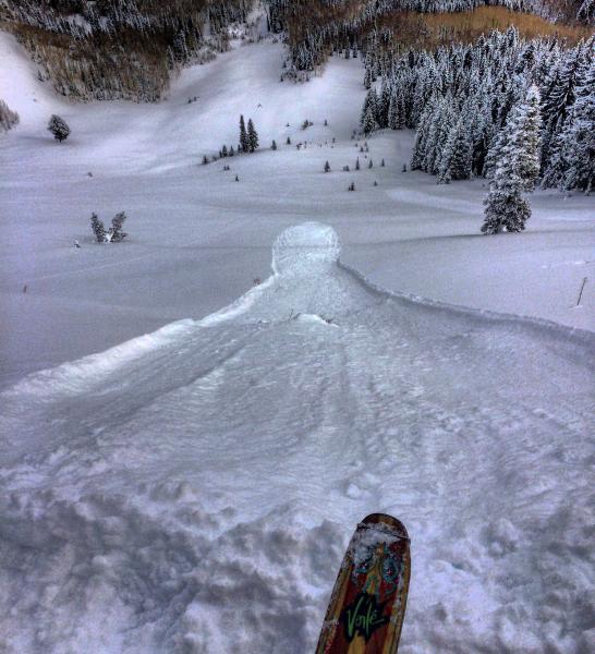
recent activity Fairly widespread sluffing in the low density snow was noted on a variety of aspects yesterday, but they needed slopes approaching 40° and steeper. Minor wet loose activity also noted on some steep east facing terrain by mid-morning with the direct sun, but that's now a thing of the past, noted only in a scratchy breakable crust in that terrain today.
I work in the Tetons in the summer and risk to our team is central to the calculus of planning and executing a rescue or recovery in the mountains. This is oversimplified and perhaps a bit overblown, but we "Risk a little to save a little, risk a lot to save a lot." This was what I was thinking yesterday on my backcountry tour in that the snow was great almost anywhere. One could push it in steep northerly terrain, but there was no need to do so. You could risk a lot for good snow or you could risk almost nothing for the same by choosing lower angle terrain on any aspect. Different risk, same reward. |
| type | aspect/elevation | characteristics |
|---|

|
|
LIKELIHOOD
 LIKELY
UNLIKELY
SIZE
 LARGE
SMALL
TREND
 INCREASING DANGER
SAME
DECREASING DANGER
|
|
description
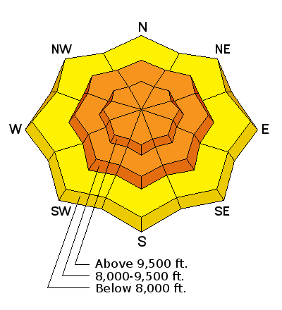
Sensitive new and developing wind drifts up to a couple feet deep will be found in steeper terrain in unusual aspects and loading zones today. There's plenty of low density snow to blow around and those that travel by rote will be surprised at the new pattern of drifts from the gusty southeast to northeast winds. In the off-chance the surface hoar wasn't destroyed and the arms of the low density dendrites weren't hacked off by the winds, these drifts may be sensitive enough to be triggered at a distance. Cornices may also calve off on approach as they did yesterday along the south end of the PC ridgeline. |
| type | aspect/elevation | characteristics |
|---|

|
|
LIKELIHOOD
LIKELY
UNLIKELY
SIZE
LARGE
SMALL
TREND
INCREASING DANGER
SAME
DECREASING DANGER
|
|
description
More low density new snow on top of more low density new snow should make for continued sluffing and point releases on the steepest slopes at the mid and upper elevations. Remember to look over your shoulder if you're descending steep terrain; move diagonally across the slope and move from spine to spine if choosing steeper wind-sheltered terrain today. Although these sluffs are fairly predictable and manageable, they're likely to run spontaneously today and could be problematic if you find yourself above unforgiving terrain. |
| type | aspect/elevation | characteristics |
|---|

|
|
LIKELIHOOD
 LIKELY
UNLIKELY
SIZE
 LARGE
SMALL
TREND
INCREASING DANGER
SAME
DECREASING DANGER
|
|
description
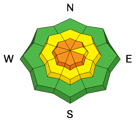
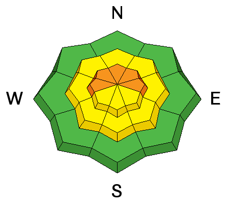
The monsters in the basement. Are they healing? Many signs point to yes; however they're always slow to heal. Pockety deep slab avalanches exist on a variety of aspects and elevations and tend to be more stressed during times of additional loading and/or large triggers such as multiple sleds on a slope, large cornice fall, or step down avalanching from slides cascading down from above. What's unusual is that they're also found on on the southerly end of the dial. The weak early season snow is now buried by upwards of 50-80"+ of snow. That's not the problem. The problem is that the steep slopes that have avalanched once or even twice this season harbor much shallower snow above. Trigger points include steep, thin, rocky terrain. |
 |
weather I'd expect another few low density inches today on a northeast to northerly flow. Mountain temps will be in the single digits, dropping to 0°F tomorrow. Northeast to north winds will remain brisk, blowing 25-30mph. We'll be in a cold moist northwest flow over the next couple days with high pressure building late in the week. |
| general announcements Remember your information can save lives. If you see anything we should know about, please participate in the creation of our own community avalanche advisory by submitting snow and avalanche conditions. You can also call us at 801-524-5304, email by clicking HERE, or include #utavy in your tweet or Instagram. To get help in an emergency (to launch a rescue) in the Wasatch, call 911. Be prepared to give your GPS coordinates or the run name. Dispatchers have a copy of the Wasatch Backcountry Ski map. Backcountry Emergencies. It outlines your step-by-step method in the event of a winter backcountry incident. If you trigger an avalanche in the backcountry, but no one is hurt and you do not need assistance, please notify the nearest ski area dispatch to avoid a needless response by rescue teams. Thanks. Salt Lake and Park City – Alta Central (801-742-2033), Canyons Resort/PCMR Dispatch (435)615-1911 Snowbasin Resort Dispatch (801-620-1017), Powder Mountain Dispatch (801-745-3772 x 123). Sundance Dispatch (801-223-4150) EMAIL ADVISORY If you would like to get the daily advisory by email you will need to subscribe here. DAWN PATROL Hotline updated daily by 5-530am - 888-999-4019 option 8. Twitter Updates for your mobile phone - DETAILS UDOT canyon closures: LINK TO UDOT, or on Twitter, follow @UDOTavy, @CanyonAlerts or @AltaCentral Utah Avalanche Center mobile app - Get your advisory on your iPhone along with great navigation and rescue tools. Powderbird Helicopter Skiing - Blog/itinerary for the day Lost or Found something in the backcountry? - http://nolofo.com/ To those skinning uphill at resorts: it is your responsibility to know the resort policy on uphill travel. You can see the uphill travel policy for each resort here. IMPORTANT: Before skinning or hiking at a resort under new snow conditions, check in with Ski Patrol. Resorts can restrict or cut off access if incompatible with control and grooming operations. Benefit the Utah Avalanche Center when you shop from Backcountry.com or REI: Click this link for Backcountry.com or this link to REI, shop, and they will donate a percent of your purchase price to the UAC. Both offer free shipping (with some conditions) so this costs you nothing! Benefit the Utah Avalanche Center when you buy or sell on ebay - set the Utah Avalanche Center as a favorite non-profit in your ebay account here and click on ebay gives when you buy or sell. You can choose to have your seller fees donated to the UAC, which doesn't cost you a penny. This information does not apply to developed ski areas or highways where avalanche control is normally done. This advisory is from the U.S.D.A. Forest Service, which is solely responsible for its content. This advisory describes general avalanche conditions and local variations always exist. |