25th Annual Black Diamond Fall Fundraising Party
Thursday, September 13; 6:00-10:00 PM; Black Diamond Parking Lot
25th Annual Black Diamond Fall Fundraising Party
Thursday, September 13; 6:00-10:00 PM; Black Diamond Parking Lot
| Advisory: Ogden Area Mountains | Issued by Paige Pagnucco for Wednesday - January 17, 2018 - 5:59am |
|---|

|
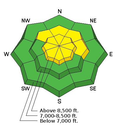
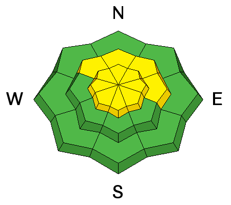
bottom line The avalanche danger is MODERATE. Heightened avalanche danger exists on steep, mid and upper elevation slopes facing northerly through easterly. Human triggered avalanches are possible, and large, deadly avalanches can be triggered in isolated places. Use a slope inclinometer and compass to identify and avoid the steep, north through easterly facing slopes, where you are most likely to trigger an avalanche. If you're headed into the backcountry - or exiting though the gates at the ski area - you must have the proper gear, training, and skilled partners.
|
 |
special announcement To get help in an emergency (to request a rescue) in the Wasatch, call 911. Be prepared to give your GPS coordinates. If you trigger an avalanche in the backcountry, but no one is hurt and you do not need assistance, please notify the nearest ski area dispatch to avoid a needless response by rescue teams. Thanks.
|
 |
current conditions Currently in the Ogden area mountains it's in the mid to high 20's F and winds are out of the west at 5-10 mph with gusts in the teens. Areas of softer now are getting harder and harder to find but if you hunt for shady, wind sheltered, low angle slopes above about 8,000', you might find some "loud" powder with surface hoar and near surface facets making for fast, fun riding conditions. Sun affected slopes have a crust that should soften with today's warmth and direct sun. Some observers have even found "corn" snow on south facing slopes. Overall, the Ogden area is in dire need of a real Utah winter storm that'll help to cover up bushes, stumps and rocks, make approaches less "sporty", and bring the zone to a more user friendly status. Stay tuned ... |
 |
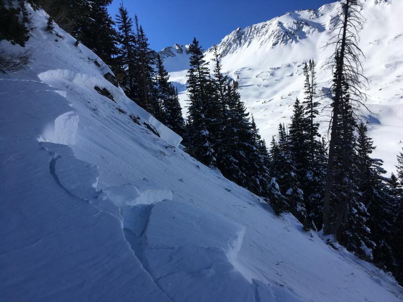
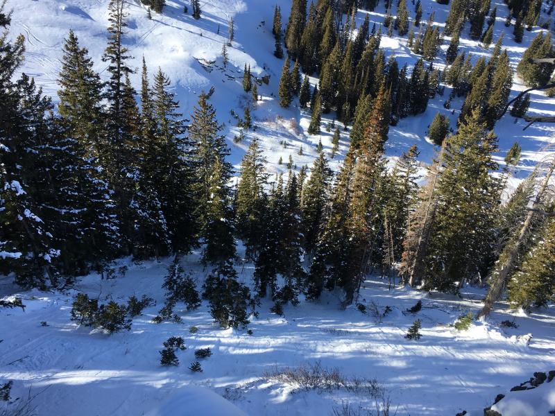
recent activity Besides last week's natural cycle, there have been no recent reports of avalanches from the backcountry or at the Ogden resorts. Here's a link to read about last week's avalanche activity. Seems like all the action is to the north and south of the Ogden area mountains in terms of close calls. UAC forecasters checked out a few avalanche accidents yesterday where the riders involved rolled the dice and somehow got seriously lucky. Maybe the Ogden riders and sliders aren't as prone to gambling - which is a good thing when you are dealing with persistent weaknesses. Here's a picture from the Logan zone on the east side of Logan Peak where two riders triggered a LARGE, hard slab avalanche on Sunday. One rider was able to outrun it while the other miraculoulsy got spit out at the toe. We'll post more info today. This path has had numerous close calls as well as fatalitlies in the past.
Another close call from the weekend in the Cardiff area where a skier triggered a slab avalanche and was reportedly mostly buried. He came away uninjured despite being dragged through tight trees along the way. Read the report here.
|
| type | aspect/elevation | characteristics |
|---|

|
|
LIKELIHOOD
 LIKELY
UNLIKELY
SIZE
 LARGE
SMALL
TREND
 INCREASING DANGER
SAME
DECREASING DANGER
|
|
description
Human-triggered persistent slab avalanches are still possible in the Ogden zone. These types of avalanches are getting harder and more stubborn to trigger but, if you happen to find the "sweet" spot, perhaps in a shallower area, the consequences of failure still remain high. It will be easier to trigger the slab where it is thinner and/or if you exert more force, like if you are on a snowmobile or snowbike. Overall, poor snowpack structure exists above about 8300' in the Ogden area mountains and is most pronounced on the northerly through easterly aspects. (Both the Logan and Salt Lake accidents were avalanches that failed on a persistent weak layer.) Terrain choice is really the only thing we can control. Avoid steep slopes (above 30 degrees) on north through east facing slopes at mid and upper elevations today and you'll avoid this problem. |
 |
weather Today will be a beauty in the Ogden area mountains - sunshine, temperatures nearing 40 F and calm winds. A great day to walk around in the mountains and take a look around before the next storm arrives. Confidence is high for a real winter storm to impact the Ogden zone Friday through Saturday. Too early to guesstimate potential snow amounts but word has it that Ben Lomond could get a direct hit. Tomorrow things start ramping up with warm temperatures, increasing clouds and winds picking up speed into the afternoon/evening. |
| general announcements CLICK HERE FOR MORE GENERAL INFO AND FAQ Support the UAC through your daily shopping. When you shop at Smith's, or online at REI, Backcountry.com, Patagonia, NRS, Amazon, eBay a portion of your purchase will be donated to the FUAC. See our Donate Page for more details on how you can support the UAC when you shop. Benefit the Utah Avalanche Center when you buy or sell on eBay - set the Utah Avalanche Center as a favorite non-profit in your eBay account here and click on eBay gives when you buy or sell. You can choose to have your seller fees donated to the UAC, which doesn't cost you a penny. This information does not apply to developed ski areas or highways where avalanche control is normally done. This advisory is from the U.S.D.A. Forest Service, which is solely responsible for its content. This advisory describes general avalanche conditions and local variations always occur. |