| Please join us at the 23rd annual Black Diamond Fall Fundraiser Party Thursday Sept 15. Tickets are on sale now here, at the Black Diamond store & at REI. Special bonus raffle for online ticket purchasers! |
| Please join us at the 23rd annual Black Diamond Fall Fundraiser Party Thursday Sept 15. Tickets are on sale now here, at the Black Diamond store & at REI. Special bonus raffle for online ticket purchasers! |
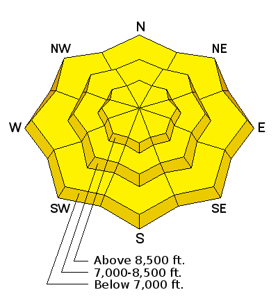
| Advisory: Ogden Area Mountains | Issued by Brett Kobernik for Wednesday - February 10, 2016 - 7:10am |
|---|

|
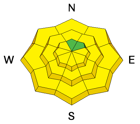
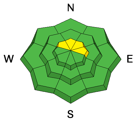
bottom line The avalanche danger starts out mostly LOW this morning but will rise to MODERATE as the daytime heating starts. Carefully monitor the sunny slopes you are on and what is above you watching for the snow to become damp and sloppy.
|
 |
special announcement Wednesday February 10th - Avalanche Clinic for Ice Climbers at 6 p.m. at Sandy Momentum climbing gym. For more info click HERE. Thursday, February 10th, the Utah Adventure Journal speaker series features Todd Offenbacher More info HERE. |
 |
current conditions Temperatures are mild in the high country this morning with readings at 9500 feet in the mid to upper 30s. This is the first night we've seen overnight temperatures above freezing. Wind speeds are light from the west or southwest. Riding conditions have deteriorated on many aspects due to sun and wind but folks are still finding enjoyable snow. |
 |
recent activity It appears that wet activity on Tuesday was not as active as the previous days. |
| type | aspect/elevation | characteristics |
|---|

|
|
LIKELIHOOD
 LIKELY
UNLIKELY
SIZE
 LARGE
SMALL
TREND
 INCREASING DANGER
SAME
DECREASING DANGER
|
|
description
Wet activity can be hard to forecast. The key is to just pay attention during the day and be ready to move off of slopes as they become too wet. Here are some other things to consider today. Despite warm overnight temperatures, radiational cooling should have frozen the snow surface up again. Although, warm temperatures overnight may lead to the wet activity getting an earlier start today. However, we may see some thin clouds that would counteract the heating some and lessen the wet activity. Also, usually the wet activity is most active during the first few days of the heating event. But, as temperatures remain warm overnight for a number of days, we can see percolation of the melt water loosen up deeper weak layers. So, there is a big push-pull affect that you should keep in mind but most importantly, choose terrain where you can exit easily if things become more unstable more quickly than you anticipated. Here's a great video from Bruce who was looking at southerly facing terrain on Tuesday: Bruce checking southerly slopes for wet activity |
| type | aspect/elevation | characteristics |
|---|

|
|
LIKELIHOOD
 LIKELY
UNLIKELY
SIZE
LARGE
SMALL
TREND
 INCREASING DANGER
SAME
DECREASING DANGER
|
description
|
 |
weather Someone definitely flipped the switch on what seemed like an unending series of storms. We are seeing the exact opposite now with a significant ridge of high pressure that will stay with us at least through the weekend. Temperatures will again be warm today with 9500 foot highs in the low 40s. West southwest wind should be light to moderate in speed. We'll probably see some high clouds that may not be much more than fairly thin. Thursday looks similar with perhaps a few more clouds and slightly warmer temperatures. |
general announcements
|


