| Please join us at the 23rd annual Black Diamond Fall Fundraiser Party Thursday Sept 15. Tickets are on sale now here, at the Black Diamond store & at REI. Special bonus raffle for online ticket purchasers! |
| Please join us at the 23rd annual Black Diamond Fall Fundraiser Party Thursday Sept 15. Tickets are on sale now here, at the Black Diamond store & at REI. Special bonus raffle for online ticket purchasers! |
| Advisory: Ogden Area Mountains | Issued by Evelyn Lees for Monday - February 8, 2016 - 7:18am |
|---|

|
bottom line The avalanche danger is MODERATE on steep upper elevation slopes for triggering a wind drift. The danger is also MODERATE for triggering a wet, loose sluff with daytime heating and strong sun - natural wet loose slides can also be expected, so also avoid travel below the steep sunny slopes once they heat.
And finally, a MODERATE avalanche danger remains on steep, mid to upper elevation slopes facing west through north through east, where deep slides breaking near the ground can be triggered in shallower snowpack areas, especially slopes that have slid one or more times this year.
|
 |
special announcement Tuesday February 9th - Fireside Chat at 7 p.m. at Black Diamond. UAC Forecaster Brett Kobernik will discuss current conditions and his own avalanche involvement on the Skyline from last week. Wednesday February 10th - Avalanche Clinic for Ice Climbers at 6 p.m. at Sandy Momentum climbing gym. For more info click HERE. Yard Sale! Stop by our facebook page and check out some goods we have for sale, donated by our many supporters, including skis, clothes, bindings, and boots. |
 |
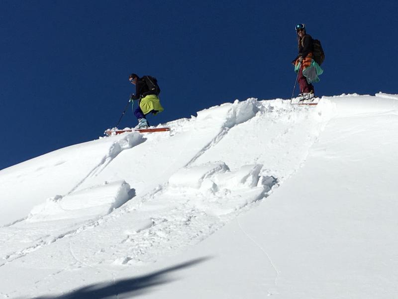
current conditions Under clear skies, temperatures at most elevations range from the mid 20s to 30 degrees, with the coolest temperatures in the canyon bottoms. The northerly winds are only averaging 5 to 15 mph, even across the highest peaks. Between wind damage and sun crusts, powder is becoming rare commodity - the prime real estate is on mid and upper elevation, northwest through northeasterly facing slopes that are wind sheltered. Kory Davis photo of typical Ogden wind sculpted surface.
|
 |
recent activity Recently reported avalanche activity from the Ogden area mountains includes: a class 2 "pocket" (class 2 means deep enough to bury some one) in the Mill Canyon area a few days ago, failing on surface hoar; a recent slide of the ridge line of Ben Lomond, N facing, 9,000' (perhaps a wind slab?) and wet loose activity from Saturday. |
| type | aspect/elevation | characteristics |
|---|

|
|
LIKELIHOOD
 LIKELY
UNLIKELY
SIZE
 LARGE
SMALL
TREND
 INCREASING DANGER
SAME
DECREASING DANGER
|
|
description
Along mid and upper elevation ridge lines and in open bowls, you will find firm to hard wind slabs on a variety of aspects. Expect them to be stiff and less reactive today – which means you could get well out onto the slab before it fails above you. The terrain you’re in determines how serious these slabs are – if you can be carried off a cliff, into trees or go for a very long ride, getting knocked off balance by even a small wind slab is very bad news. |
| type | aspect/elevation | characteristics |
|---|

|
|
LIKELIHOOD
 LIKELY
UNLIKELY
SIZE
LARGE
SMALL
TREND
 INCREASING DANGER
SAME
DECREASING DANGER
|
|
description
A good overnight refreeze under clear skies will have the snow surface well frozen this morning, and stable. But like clockwork, with sun, daytime heating and light winds – the snow surface will rapidly heat and wet sluffs could be a little larger today. The Ogden area mountains have a rain crust to somewhere between 7,200' and 8,000', depending on exact location. From these elevations down, this crust is a slick surface for the wet sluffs to run on. In a few isolated places, a wet sluff could break down into deeper wet layers. So, as soon as the crusts become punchy, the snow damp and sloppy or you if trigger small wet sluffs, it’s time to get off and out from under those steep sunny slopes and head to cooler terrain. Even the snow on the shady terrain is slowly heating, to a higher elevation each day. Using a small test slope Saturday to check the sensitivity of heating wind drifts. Results - positive! Women's Backcountry 101 class.
|
| type | aspect/elevation | characteristics |
|---|

|

|
LIKELIHOOD
 LIKELY
UNLIKELY
SIZE
 LARGE
SMALL
TREND
 INCREASING DANGER
SAME
DECREASING DANGER
|
|
description
Only in isolated places could you still trigger a deep slab breaking on facets near the ground. The most likely terrain would be in shallow snow pack areas, especially slopes that have slid one or more times this winter. This is the wild card – very low probability, but with large consequences. Trigger points could be shallower spots on a slope, such as rock areas or steep break overs. |
 |
weather It’s going to be another warm, sunny day, with mostly clear skies. Ridge line temperatures will warm to near freezing, and 8000’ highs into the low 40s. The northerly winds will continue to decrease, with most stations averaging less than 10 mph. As the strong ridge becomes centered overhead Tuesday and Wednesday, ridge line temperatures will reach into the upper 30s. Looking to the future, unfortunately there is no new snow in sight. |
| general announcements Remember your information can save lives. If you see anything we should know about, please participate in the creation of our own community avalanche advisory by submitting snow and avalanche conditions. You can also call us at 801-524-5304, email by clicking HERE, or include #utavy in your tweet or Instagram. To get help in an emergency (to launch a rescue) in the Wasatch, call 911. Be prepared to give your GPS coordinates or the run name. Dispatchers have a copy of the Wasatch Backcountry Ski map. Backcountry Emergencies. It outlines your step-by-step method in the event of a winter backcountry incident. If you trigger an avalanche in the backcountry, but no one is hurt and you do not need assistance, please notify the nearest ski area dispatch to avoid a needless response by rescue teams. Thanks. Salt Lake and Park City – Alta Central (801-742-2033), Canyons Resort/PCMR Dispatch (435)615-1911 Snowbasin Resort Dispatch (801-620-1017), Powder Mountain Dispatch (801-745-3772 x 123). Sundance Dispatch (801-223-4150) EMAIL ADVISORY If you would like to get the daily advisory by email you will need to subscribe here. DAWN PATROL Hotline updated daily by 5-530am - 888-999-4019 option 8. Twitter Updates for your mobile phone - DETAILS UDOT canyon closures: LINK TO UDOT, or on Twitter, follow @UDOTavy, @CanyonAlerts or @AltaCentral Utah Avalanche Center mobile app - Get your advisory on your iPhone along with great navigation and rescue tools. Powderbird Helicopter Skiing - Blog/itinerary for the day Lost or Found something in the backcountry? - http://nolofo.com/ To those skinning uphill at resorts: it is your responsibility to know the resort policy on uphill travel. You can see the uphill travel policy for each resort here. IMPORTANT: Before skinning or hiking at a resort under new snow conditions, check in with Ski Patrol. Resorts can restrict or cut off access if incompatible with control and grooming operations. Benefit the Utah Avalanche Center when you shop from Backcountry.com or REI: Click this link for Backcountry.com or this link to REI, shop, and they will donate a percent of your purchase price to the UAC. Both offer free shipping (with some conditions) so this costs you nothing! Benefit the Utah Avalanche Center when you buy or sell on ebay - set the Utah Avalanche Center as a favorite non-profit in your ebay account here and click on ebay gives when you buy or sell. You can choose to have your seller fees donated to the UAC, which doesn't cost you a penny. This information does not apply to developed ski areas or highways where avalanche control is normally done. This advisory is from the U.S.D.A. Forest Service, which is solely responsible for its content. This advisory describes general avalanche conditions and local variations always exist. |