| Please join us at the 23rd annual Black Diamond Fall Fundraiser Party Thursday Sept 15. Tickets are on sale now here, at the Black Diamond store & at REI. Special bonus raffle for online ticket purchasers! |
| Please join us at the 23rd annual Black Diamond Fall Fundraiser Party Thursday Sept 15. Tickets are on sale now here, at the Black Diamond store & at REI. Special bonus raffle for online ticket purchasers! |
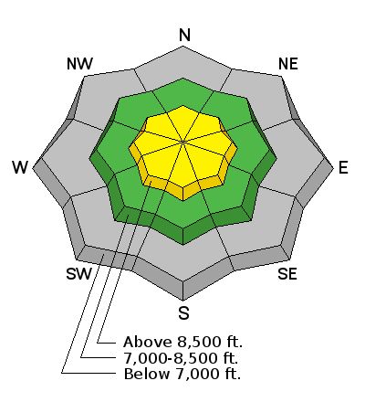
| Advisory: Ogden Area Mountains | Issued by Drew Hardesty for Tuesday - November 17, 2015 - 7:29am |
|---|

|
bottom line Shallow areas of new wind drifts up high will lead to areas of Moderate danger. They'll be pockety in nature and relegated to the upper elevations and may be sensitive to human weight. Avoid the smooth and rounded drifts and remember that any slide will likely result in traumatic injury due to the thin snow cover.
|
 |
special announcement
Remember, control work is not being done at the unopened ski areas, and that terrain must be treated as backcountry. |
 |
current conditions Snow depths are roughly 6-10" at the mid and upper elevations, though you'd still consider yourself lucky to ride without tripping over rocks and deadfall. Now with the storm rolling off to the east, temperatures have plummeted into the teens. Winds - oh yes the bad news - the winds picked up in the early afternoon yesterday and remain moderate to strong, currently blowing 45mph with gusts to 60 along the highest peaks and ridgelines.
|
 |
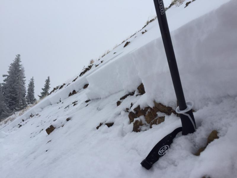
recent activity The Ogden mountain barely have enough snow, but what we have in the central Wasatch may be a portent of things to come in Ogden. Breaking trail along the west ridge of 10,420', it felt that we were just on this side of the tipping point for avalanche activity. Cracking around the skis and wide propagation of shooting cracks above and adjacent to me was the rule and not the exception. Perhaps with a touch more wind.... "The Wind Was a Game Changer." Along the south end of the Park City ridgeline an experienced backcountry party did find the tipping point and remotely triggered a 6-12" deep and 150' wide avalanche on a steep northwest terrain feature at 9400'. The party undercut the slope and had the avalanche pull out well above them, essentially ripping out to the weak faceted snow near the ground. Their excellent report can be found here. (Photo - S. Deutschlander)
|
| type | aspect/elevation | characteristics |
|---|

|
|
LIKELIHOOD
 LIKELY
UNLIKELY
SIZE
 LARGE
SMALL
TREND
 INCREASING DANGER
SAME
DECREASING DANGER
|
|
description
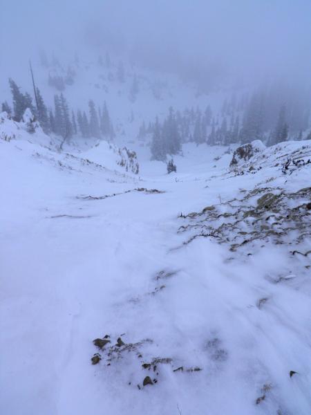
Plenty, plenty of low density snow to blow around. While the most severe winds currently seem to be relegated to the highest elevations, it's often surprising to see the extent of the drifting and wind loading across the landscape. With strong winds, classic starting zones may be scoured or sensitive drifts may lie a third of the way down the run. (Photo Mark White). Pay close attention to where areas have been - and are currently being - loaded or cross-loaded into steep terrain. Some hard slabs will be welded in, some may pull out while you're a few turns into the slope. Click on the 'i' next to the infographic for more info. Extra Caution: Any wind slab triggered at the mid and upper elevation west through north through east facing terrain may steep down to the ground, resulting in a larger avalanche.
|
 |
weather Increased cloud cover, a warming trend, and sustained moderate to strong northwest winds are in store for the mountains today. We'll see temps rising to the low to mid 20s at 10,000', the upper 20s to low 30s at 8000'. The northwesterlies keep their momentum through the afternoon, blowing 35-40mph along the most exposed ridgelines. Some spits of precipitation and riming may be possible over the next few days with alternating warm air advection and minor cold fronts. It all may add up to a few inches here and there tomorrow and again Thursday night. Most of the energy, wind and precip looks to ride to the north of us. |
| general announcements Remember your information can save lives. If you see anything we should know about, please participate in the creation of our own community avalanche advisory by submitting snow and avalanche conditions. You can also call us at 801-524-5304, email by clicking HERE, or include #utavy in your tweet or Instagram. To get help in an emergency (to launch a rescue) in the Wasatch, call 911. Be prepared to give your GPS coordinates or the run name. Dispatchers have a copy of the Wasatch Backcountry Ski map. If you trigger an avalanche in the backcountry, but no one is hurt and you do not need assistance, please notify the nearest ski area dispatch to avoid a needless response by rescue teams. Thanks. Salt Lake and Park City – Alta Central (801-742-2033), Canyons Resort/PCMR Dispatch (435)615-1911 Snowbasin Resort Dispatch (801-620-1017), Powder Mountain Dispatch (801-745-3772 x 123). Sundance Dispatch (801-223-4150) EMAIL ADVISORY If you would like to get the daily advisory by email you will need to subscribe here. DAWN PATROL Hotline updated daily by 5-530am - 888-999-4019 option 8. Twitter Updates for your mobile phone - DETAILS UDOT canyon closures: LINK TO UDOT, or on Twitter, follow @UDOTavy, @CanyonAlerts or @AltaCentral Utah Avalanche Center mobile app - Get your advisory on your iPhone along with great navigation and rescue tools. Wasatch Powderbird Guides Blog/Itinerary for the Day. Lost or Found something in the backcountry? - http://nolofo.com/ To those skinning uphill at resorts: it is your responsibility to know the resort policy on uphill travel. You can see the uphill travel policy for each resort here. IMPORTANT: Before skinning or hiking at a resort under new snow conditions, check in with Ski Patrol. Resorts can restrict or cut off access if incompatible with control and grooming operations. Benefit the Utah Avalanche Center when you shop from Backcountry.com or REI: Click this link for Backcountry.com or this link to REI, shop, and they will donate a percent of your purchase price to the UAC. Both offer free shipping (with some conditions) so this costs you nothing! Benefit the Utah Avalanche Center when you buy or sell on ebay - set the Utah Avalanche Center as a favorite non-profit in your ebay account here and click on ebay gives when you buy or sell. You can choose to have your seller fees donated to the UAC, which doesn't cost you a penny. This information does not apply to developed ski areas or highways where avalanche control is normally done. This advisory is from the U.S.D.A. Forest Service, which is solely responsible for its content. This advisory describes general avalanche conditions and local variations always exist. |