| Please join us at the 23rd annual Black Diamond Fall Fundraiser Party Thursday Sept 15. Tickets are on sale now here, at the Black Diamond store & at REI. Special bonus raffle for online ticket purchasers! |
| Please join us at the 23rd annual Black Diamond Fall Fundraiser Party Thursday Sept 15. Tickets are on sale now here, at the Black Diamond store & at REI. Special bonus raffle for online ticket purchasers! |
| Advisory: Moab Area Mountains | Issued by Eric Trenbeath for Friday - February 19, 2016 - 6:25am |
|---|

|
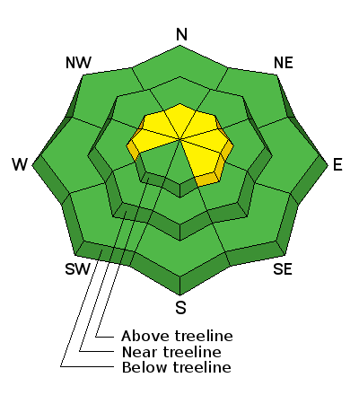
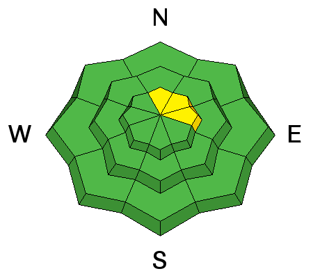
bottom line In upper elevation, wind exposed terrain there is a MODERATE avalanche danger both for newly deposited wind slabs, and older persistent slabs. This danger exists primarily on steep, northerly facing aspects, on the lee sides of terrain features, gully walls, or beneath rock bands. At mid and lower elevations, the avalanche danger is generally LOW.
|
 |
special announcement With the freedom of the backcountry comes responsibility, and this social responsibility in backcountry avalanche terrain is paramount as backcountry use explodes. Establishing a clear set of expectations in terms of Knowledge, Awareness and Wisdom is imperative to protect ourselves as well as our access to backcountry terrain. Backcountry Responsibility Objective from Trent Meisenheimer on Vimeo.
|
 |
current conditions Nuking southwest winds, in excess of 70 mph, blew down trees and strafed the snow surface to the point that it is now nearly impossible to find any soft, settled snow anywhere. I'm usually pretty optimistic about being able to find some decent riding and turning conditions but I'm about ready to throw in the towel. High pressure is again returning for the long term, and our best hope will again be to focus on southerly aspects in the hopes of finding some corn like snow in the next few days. In addtition to turning the snow surface into craters of the moon, the strong winds transported a fair amount of snow. Check out this video:
La Sal wind transported snow 021816 from Utah AvalancheCenter on Vimeo. Winds this morning have backed off to around 20 mph along ridgetops from the southwest, and it is currently 23 degrees at 10,000;.
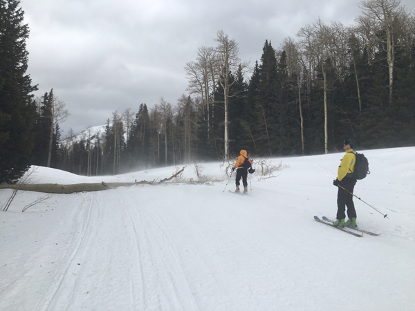
This tree blew down over the groomed trail into Gold Basin. Winds, temperature and humidity on Pre-Laurel Peak New snow totals, temperature and humidity in Gold Basin Total snow depth and temperature at Geyser Pass Trailhead |
 |
recent activity
|
| type | aspect/elevation | characteristics |
|---|

|
|
LIKELIHOOD
 LIKELY
UNLIKELY
SIZE
 LARGE
SMALL
TREND
 INCREASING DANGER
SAME
DECREASING DANGER
|
|
description
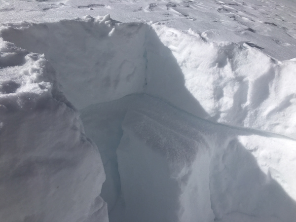
Strong winds yesterday dug into the snow surface and moved plenty of snow around. New, stiff wind slabs up to 6" deep have developed on the lee sides of terrain features, and in out of the way places in wind exposed terrain. Yesterday, I found them to be non-reactive on slopes less steep than 35 degrees right around treeline, but I suspect that if you get into steeper terrain up in the alpine you could trigger a slide with enough oomph in it to take you for a ride. Be on the lookout for stiff, supportable snow with a smooth, chalky surface that feels hollow like a drum. A triggered wind slab also has the potential to step down to a buried, near surface facet layer causing a deeper, more dangerous avalanche.
In spite of a lack of available loose snow for transport, there was a lot of snow blowing around up there yesterday. |
| type | aspect/elevation | characteristics |
|---|

|
|
LIKELIHOOD
 LIKELY
UNLIKELY
SIZE
 LARGE
SMALL
TREND
INCREASING DANGER
SAME
DECREASING DANGER
|
|
description
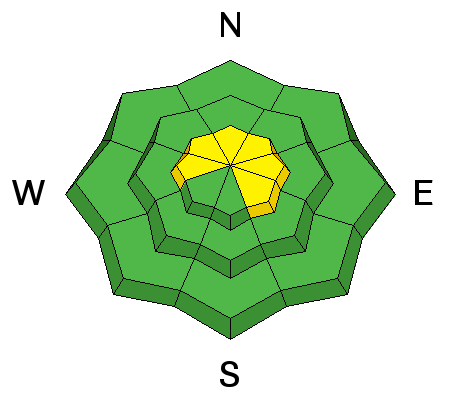
In general, the danger for triggering a persistent slab, or deep persistent slab is growing increasingly unlikely but there are still a few isolated areas where buried, near surface facets exist in the upper portion of the snowpack. There are also a few places where the snowpack is shallow enough that an overlying slab could be triggered down to basal facets, or depth hoar in the ground Areas where you may still encounter a problem are on steep, northerly facing aspects where the snow is shallow, or in areas of extreme rocky terrain.
New wind slabs have been added to the top of this structure, and it is still possible to trigger an avalanche down to this buried weak layer of faceted snow. |
 |
weather Back into the doldrums we go. Today Sunny, with a high near 39. Windy, with a southwest wind 15 to 20 mph increasing to 25 to 30 mph in the morning. Winds could gust as high as 40 mph. Tonight Mostly clear, with a low around 25. Windy, with a west southwest wind 20 to 30 mph, with gusts as high as 40 mph. Saturday Sunny, with a high near 41. Breezy, with a west southwest wind 15 to 20 mph. Saturday Night Mostly clear, with a low around 29. Northwest wind 5 to 10 mph becoming east northeast after midnight. Sunday Mostly sunny, with a high near 34. Light north northwest wind becoming northwest 5 to 10 mph in the afternoon. |
| general announcements Road Conditions: The road is plowed and mostly melted out down to the dirt. Grooming: A tree is down over the Gold Basin trail. A Forest Service sawyer will get up there as quick as they can to cut it out. To post an observation go here. You can view Moab observations here. You can also give me a call on my cell phone at 801-647-8896 To receive this advisory by email go here. This information does not apply to developed ski areas or highways where avalanche control is normally done. This advisory is from the U.S.D.A. Forest Service, which is solely responsible for its content. This advisory describes general avalanche conditions and local variations always exist. |