| Please join us at the 23rd annual Black Diamond Fall Fundraiser Party Thursday Sept 15. Tickets are on sale now here, at the Black Diamond store & at REI. Special bonus raffle for online ticket purchasers! |
| Please join us at the 23rd annual Black Diamond Fall Fundraiser Party Thursday Sept 15. Tickets are on sale now here, at the Black Diamond store & at REI. Special bonus raffle for online ticket purchasers! |
| Advisory: Moab Area Mountains | Issued by Bruce Tremper for Tuesday - February 2, 2016 - 6:22am |
|---|

|
bottom line There is a CONSIDERABLE danger of human triggered avalanches today, meaning "Dangerous conditions. Choose conservative terrain." You'll likely find human triggered avalanche potential in two types of terrain: 1) on the buried, persistent weak layers in the preexisting snow on the shady aspects, such as northwest, north, northeast and east facing slopes. 2) on any steep slope with recent wind deposits.
|
 |
avalanche warning I have allowed the Avalanche Warning to expire. |
 |
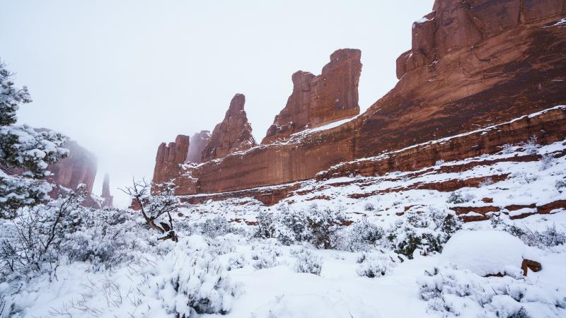
current conditions Hello, this is Bruce Tremper, filling in for Eric Trenbeath for the next week. It was quite a storm. We did not get nearly as much snow as forecast, but it's still significant: Here's storm totals I can gather from the automated weather stations: La Sal Mountains: Abajo Mountains I did not attempt the Geyser Pass road yesterday and I have no information about it. I heard from a friend of a friend that he did not make it very far in his Xterra 4x4. I'm assuming it's quite a mess. We will head up tomorrow and bring snowmobiles and I'll give you a report. Winds, temperature and humidity on Pre-Laurel Peak New snow totals, temperature and humidity in Gold Basin Total snow depth and temperature at Geyser Pass Trailhead I took a well-deserved day off yesterday and it was sure nice in Arches... |
 |
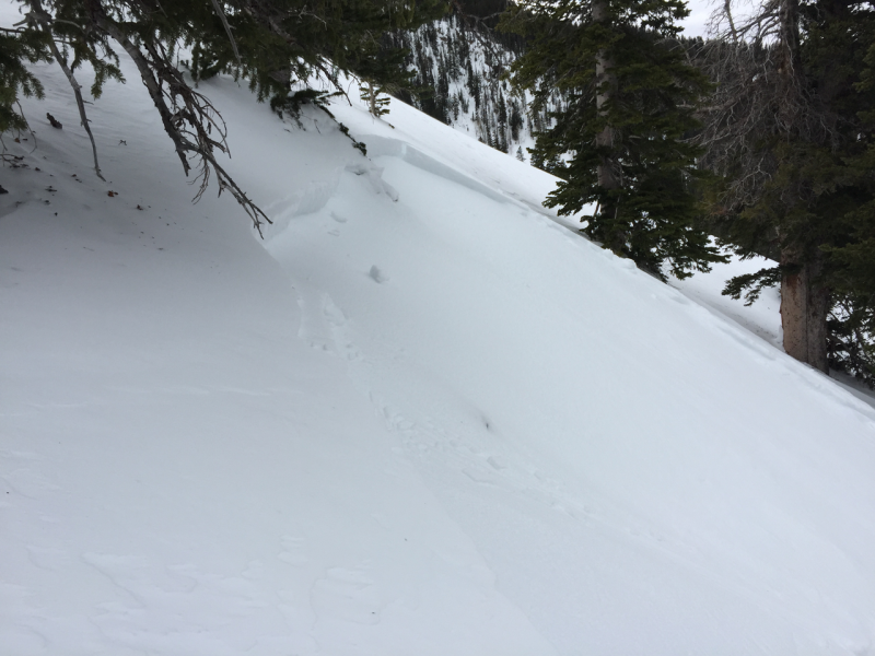
recent activity Two days ago, just when the first wave of this storm arrived, someone found a wind slab in Gold Basin. Luckily, it was a fairly small slide and they were able to get off to the side. Here's the link to their observation: https://utahavalanchecenter.org/avalanches/26488
|
| type | aspect/elevation | characteristics |
|---|

|

|
LIKELIHOOD
 LIKELY
UNLIKELY
SIZE
 LARGE
SMALL
TREND
 INCREASING DANGER
SAME
DECREASING DANGER
|
|
description
Since I did not make it to the mountains yesterday and have no other reports, I'll take a guess at what's going on. Any instabilities within the new snow should, in theory, settle out fairly quickly as it came in fairly warm and now it's quite cold. I'm most worried about any new snow slabs sliding on persistent weak layers that formed on the preexisting snow surface during the clear weather this past week, plus repeater slide paths that retained their thin, weak snow. You will find these mainly on the shady aspects, such as northwest, north, northeast and east facing slopes mostly at higher elevations but I was also seeing some surface hoar in basin bottoms where the cold air pools.
|
| type | aspect/elevation | characteristics |
|---|

|
|
LIKELIHOOD
LIKELY
UNLIKELY
SIZE
LARGE
SMALL
TREND
 INCREASING DANGER
SAME
DECREASING DANGER
|
|
description
The north wind is blowing this morning and it's forecast to increase and remain blustery for the next day or so. The wind will likely redistribute snow onto downwind terrain and create stiff wind slabs. As always, avoid steep slopes with recent wind deposits. They will looks smooth and rounded. They will also feel "slabby" meaning hard on top with soft snow underneath and they often sound hollow like a drum.
|
 |
weather The storm is over but we will continue to have cold, moderately strong winds from the north and northwest for the next couple days. Winds should blow 20, gusting to 40 along the exposed terrain with temperatures near zero. We may get a few lingering snow showers this morning and we have a slight chance of additional snow on Thursday and Friday. Here's the National Weather Service link to the point forecast for the La Sal Mountains. |
| general announcements Road Conditions: The road has not been plowed. I did not attempt the Geyser Pass road yesterday and I have no information about it. I heard from a friend of a friend that he did not make it very far in his Xterra 4x4. I'm assuming it's quite a mess. We will head up tomorrow and bring snowmobiles and I'll give you a report. There is a meeting this afternoon to determine the plowing future of the Geyser Pass road. I'll give you a report, hopefully tomorrow. Grooming: The tracks have not been groomed. Thanks for sending in your observations. You can view Moab observations here. To post an observation go here. You can also give me a call on my cell phone at 801-231-4744 To receive this advisory by email go here. This information does not apply to developed ski areas or highways where avalanche control is normally done. This advisory is from the U.S.D.A. Forest Service, which is solely responsible for its content. This advisory describes general avalanche conditions and local variations always exist. |