25th Annual Black Diamond Fall Fundraising Party
Thursday, September 13; 6:00-10:00 PM; Black Diamond Parking Lot
25th Annual Black Diamond Fall Fundraising Party
Thursday, September 13; 6:00-10:00 PM; Black Diamond Parking Lot
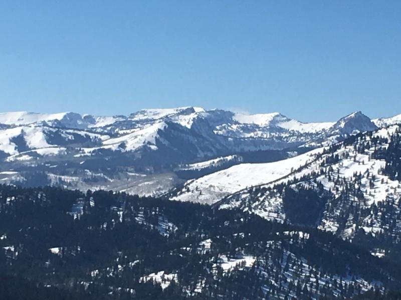
| Advisory: Logan Area Mountains | Issued by Paige Pagnucco for Wednesday - February 14, 2018 - 5:55am |
|---|


|
bottom line Avalanche danger is generally Low. Even though avalanches are unlikely, continue to practice good communication and safe travel protocols.
|
 |
special announcement Looking to shred the groomers? We have discount lift tickets for Alta, Snowbird, Brighton, Solitude, Snowbasin,and Beaver Mountain. Details and order information here. All proceeds from your purchase go towards paying for avalanche forecasting and education. |
 |
current conditions Snow surface conditions remain quite variable across the Logan area mountains. Rain crusts, wind buff, corn snow, punchy slabs, pockets of soft snow - you name it, we've got it. Moving around on skis is like playing roulette, you just never know what you're going to get until you're right on top of it. Sledding is decent on the roads and well-traveled paths but becomes a bit challenging once you head off trail.
High elevation terrain looks pretty well covered though trailhead access across the zone is thin and icy. |
 |
recent activity No avalanches have been reported recently in the Logan zone.
|
| type | aspect/elevation | characteristics |
|---|

|

|
LIKELIHOOD
 LIKELY
UNLIKELY
SIZE
 LARGE
SMALL
TREND
 INCREASING DANGER
SAME
DECREASING DANGER
|
|
description
Despite strong winds in the forecast, with little to no snow available for transport, we'll likely not see wind slabs form until it actually starts snowing tonight. Continue to practice safe travel protocols by exposing only one person at a time when moving through avalanche terrain. Widespread buried faceted layers appear dormant for now, but if you trigger an avalanche running on old snow it could be dangerous. Continue to avoid very steep rocky slopes with shallow snow and poor snow structure.
Widespread buried faceted snow exists across the Logan Zone. This is very weak snow, but the suspect weak layers appear dormant currently under a hardening slab. The snow is generally stable in most areas. |
 |
weather Snow is on the way! A storm is set to move into the Logan zone tonight preceded by strong southwest winds today. Wind speeds will increase throughout the day with gusts nearing 40 mph along ridgelines. Strong winds are expected to continue through the night. If the stars align, we could get 2-4" overnight and 1-3" tomorrow - a nice refresher for our tired snowpack. Keep your fingers crossed! Stormy weather continues through Thursday evening when the system clears out and leaves behind cold temperatures in its wake. Today: A 30 percent chance of snow after 11am. Mostly cloudy, with a high near 30. Breezy, with a southwest wind 18 to 26 mph, with gusts as high as 40 mph. Total daytime snow accumulation of less than one inch possible. |
| general announcements The latest UAC podcast - "Recreating Like a Pro - A Conversation with IFMGA guide Anna Keeling" is live. This podcast will be ideal for anyone looking to pick up some tips and tricks from a professional mountain guide for recreating in the winter backcountry environment. The UAC Marketplace is online. The holiday auction is closed, but our online marketplace still has deals on skis, packs, airbag packs, beacons, snowshoes, soft goods and much more. The UAC has new support programs with Outdoor Research and Darn Tough. Support the UAC through your daily shopping. When you shop at Smith's, or online at Outdoor Research, REI, Backcountry.com, Darn Tough, Patagonia, NRS, Amazon, eBay a portion of your purchase will be donated to the FUAC. See our Donate Page for more details on how you can support the UAC when you shop. Benefit the Utah Avalanche Center when you buy or sell on eBay - set the Utah Avalanche Center as a favorite non-profit in your eBay account here and click on eBay gives when you buy or sell. You can choose to have your seller fees donated to the UAC, which doesn't cost you a penny Check it out on ITunes, Stitcher, the UAC blog, or wherever you get your podcasts. Now is a great time to practice companion rescue techniques with your backcountry partners. Here's our rescue practice video. EMAIL ADVISORY: If you would like to get the daily advisory by email you will need to subscribe here. Remember your information can save lives. If you see anything we should know about, please help us out by submitting snow and avalanche observations. You can also call us at 801-524-5304, email by clicking HERE, or include #utavy in your tweet or Instagram. This advisory is from the U.S.D.A. Forest Service, which is solely responsible for its content. This advisory describes general avalanche conditions and local variations always occur. |