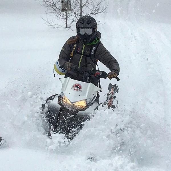
| Please join us at the 23rd annual Black Diamond Fall Fundraiser Party Thursday Sept 15. Tickets are on sale now here, at the Black Diamond store & at REI. Special bonus raffle for online ticket purchasers! |
| Please join us at the 23rd annual Black Diamond Fall Fundraiser Party Thursday Sept 15. Tickets are on sale now here, at the Black Diamond store & at REI. Special bonus raffle for online ticket purchasers! |
| Advisory: Logan Area Mountains | Issued by Toby Weed for Friday - April 1, 2016 - 7:01am |
|---|

|
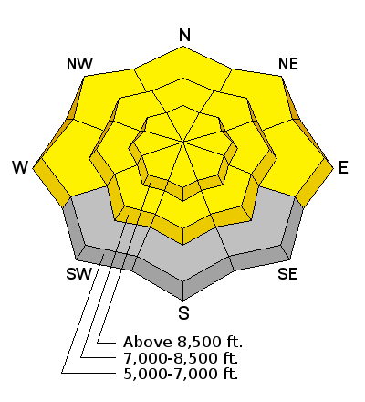
bottom line MODERATE (level 2): Heat from the high angled April sun will begin to melt and saturate this week's new snow, creating heightened wet avalanche conditions in the backcountry. Natural and triggered wet avalanches are possible during the heat of the day. Evaluate the snow and terrain carefully, and stay off and out from under steep slopes with sun-warmed and/or saturated fresh snow.
|
 |
current conditions The Tony Grove Snotel at 8400' reports 25 degrees and there's 98 inches of total snow containing 107% of average water for the date. I'm reading 16 degrees at the 9700' CSI Logan Peak weather station, with a north wind averaging 16 mph currently.
This week's deep new snow is already moist, and solar warming today will create heightened wet avalanche conditions on steep slopes in the backcountry.
|
 |
recent activity
***To view our updated list of backcountry observations and avalanche activity from around Utah, go to our observations page |
| type | aspect/elevation | characteristics |
|---|

|
|
LIKELIHOOD
 LIKELY
UNLIKELY
SIZE
 LARGE
SMALL
TREND
 INCREASING DANGER
SAME
DECREASING DANGER
|
|
description
Moist sluffs entraining significant piles of melt-saturated fresh snow from this week are possible and may become likely today in sunny terrain, when slopes with 1 to 2 feet of moist new snow are warmed by direct solar heating.
|
| type | aspect/elevation | characteristics |
|---|

|
|
LIKELIHOOD
LIKELY
UNLIKELY
SIZE
LARGE
SMALL
TREND
INCREASING DANGER
SAME
DECREASING DANGER
|
|
description
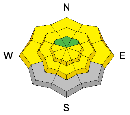
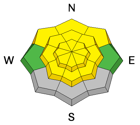
Although most of the instability has probably settled out by now, you still might trigger soft slabs in the storm snow from this week in some steep upper elevation terrain. Wet (or heat-induced moist) soft slabs are possible on some steep sheltered (and sunny) slopes with significant accumulations from this week. Observers report significant new wet activity involving this week's snow, apparently including evidence of some recent wet slab avalanches in lower Providence Canyon.
|
 |
weather A high pressure system will move over the region for the weekend. Expect sunny skies in the mountains today, with moderate north-northeast winds and 9000' high temperatures expected to reach around 39 degrees. It'll be mostly clear tonight with a low around 28 degrees and winds becoming light and variable. It'll be mostly sunny tomorrow with a high near 43 degrees and increasing winds veering from the west southwest. Looks like thunder showers will be a possibility on Sunday. |
| general announcements The National Avalanche Center recently completed an animated tutorial on the North American Avalanche Danger Scale. HERE Please submit snow and avalanche observations from your ventures in the backcountry HERE. You can call us at 801-524-5304 or email HERE, or include #utavy in your Instagram or Tweet us @UAClogan. To report avalanche activity in the Logan Area or to contact the local avalanche forecaster call me, Toby, at 435-757-7578. We'll update this advisory throughout the season on Monday, Wednesday, Friday, and Saturday mornings by about 7:30 This advisory is produced by the U.S.D.A. Forest Service, which is solely responsible for its content. It describes only general avalanche conditions and local variations always exist.
|