| Please join us at the 23rd annual Black Diamond Fall Fundraiser Party Thursday Sept 15. Tickets are on sale now here, at the Black Diamond store & at REI. Special bonus raffle for online ticket purchasers! |
| Please join us at the 23rd annual Black Diamond Fall Fundraiser Party Thursday Sept 15. Tickets are on sale now here, at the Black Diamond store & at REI. Special bonus raffle for online ticket purchasers! |
| Advisory: Abajo Area Mountains | Issued by Eric Trenbeath for Friday - February 12, 2016 - 6:41am |
|---|


|
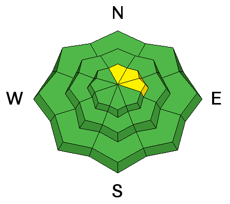
bottom line The avalanche danger is generally LOW but there remains a very isolated, or MODERATE danger for triggering a deep avalanche to the ground on steep, upper elevation, northerly aspects. Suspect steep slopes with convex break-overs or areas of rocky, more radical terrain. And with daytime heating, the danger for loose wet avalanche activity may rise to MODERATE on sun exposed slopes in the afternoon.
|
 |
special announcement Thanks to the Canyon Country Discovery Center for hosting Monticello's first Know Before You Go presentation, and to everyone who turned out and made it a success! |
 |
current conditions
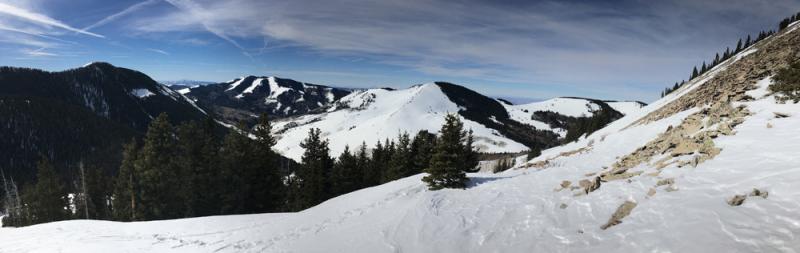
It's a mixed bag of spring like conditions out there. Wind and sun have taken their toll on the snow surface in exposed areas. Soft, powder-like snow can be found on sheltered, shady aspects. Varying degrees of breakable crust can be found on sunny slopes, with supportable corn snow developing on due south aspects.
Winds, temperature and humidity on Abajo Peak. Snow totals at Buckboard Flat. Snow totals at Camp Jackson.
|
 |
recent activity
|
| type | aspect/elevation | characteristics |
|---|

|
|
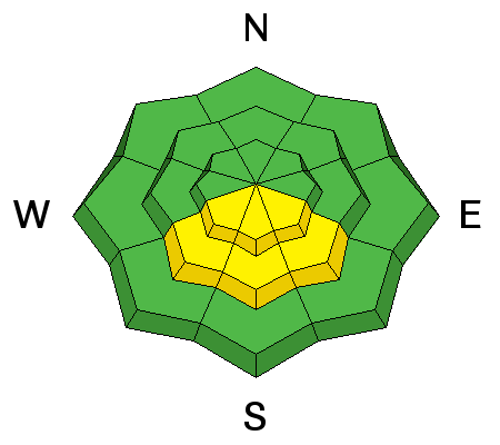
LIKELIHOOD
 LIKELY
UNLIKELY
SIZE
 LARGE
SMALL
TREND
 INCREASING DANGER
SAME
DECREASING DANGER
|
|
description
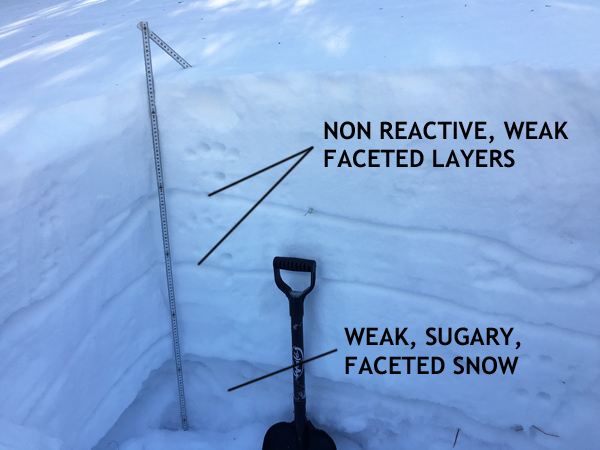
Time and warm temperatures have largely healed instabilities within the snowpack. Snowpits reveal some weak layers, but they aren't reacting to applied stress. The only concern at this point is weak, sugary, faceted snow at the ground. It is growing increasingly unlikely that you will trigger an avalanche down to this weak snow but if you did, it would be large and dangerous. You are mostly likely to find this isolated problem on steep, upper elevation slopes with a northerly aspect. Suspect areas with steep, convex rolls in and around rocky, more radical terrain.
I dug this snowpit on a north facing aspect near North Creek Pass. The weak, sugary, faceted snow also known as depth hoar is the primary concern.
|
| type | aspect/elevation | characteristics |
|---|

|
|
LIKELIHOOD
 LIKELY
UNLIKELY
SIZE
 LARGE
SMALL
TREND
 INCREASING DANGER
SAME
DECREASING DANGER
|
|
description
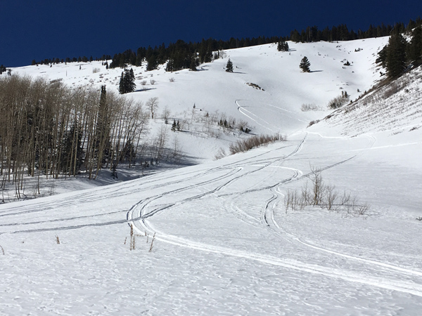
In my travels on Thursday, I observed the snow getting sloppy and wet on southerly aspects. I did not observe any wet slide avalanche activity. Nevertheless, as daytime heating affects the snow, be alert to signs of instability such as sloppy, wet snow, and roller balls or pinwheels coming down the slope. If these signs are present, it is time to stay off of and out from under steep, sun exposed slopes. |
 |
weather Today Sunny, with a high near 46. West southwest wind 5 to 10 mph. Tonight Mostly clear, with a low around 29. Southwest wind around 10 mph. Saturday Sunny, with a high near 45. West southwest wind 10 to 15 mph, with gusts as high as 25 mph. Saturday Night Partly cloudy, with a low around 26. Breezy, with a west northwest wind 15 to 20 mph. Sunday Sunny, with a high near 38. Breezy, with a northwest wind 15 to 25 mph, with gusts as high as 40 mph. Sunday Night Partly cloudy, with a low around 25. Blustery. Washington's Birthday Sunny, with a high near 36. |
| general announcements Let me know what you are seeing down there by posting an observation here. You can also call me on my cell phone at 801-647-8896 To receive this advisory by email go here. This information does not apply to developed ski areas or highways where avalanche control is normally done. This advisory is from the U.S.D.A. Forest Service, which is solely responsible for its content. This advisory describes general avalanche conditions and local variations always exist. |