| Please join us at the 23rd annual Black Diamond Fall Fundraiser Party Thursday Sept 15. Tickets are on sale now here, at the Black Diamond store & at REI. Special bonus raffle for online ticket purchasers! |
| Please join us at the 23rd annual Black Diamond Fall Fundraiser Party Thursday Sept 15. Tickets are on sale now here, at the Black Diamond store & at REI. Special bonus raffle for online ticket purchasers! |
| Advisory: Abajo Area Mountains | Issued by Eric Trenbeath for Monday - January 25, 2016 - 6:45am |
|---|


|
bottom line The avalanche danger is MODERATE on steep slopes that face NW-N-SE. In these areas, it is possible for the additional weight of a rider to cause a deep and dangerous avalanche releasing on buried weak snow. Suspect gullies and terrain that is heavily featured with steep roll overs and convexities. Elsewhere, the avalanche danger is generally LOW.
|
 |
special announcement This advisory provides updated detailed snow and avalanche conditions on weekends, with an update Monday morning. This information is to be used as a baseline for the upcoming week, and users need to be aware of the changing nature of avalanche conditions. New snow, winds, and a rapid rise in temperature all translate to a rise in avalanche danger. Use the links below to stay abreast of current conditions. |
 |
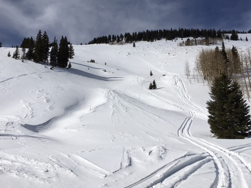
current conditions A trace to maybe 2" fell in the mountains on Sunday. Snow depth varies from 3-4' depending on elevation throughout the range, but some wind and sun exposed slopes have been stripped back down to near the ground. Soft snow still remains on sheltered, northerly aspects Winds, temperature and humidity on Abajo Peak. Snow totals at Buckboard Flat. Snow totals at Camp Jackson.
A tired and worn snow surface. We need some new snow!
|
 |
recent activity
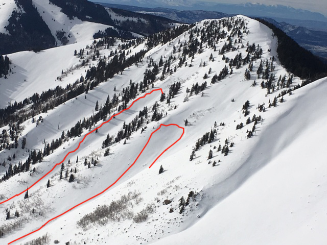
These slides are from the storm of Jan 8, but I finally got far enough in to observe them. They are on southeast facing Jackson Ridge, and look to have broke between 2-3' deep, and ran for close to 1000'. With the current snowpack structure, we'll likely see activity like this again if we get another significant storm with a foot or more of snow.
|
| general announcements This advisory is from the U.S.D.A. Forest Service, which is solely responsible for its content. This advisory describes general avalanche conditions and local variations always exist. |