| Please join us at the 23rd annual Black Diamond Fall Fundraiser Party Thursday Sept 15. Tickets are on sale now here, at the Black Diamond store & at REI. Special bonus raffle for online ticket purchasers! |
| Please join us at the 23rd annual Black Diamond Fall Fundraiser Party Thursday Sept 15. Tickets are on sale now here, at the Black Diamond store & at REI. Special bonus raffle for online ticket purchasers! |
| Advisory: Abajo Area Mountains | Issued by Eric Trenbeath for Monday - December 28, 2015 - 7:00am |
|---|

|
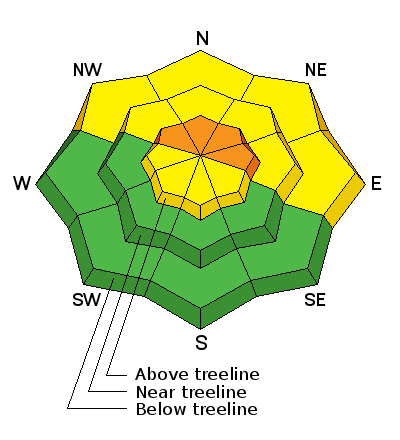
bottom line The avalanche danger remains CONSIDERABLE on steep, wind drifted, northerly facing aspects, and human triggered avalanches are likely in these areas. The avalanche danger is generally MODERATE on mid to lower elevation slopes. On sun exposed aspects at lower elevations, the avalanche danger is generally LOW.
|
 |
special announcement This advisory will provide detailed snow, avalanche and mountain weather information on weekends. During the week, general information and an overall danger rating will be provided. |
 |
current conditions Winds, temperature and humidity on Abajo Peak. Snow totals at Buckboard Flat.
|
 |
weather Today Partly sunny, with a high near 19. Southwest wind 10 to 15 mph. Tonight A 20 percent chance of snow after 8pm. Mostly cloudy, with a low around 2. Southwest wind 5 to 10 mph. Tuesday A 30 percent chance of snow. Mostly cloudy and cold, with a high near 10. West wind 5 to 10 mph. Tuesday Night A 20 percent chance of snow after 11pm. Mostly cloudy, with a low around -1. Wind chill values as low as -20. West wind around 15 mph. Wednesday A 20 percent chance of snow. Partly sunny and cold, with a high near 9. West northwest wind around 15 mph. Wednesday Night A 20 percent chance of snow. Mostly cloudy, with a low around -1. Thursday A 10 percent chance of snow before 11am. Mostly sunny and cold, with a high near 9. Thursday Night Partly cloudy, with a low around 0. New Year's Day A slight chance of snow after 11am. Mostly sunny, with a high near 11.
|
| general announcements This advisory is from the U.S.D.A. Forest Service, which is solely responsible for its content. This advisory describes general avalanche conditions and local variations always exist. |


