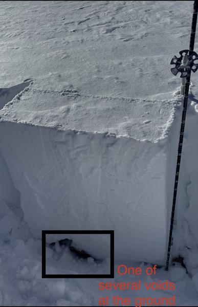
I travelled down to the central bit of the PC ridgeline today and did a little investigating at 9700’ on a 38° East-facing slope. My pit showed a total snow depth of 110cm and a surprising amount of three-finger uniformity between the surface and the top of the still-easily identifiable CERC. That crust now sits only about 20-25cm above the ground. Below this 4-5cm thick feature, I came across an empty space (or two or three), the sugary facets covering the ground still not uniformly filling in the voids.
I performed two tests, getting ECTPV on the first and ECTX on the second. Well hmmm, what to make of that? I think this is an example where knowing the surface on which the snow sits can be quite useful. Special variability in steep, rocky terrain with a shallow snowpack containing facets at the ground interface creates a setup where plenty of weak pockets can hide, just waiting for the right trigger. The CERC then provides that connectivity to turn a little local collapse into a big, bad avalanche. The danger may be decreasing, slowly, but it’s still down there, invisible as we slash that spongy surface fun.