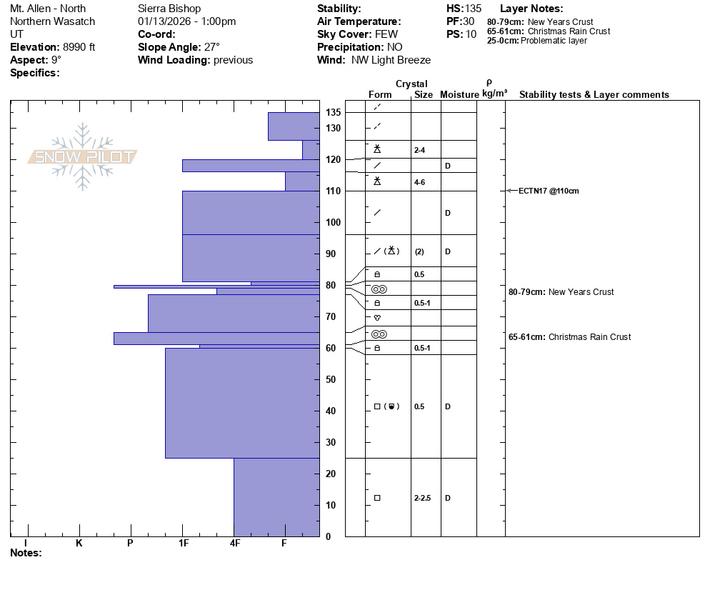
Weaker snow at the base of the pack than expected. Found cold, dry facets up to 3 mm, though slightly rounding. Drew found ECTP29, ECTX, and PST 50/100. Nearby at 8,900 feet in a slightly more wind loaded zone, Nikki found a similar snowpack structure with cold, dry facets at the ground but was unable to get any results outside of collapses within the upper graupel layer. Another patroller also scored an ECTP (H) from the shoulder on a similar aspect, but a bit lower in elevation.
The first two photos show the initial snowpit Drew dug, with examples of basal facet grains. The second two photos show the snowpit and pit profile Nikki dug at 9,800 feet.
Probing in the upper elevations showed 100 to 140 cm of snow on the ground, with lots of structure within the snowpack. Crusts ranged from 5 mm to 1 cm to 5 cm, with not much weak snow adjacent to the crusts. Overall take is generally LOW danger, with a PWL remaining as a dormant problem in upper elevation shady terrain. The problem seems very isolated to specific terrain: upper elevation shady slopes that are shallower, including repeater zones or rocky features.
Ski areas have not reported any results to the basal layer since early December, though avalanches have run on the upper crust as recently as the January 5th storm cycle.
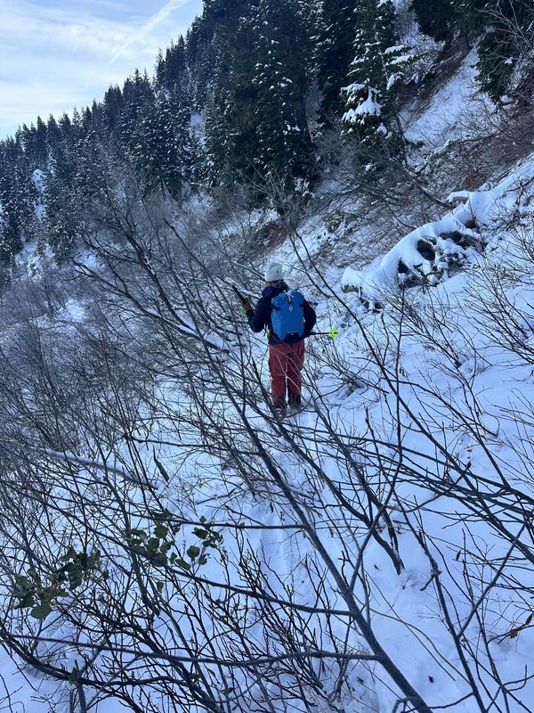
Following our step into Taylor Canyon, we also moved through No Name and into Hell’s Canyon. Similarly, we could feel the very structured snowpack, but the crusts were slightly less supportable. The snow surface was weakening, and near 7,400 feet we started to notice surface hoar in protected areas. As we descended, coverage became very sparse and travel became very, very bushy and rather hateful at times (See final photo...) Coverage is thin below 7,000 feet.