Spent the day cruising ridgelines and summits in Big Cottonwood (Little Water, Powder Park 1, Sheep S&*t Ridge, Squaretop, Desolation) with two goals:
1. As this was my first outing in mid BCC, look at snowpack depths.
The Jan 8/9 storm did wonders for mid-BCC, putting down a dense 100+ cm snowpack above 8,000'
2. Look for surface hoar in areas similar to avalanche activity along the BCC ridgelines above Park City and Millcreek.
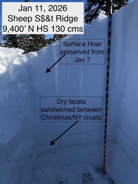
I had not seen surface hoar or near surface facets that were buried in the Jan 8/9 storm, but there has been some recent avalanche activity that has run on this layer of surface hoar. Traveling along Sheep S&*t Ridge, I dug in a few areas and could identify the surface hoar layer that is now buried down ~20 cms, although more deeply in wind-loaded areas.
ECT results were all poor quality ECTN failing on the surface hoar, likely due to (1) the lack of a strong slab on top, and (2) the surface hoar layer is not especially weak.
I was able to get clean shears in this layer with shovel tilt tests, and also got a small collapse on an adjacent slope, likely collapsing on the layer of surface hoar.
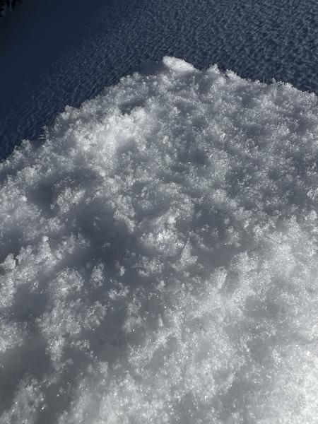
The surface hoar layer is not that weak: the feathers are now laying down (and not upright) and it is also "thinning" where the surface hoar is being bonding to crystals above the layer which strengthens the layer.
Photos of pit with surface hoar layer and surface hoar crystals from a shovel shear test.
Overall, this layer is not that weak, but I never trust surface hoar and would not get on a steep, wind-loaded slope where this surface hoar is present.