Observation Date
1/9/2026
Observer Name
Ted Scroggin
Region
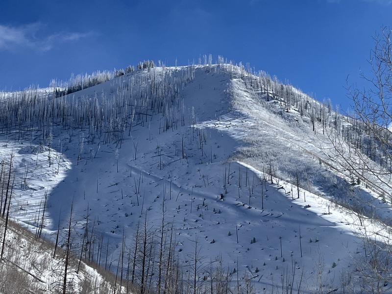
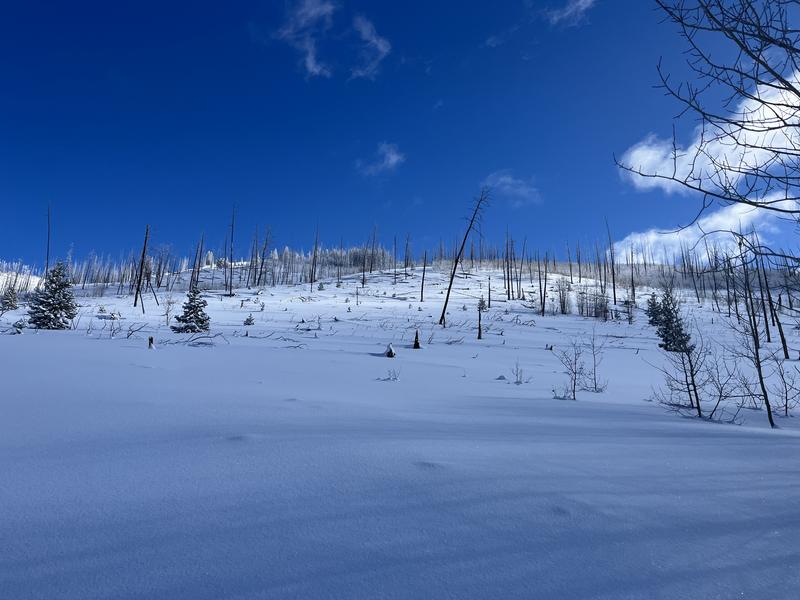
Uintas » East Fork Bear
Location Name or Route
E. Fk. Bear
Weather
Sky
Clear
Wind Direction
Northeast
Wind Speed
Light
Weather Comments
Clear and cold with temperatures this morning in the teens, add in a little northeast wind and things stayed on the cool side.
Snow Characteristics
New Snow Depth
8"
New Snow Density
Low
Snow Surface Conditions
Powder
Faceted Loose
Snow Characteristics Comments
The mid-week storm left around 6-8" of fairly low density snow near the north slope trailhead with slightly more snow at the higher elevations. The traveling and snow conditions on the east side of the highway are still a bit thin.
Red Flags
Red Flags
Collapsing
Poor Snowpack Structure
Red Flags Comments
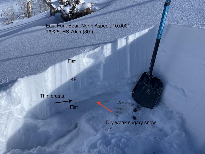
A thinner snowpack with weak dry sugary snow near the ground is the general set-up in this area. The slab above the weak snow is like 4F density in areas not affected by the wind. I did have two quite big collapses as I neared the ridgeline where the wind had drifted the snow.
Avalanche Problem #1
Problem
Persistent Weak Layer
Trend
Same
Problem #1 Comments
The slab above the weak snow near the ground is still on the soft side until you get into the windy exposed terrain where there is a stiffer slab. I did experience two decent collapses that shook the snow out of a few small aspen trees.
Comments
Great snow quality today, but this area is still on the thin side with stumps and down trees.
Only around 30" or so in the East Fork of the Bear River. Dry weak sugary snow near the ground with a 4F slab above and a couple of thin crusts generally make up the snowpack. I did identify what might be the New Years mist layer below the recent storm snow where I got an ECT to propagate on ten taps.
Today's Observed Danger Rating
Moderate
Tomorrows Estimated Danger Rating
Moderate
Coordinates