Observation: Laurel Highway

Observation Date
1/3/2026
Observer Name
Chris Benson
Region
Moab » Laurel Highway
Location Name or Route
Coyote Chute to Gold Miners
Weather
Sky
Overcast
Wind Direction
Southwest
Wind Speed
Moderate
Weather Comments
Ridgetop winds were transporting snow around 3pm with visible cornice/pillow building on N side of Laurel Ridge
Snow Characteristics
New Snow Depth
10"
New Snow Density
Medium
Snow Surface Conditions
Powder
Wind Crust
Rain-Rime Crust
Snow Characteristics Comments

Snow surface is a mixed bag. Lots of rime/clear ice falling off trees making the surface quite variable. Westerly aspects near treeline had a rime-crust.

Depth of snow pack seemed to vary from 30-70 cms.

Red Flags
Red Flags
Wind Loading
Collapsing
Poor Snowpack Structure
Red Flags Comments
Wind loading was visible. Got one collapse on a NE aspect when breaking through into the underlying facets. Poor structure exists on northerly aspects.
Avalanche Problem #1
Problem
Wind Drifted Snow
Trend
Same
Problem #1 Comments

Wind-stiffened slabs could be sensitive to weight of a rider. Active wind-transport was observed around 3pm.

Avalanche Problem #2
Problem
Persistent Weak Layer
Trend
Same
Problem #2 Comments

Early season snow has faceted, albeit under a variable crust. Didn't get propagating results on ECT but localized collapsing is strong evidence that with the right slab, this weak layer could produce an avalanche.

Snow Profile
Aspect
Northeast
Elevation
11,300'
Slope Angle
25°
Comments

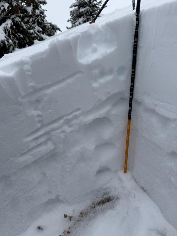
Photo of pit in Coyote Chute. Any thing on the north side of the compass has poor snow pack structure.

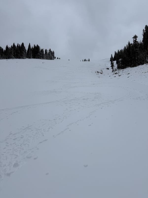
Goldminer's- skied pretty well. This south aspect had almost entirely melted and contained dense new snow on top of grass.

Egress from Gold Basin was easy and fast. Lots of good skiing can be found on low-angle simple terrain.

Today's Observed Danger Rating
Moderate
Tomorrows Estimated Danger Rating
Moderate
Coordinates