Observation Date
12/27/2025
Observer Name
Tim Matthews Sean Zimmerman-Wall
Region
Salt Lake » Little Cottonwood Canyon » Grizzly Gulch » Patsy Marly
Location Name or Route
LCC Grizzly Gulch Patsey Marley West Ridge.
Weather
Sky
Overcast
Precipitation
Heavy Snowfall
Wind Direction
West
Wind Speed
Light
Weather Comments
Overcast skies throughout the morning hours with the sun poking out and improving visibility a couple of times. Although, only very briefly. Heavy early morning snowfall rates of 1" an hour while making our way up the canyon. By mid morning the heavy snowfall backed off to moderate, and quickly after that transitioned again to light snowfall. Lower in terrain the winds were light. As we gained elevation the winds became more moderate out of the west.
Snow Characteristics
New Snow Depth
10"
New Snow Density
Low
Snow Surface Conditions
Powder
Rain-Rime Crust
Snow Characteristics Comments
10" of new right side up low density powder wasn't quite enough to keep you off of the Christmas Eve rain crust, but it certainly made a huge difference on the fun factor scale. The most recent storm snow started as graupel, but was mostly stellars.
Red Flags
Red Flags
Heavy Snowfall
Wind Loading
Poor Snowpack Structure
Red Flags Comments
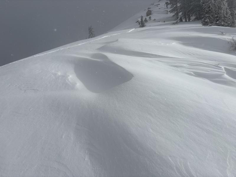
I've listed heavy snowfall because it likely snowed an inch an hour for 6 hours in the early morning before backing off to moderate, and then light snowfall by late morning. The Low density snow though didn't add much new weight. We came across a few sections of wind drifted snow, but these slabs were still quite soft, and did not promote cracking. We topped out at about 10,500'. I'd suspect as you gain elevation you could find some stiffer wind slabs that might be a problem. No cracking or collapsing was noted today, but the snowpack structure still remains poor. There is strong snow over weaker snow present, and we were able to get sudden results in CT's and propagating results in ECT's.
Avalanche Problem #1
Problem
Persistent Weak Layer
Trend
Same
Problem #1 Comments
Where to begin? The snowpack structure remains poor in the mid to upper elevation terrain facing NW-N-E. The level of uncertainty is high with this one. Neither of us have ever seen a set up quite like this. I think that if you were to be able to trigger a persistent slab avalanche right now it would be in the higher upper elevation band where the rain crust might be thinner, and unable to bridge the weight of a skier, or rider.
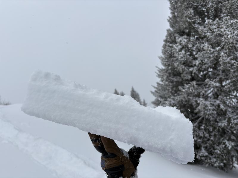
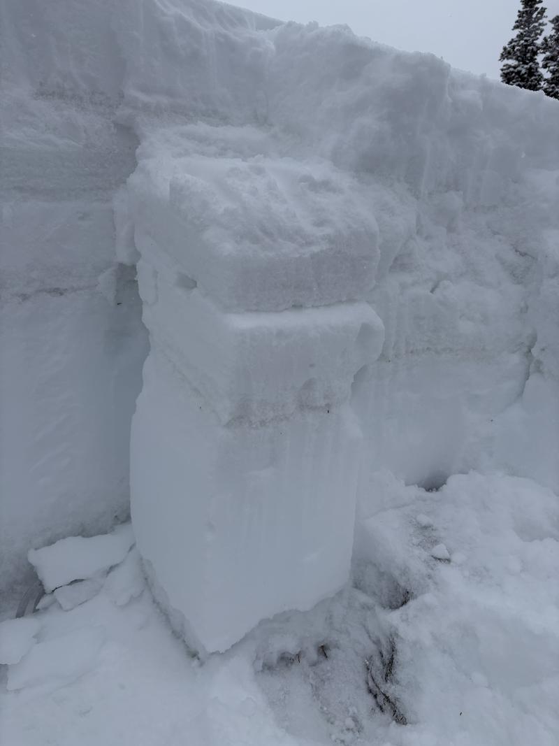
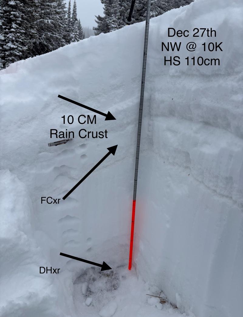
The Christmas Eve crust in our pit today was 10cm thick and knife hard. My partner and I think it will be able to support a lot of weight. How much weight? We don't know. It will connect a larger slab over more terrain, and at some point create very large avalanches. We did get sudden results today in CT's on the rounding facets just below the crust, and near the ground in the rounding depth hoar. We also, had propagating results in ECT's at the same interfaces. In the ECT's we were thinking that by isolating the rain crust it acted as the slab, and produced results that we would not have likely seen otherwise. It was not collapsing under our weight alone. Lots of questions remain. Of note: All layers in our pit were dry grains.
Also, would like to track facets growing on top of the rain crust, and see if the rain crust becomes the bed surface for future snow.
Avalanche Problem #2
Problem
New Snow
Trend
Decreasing Danger
Problem #2 Comments
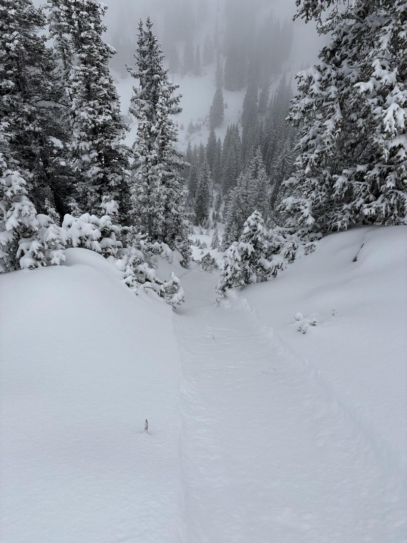
In steep continuous terrain you could easily trigger dry loose avalanches that picked up speed as the snow moved downhill, but didn't really fan out wider than your skis that started the motion. As for storm slab instabilities. Seems like the storm snow was soft enough to not promote cracking, and bonded well enough to the rain crust. Stiffen the snow up with some wind and all bets are off. Lots of snow available for transport again. I'd suspect this problem will get changed to wind drifted snow.
Snow Profile
Aspect
Northwest
Elevation
10,000'
Slope Angle
28°
Comments
Photo 1: Dry loose in continuous steep terrain.
Photo 2: 10cm knife hard rain crust that would make the PNW proud.
Photo 3: CTH sudden planner result in the rounding facets below the crust, and a sudden collapse in the upper rounding depth hoar near the ground on the loading step. Had a similar result in an ECT.
Photo 4: Pit mock up of all the junk.
Photo: 5: Soft wind drifted snow. Snow did not crack under skis.
Video: ECTP 16 @ 74cm on small rounding facets, and @ 18cm on rounding depth hoar. Did the crust serve as the slab, and otherwise would not have failed?
Video
Today's Observed Danger Rating
Moderate
Tomorrows Estimated Danger Rating
Moderate
Coordinates