I traveled with snow safety team from Park City/Canyons to look at a remotely-triggered avalanche from Sunday, December 21 on a north-facing slope at 9,400 feet on Murdock Peak. Although others have been finding damp/moist facets - such as what Bo Torrey was finding on Dec 22 near Empire Pass - we found dry and very weak facets and depth hoar down near the ground. Although the snowpack is thin throughout the range, there is still some spatial variability on northerly aspects where in some areas that have had more snow and/or wind-loading, there is a deeper and stronger slab on top of the facets. Where we traveled today, the snowpack was supportable, but shallow. Our group of three all felt the structure we found today would not support much of a load of new snow/water or wind-loading.
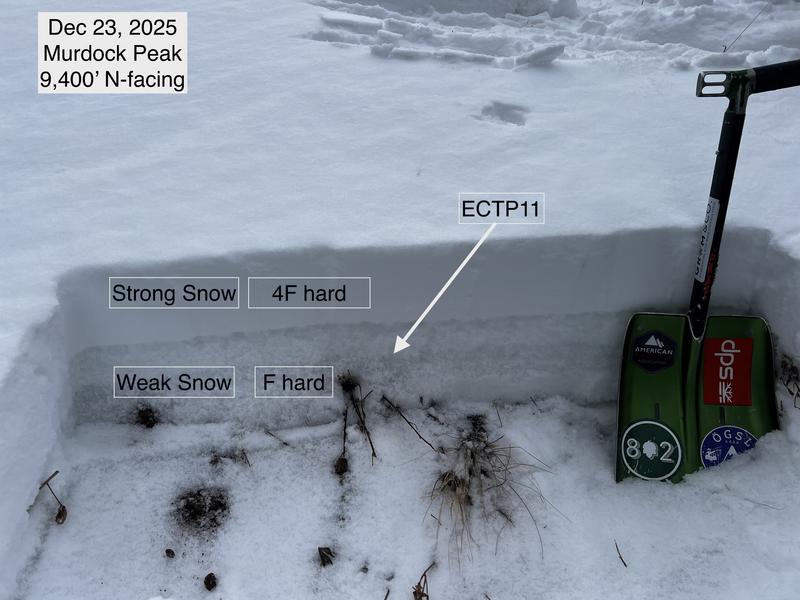
Extended column tests on the slope adjacent to the avalanche were ECTP11 (photo) and ECTPV (video).
The avalanche danger is mostly Low, with a pockety Moderate danger on isolated slopes on northerly aspects where there is a PWL.