UDOT PLANNED AVALANCHE CLOSURES!!

Observation: Currant Creek Environs

Observation Date
12/20/2025
Observer Name
StJeor
Region
Uintas » Currant Creek Environs
Location Name or Route
West Fork
Weather
Sky
Overcast
Precipitation
Light Snowfall
Wind Direction
West
Wind Speed
Moderate
Weather Comments
Sustained winds in the mid 20's gusting into the mid 30's above tree line with significant snow transport. There was 6"-10" of new snow in sheltered areas.
Snow Characteristics
New Snow Depth
10"
New Snow Density
Medium
Snow Surface Conditions
Powder
Snow Characteristics Comments

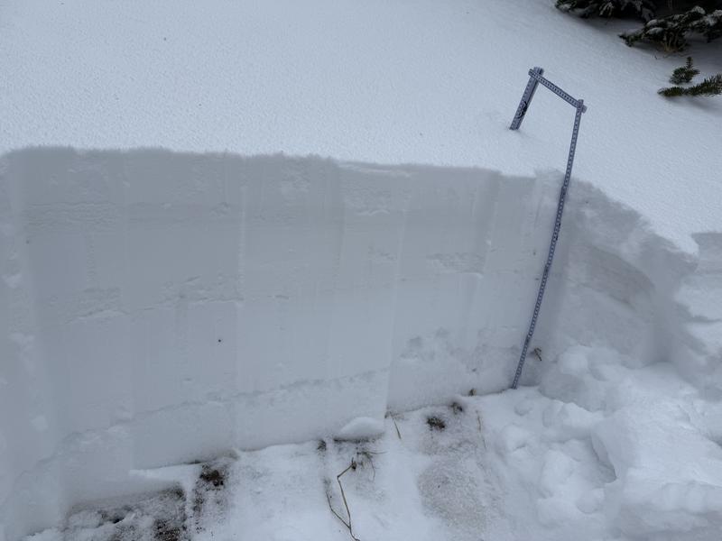
In the wind zone there was significant wind loading with 18"-24" Deep 1F slabs in wind deposited areas. Out of the wind zone 6"-10" of new snow with some graupel.

Red Flags
Red Flags
Heavy Snowfall
Wind Loading
Cracking
Collapsing
Poor Snowpack Structure
Red Flags Comments
Any slope we traveled on with old snow from October/November collapsed. We observed numerous shooting cracks on any wind loaded terrain. No recent avalanches were observed but visibility was poor and thin coverage is keeping everyone on the road.
Avalanche Problem #1
Problem
Persistent Weak Layer
Trend
Increasing Danger
Avalanche Problem #2
Problem
Wind Drifted Snow
Trend
Increasing Danger
Snow Profile
Aspect
North
Elevation
9,900'
Slope Angle
30°
Video
Today's Observed Danger Rating
Considerable
Tomorrows Estimated Danger Rating
Considerable
Snow Pilot URL