Observation Date
3/4/2024
Observer Name
Hankison & Kennedy
Region
Provo » Snake Creek
Location Name or Route
Mineshaft
Comments
Snowmobiled in from the Snake Creek trailhead, it was snowing a lot more at the trailhead than we expected. The forecast discussion was clear that this storm was fairly chaotic and although it was supposed to wrap up Sunday night it continued on strong through Monday. The Midway/Heber side of the Wasatch is pretty notorious for lower snow totals so I was happy to experience it with so much new snow.
Setting the road in was rather easy with up to 25cm of low density, unconsolidated new snow on top of a thick, widespread and supported crust. Wind drifts grew in size as we gained elevation but were soft in most places. We were on the leeward slopes of the storm but didn't see any signs of recent avalanches, sticking in the trees well below ridgetop kept us sheltered but I was aware conditions could be very different overhead.
First time digging on this side of the Wasatch, outside of the Cottonwoods. Goal was to inspect the integrity of the crust on the SE aspect adjacent to the landing of Mineshaft jump. Crust was large, rounded facets all the way to the ground with no notable results. There was a brief reprieve from the storm as we built the run in and the winds died down but the cloud cover kept the sun hidden. The landing held enough snow for a small session but the windblown knuckle exposed the dust layer that came in on the front of the storm Saturday afternoon. Soon a light fog rolled in on top of the blowing snow and we decided to call it a day with visibility quickly decreasing.
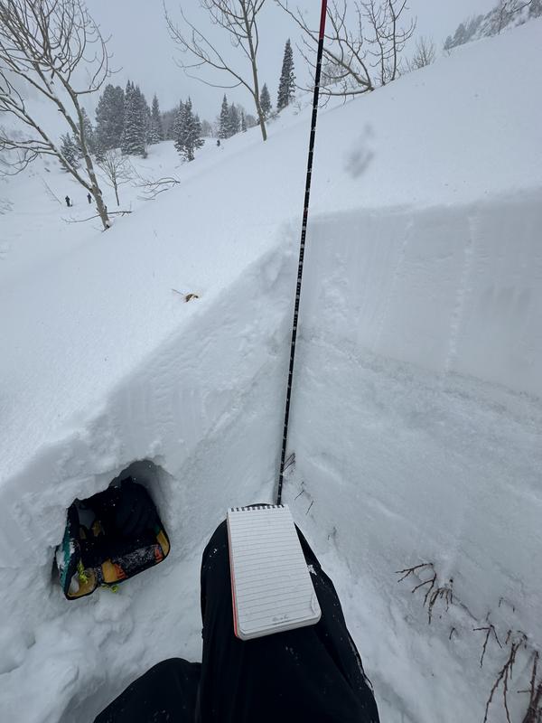
Photo 1: Practically isothermic grains below the top 85cm of the snowpack. Solars on the east side of the Wasatch are a totally different animal, haven't seen a single grain like this in the Cottonwoods yet this season.
Photo 2: Pardon the branches...felt like a cross section of a midwest manmade resort run, dust on crust. Gonna need a few deep storms (or another season) for this landing to feel as fluffy last year.

Today's Observed Danger Rating
Moderate
Tomorrows Estimated Danger Rating
Moderate
Coordinates


