Observation Date
3/1/2024
Observer Name
Kelly/Meisenheimer (x2)/Spencer/Sugihara/Campbell
Region
Ogden
Location Name or Route
Sheep Creek
Comments
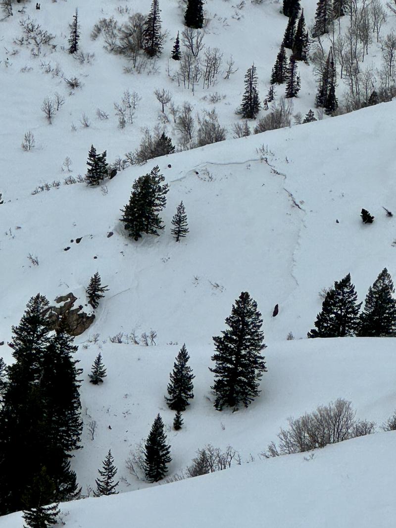
We observed a series of avalanches on east facing terrain between 7,000'- 7,300'. Read the full avalanche report HERE.
Our goal for the day was to see how the old snow surface looked prior to the incoming storm. What we found was a thin layer of dust covering all surfaces that will be a good indicator for the March 2, 2024 storm and moving forward we will be able to identify this layer and note if we still have any weak snow underneath.
We observed avalanche activity on easterly facing terrain (see avalanche report link above) isolated to steep slopes from 7,000'-7,300'. What stood out to me was that the higher ridgelines did not have signs of avalanche activity which leads me to believe that the weak layer that these slides slid on was a protected layer of facets that may have been triggered during warming over the last three days as this weak layer would have been destroyed by wind at higher elevations. We did not go to look at these slides as they were steep and over terrain traps (gully features).
We observed avalanche activity on easterly facing terrain (see avalanche report link above) isolated to steep slopes from 7,000'-7,300'. What stood out to me was that the higher ridgelines did not have signs of avalanche activity which leads me to believe that the weak layer that these slides slid on was a protected layer of facets that may have been triggered during warming over the last three days as this weak layer would have been destroyed by wind at higher elevations. We did not go to look at these slides as they were steep and over terrain traps (gully features).
The old snow surface will most likely form a stiff melt-freeze crust on all aspects below 8,000' (if not higher based on warm temperatures) as the temperatures drop. A warm snow surface with the onset of the new storm the snow should bond well. Cornices on ridgetops continue to grow and we observed some small wet loose point releases at the lowest elevations on the North Ogden Divide.

Today's Observed Danger Rating
Low
Tomorrows Estimated Danger Rating
Moderate
Coordinates


