Observation Date
12/10/2023
Observer Name
Kelly
Region
Salt Lake » Big Cottonwood Canyon » Lake Martha
Location Name or Route
Lake Catherine-Lake Martha-Tuscarora-Wolverine
Weather
Sky
Scattered
Wind Direction
North
Wind Speed
Moderate
Weather Comments
Winds were moderate to strong from the north-northwest on the ridgetops and from the north lower in the basins. Scattered clouds that lifted throughout the day.
Snow Characteristics
New Snow Density
High
Snow Surface Conditions
Powder
Snow Characteristics Comments
Primarily soft surface. Some solars (south and west) had a melt freeze crust on the surface. There was some wind rippling but it didn't affect the skiing.
Photo of wind rippling.
Avalanche Problem #1
Problem
Wind Drifted Snow
Trend
Same
Problem #1 Comments
Photo of sensitive, small, fresh, cornices along the ridgetops.
Avalanche Problem #2
Problem
Persistent Weak Layer
Trend
Decreasing Danger
Problem #2 Comments
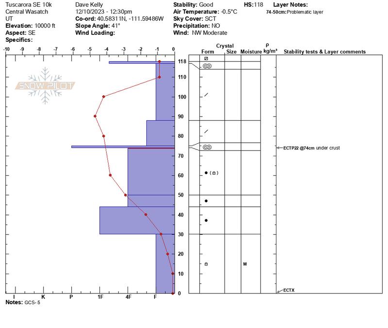
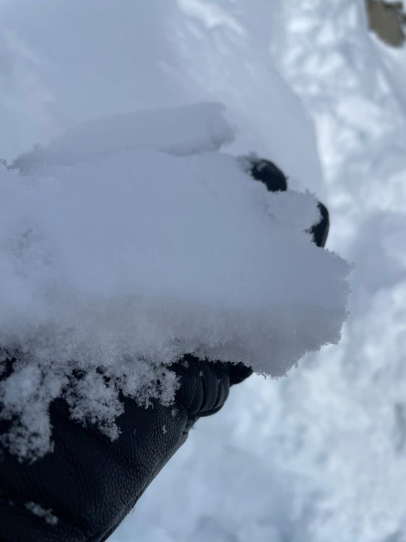
I went looking for the persistent weak layer at elevations over 9800' to see how things were looking in the highest elevations of our Salt Lake forecast area. Yesterday we observed a healing snowpack on
west and east facing slopes in White Pine . Today I looked at north and southeast facing slope in Upper Big Cottonwood Canyon. The overall trend is a healing snowpack in these locations (the caveat is that if we go high and dry with no snow and clear skies this could all change; perhaps the correct wording is that without additional weight this current PWL is looking like it is going dormant in places I've looked). The facets where I dug appear to be rounding and temperatures confirm this. There are still crusts present. I was particularly impressed by the crust on a southeast facing slope that was pencil hard. Extended colum test results are showing propagation is harder to come by and
snowpack stability is trending fair-good in many of these locations where I have been looking. I still don't trust mid elevations areas that have thinner snowpacks such as the Park City and Mill Creek ridgelines which hover just below 10,000'. They just got less snow in the last storm.
Photo of rounded facets
Snow Profile
Aspect
North
Elevation
9,900'
Slope Angle
34°
Comments
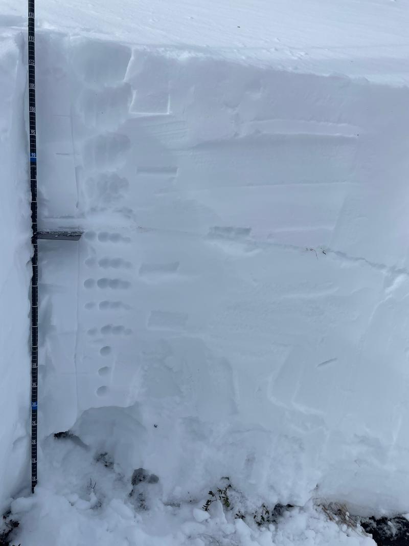
Below snowpit was on a southeast facing aspect at 10,000' and the slope angle was 41°. This location had a very slight 1 finger - crust just below the surface with the start of the smallest facets above it.
Photo of slight RR crust from the surface of the southeast facing snowpit from 10,000' elevation.
Today's Observed Danger Rating
Moderate
Tomorrows Estimated Danger Rating
Moderate
Coordinates