Observation Date
12/9/2023
Observer Name
Kelly, Thompson
Region
Salt Lake » Little Cottonwood Canyon » White Pine
Location Name or Route
White Pine- White Pine Lake- Boulder Basin-Spire
Weather
Sky
Clear
Wind Direction
North
Wind Speed
Calm
Weather Comments
Calm winds, cold temperatures (5.5°F). Very few clouds right at sunrise with clouds building up throughout the afternoon.
Snow Characteristics
Snow Surface Conditions
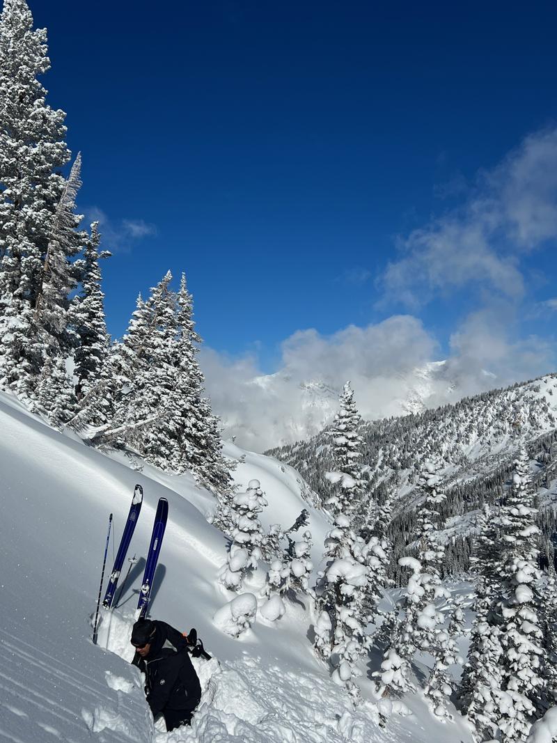
Powder
Snow Characteristics Comments
Great travel with Snowbird reporting 32.5" of snow at 1.91" of water which is right around 6% density. It was really nice snow to travel on and we observed very little wind affected surface snow where we traveled.
Soft snow cover with clouds burbling up around lunchtime.
Avalanche Problem #1
Problem
Persistent Weak Layer
Trend
Decreasing Danger
Problem #1 Comments
We went looking to see how the PWL layer was reacting on west, north, and east aspects at higher elevations. We focused on pits on west and east facing slopes and found isolated facets around a crust in the bottom few feet of the snowpack.
Snowpack temperatures taken in the snowpit on the west facing slope showed a healing snowpack; the faceted crystals were starting to show signs of rounding. The crust was deteriorating and the extended column test results showed a healing snowpack in this locaiton. We had one stability test without propagation (ECTX) and one with propagation at 30 taps (ECTP30@30cm). See west facing snowpit below.
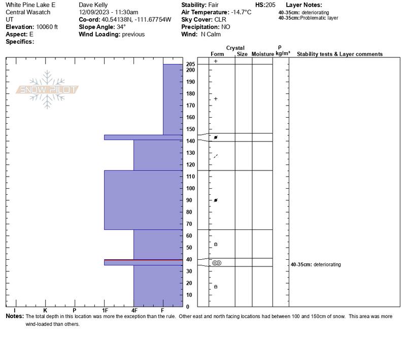
A snowpit on an east facing slope at 10,060' showed just over 6' of snow. This area was wind-loaded and was not representative of all the north-east locations we traveled over 10,000' but gave us a good idea of what the facets in a deeper snowpack looked like. Generally north-east facing terrain was 3-4' deep with a deteriorating crust with facets on either side with new snow on top.
Additional weight and more snow ( a thicker blanket) over the weak faceted snow will help to heal it over time. I think in the highest elevations over 9500' on north-east aspects the PWL is currently trending towards a decreasing danger for now. I will be wary of this with each additional snow and wind event partcularly if we have a number of days of high pressure (cold clear weather) between storms.
Avalanche Problem #2
Problem
New Snow
Trend
Decreasing Danger
Problem #2 Comments
We observed some dry loose surface snow that sloughed on the steepest slopes.
Snow Profile
Aspect
West
Elevation
9,700'
Slope Angle
29°
Where we traveled today we thought the avalanche danger using the
Avalanche Danger Scale was Moderate if you relied on the likelihood and size and distribution columns. We leaned heavily on travel advice and we treated this snowpack and today's tour as though it was a considerable day.
Today's Observed Danger Rating
Moderate
Tomorrows Estimated Danger Rating
Moderate
Coordinates