Observation: Michigan City

Observation Date
4/7/2023
Observer Name
Kelly
Region
Salt Lake » Little Cottonwood Canyon » Grizzly Gulch » Michigan City
Location Name or Route
Michigan City
Weather
Sky
Few
Wind Direction
Southwest
Wind Speed
Moderate
Weather Comments
Clear skies trending towards high thin clouds. Winds were moderate to strong from the southwest and kept the snow surface cool. Some warming of the surface in wind-protected areas. The winds were drifting snow off the ridgetops.
Snow Characteristics
Snow Surface Conditions
Melt-Freeze Crust
Snow Characteristics Comments
Snow surface was mainly breakable crust. The crust varied in thickness depending on how much sun it received yesterday. The west facing terrain had the most sun affect and there were surface runnels on southwest facing aspects. There was still a bit of dry snow on due north facing aspects.
Photo of dry loose and wind sculpted snow on north facing slope at 9600'
Photo of runneled surface southwest facing aspect at 9500'
Video of breakable crust
Red Flags
Red Flags
Recent Avalanches
Rapid Warming
Snow Profile
Aspect
Southeast
Elevation
9,700'
Slope Angle
23°
Comments
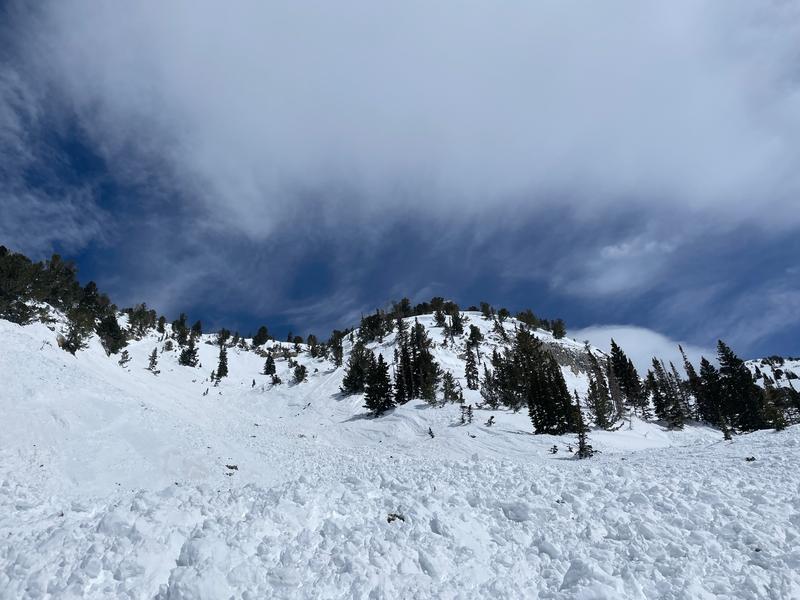
Goal for the day was to look at the avalanche remotely triggered in Grizzly Cup on April 6, 2023. Read more about this avalanche HERE.
Today's Observed Danger Rating
Considerable
Tomorrows Estimated Danger Rating
None
Coordinates