Observation: Park City Ridgeline

Observation Date
12/6/2017
Observer Name
mark white
Region
Salt Lake » Park City Ridgeline
Location Name or Route
PC Ridgeline
Weather
Sky
Clear
Wind Direction
Northeast
Wind Speed
Moderate
Weather Comments
Cold and clear with moderate N-NE winds transporting snow on the ridge line and down into more sheltered terrain. Crossloading was evident in South Monitor Bowl along with wind slab formation.
Snow Characteristics
New Snow Depth
10"
New Snow Density
Low
Snow Surface Conditions
Powder
Faceted Loose
Snow Characteristics Comments

The new snow from our last storm has settled out to about 8 to10 inches on the PC Ridgeline, the surface has already begun to facet and surface hoar has developed in sheltered terrain.

Red Flags
Red Flags
Wind Loading
Poor Snowpack Structure
Comments

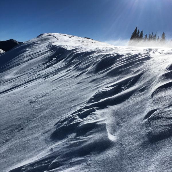
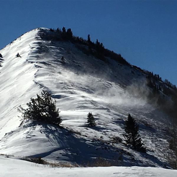
Today is the first day since our last storm that we've had wind strong enough to transport snow and form wind slabs on top of our already weak snow pack. Nothing good comes from a NE wind and it was cranking fairly hard in the afternoon. With the wind blowing in this direction you might not think its a big deal because its loading S, SW and SE slopes that did not harbor any weak faceted snow from before the storm, but the wind is also cross-loading snow over terrain features and forming firmer wind slabs in the N facing terrain that has the weakest snow. I would be suspect of any terrain on the north end of the compass that develops firm and connected wind slabs because the underlying snow pack structure is not to be trusted.

Photos: Surface Hoar forming in sheltered terrain, NE winds doing their thing.

Today's Observed Danger Rating
Moderate
Tomorrows Estimated Danger Rating
Moderate