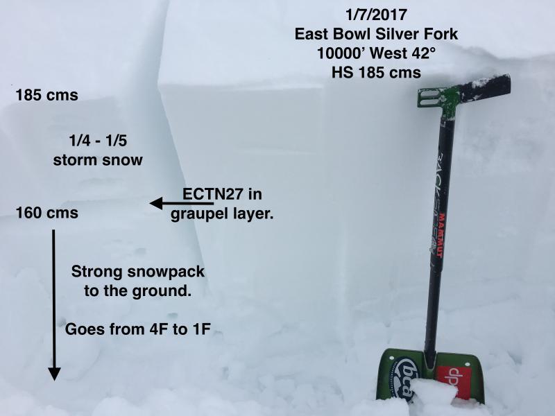
Quick tour in Silver Fork to look at the snowpack prior to the next upcoming weather event. Current snowpack in the central Wasatch looks quite strong. First photo shows a pit on a west aspect at 10000' and consistent with pits I dug on Thursday with no propagation of the column. Below the storm interface down 25 cms (10"), the snowpack goes from 4F to 1F and is strong.
This is the best-looking snowpack I have seen since 2010-11. It is deep (Snowtel sites are showing well over 100% of median; Snowbird is at 153%) and strong, with no weak layers of long-term concern. In early Jan 2011 we developed weak layers at the surface (SH and NSF) that was covered by new snow. On Jan 16, 2011 we had a rain event which led to Drew's infamous naming "MLK Crust", a layer that we had to watch the remainder of the season. Let's hope we don't repeat this.
A few random thoughts ahead of this next storm:
- With such a solid snowpack, I am thinking the Cottonwoods will be dealing with storm snow, and not expecting anything to break down deeper in the snowpack.
- Outlying areas (i.e. Lambs), as well as lower elevations in the Cottonwoods, where the snowpack is more layered may have issues deeper in the snowpack.
- Lots of cold, dry snow in steeper, sheltered drainages and terrain traps (i.e. Grizzly Gully, Donut Falls, Butler Fork) may have natural activity as wet, heavy snow accumulates.
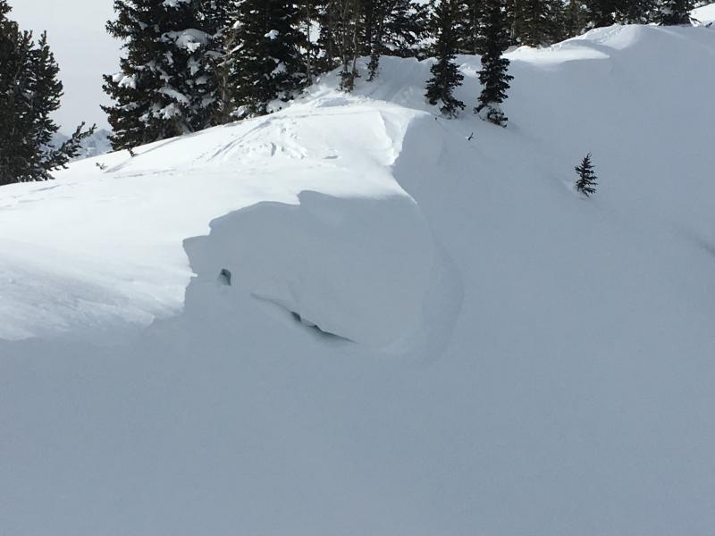
Cornices are becoming quite large and overhanging. They should continue to only grow larger with the expected increase in winds.
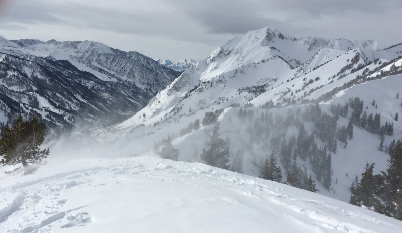
Mostly Low hazard where I was traveling this morning, with isolated Moderate where there is recent wind loading. Rising hazard beginning Sunday.