
Forecaster Comments: Yet another 5 star report from one of our MVP bc observers. Thanks Greg!
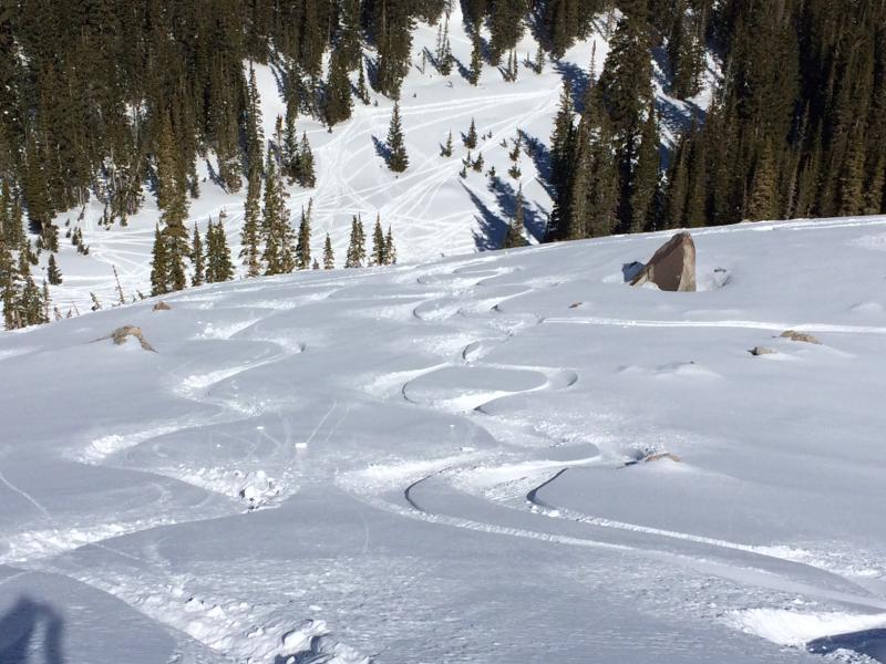
Route today was Tuscarora and Wolverine Cirque. I have been away for the past week and missed the storm, as well as resulting activity on Wednesday and Thursday, so was curious how the snowpack looked after the 3/2 storm and how the reactive mid-February facets now look. It is still relatively easy to identify the mid-February faceted layer, now down about half a meter (~20") from the snow surface. Overall it seems the slab on top has settled out and my stability tests today could not get any propagation.
Drew and Zinnia had an interesting observation from 3/9 that showed continued spatial variability, but Bruce's observation showed greater stability in the snowpack.
From what I observed today, it seems that the snowpack has adjusted to the rapid loading from earlier last week, and that it would be difficult to trigger a slab avalanche failing on the buried facets.
I was out fairly early this morning, and had returned before noon before things warmed further. But I had noticed several drainage channels and saw no wet activity, so unless we get a drastic warmup, it seems we have gone through our wet slide cycle as well. In terms of wet activity, probably the biggest concern would be terrain traps.
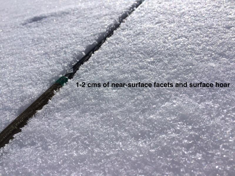
Photos showing a very thin Figure 8 Hill for nearly mid-March and shady slopes have a layer of weak near-surface facets and small-grained (< 5 mm) surface hoar. On very steep northerly aspects I was able to get some minor sluffing in this weak snow.
From what I observed today, a Low hazard
Big thanks to our forecasters and observer program. It has been a week since I have been in the field and I was able to follow events through the UAC site while I was away. We have an incredibly valuable community that readily shares information. Thanks to all.


