Observation: Reynolds Pk

Observation Date
11/24/2014
Observer Name
mark white
Region
Salt Lake » Big Cottonwood Canyon » Reynolds Pk
Location Name or Route
Reynolds peak
Weather
Sky
Broken
Precipitation
Light Snowfall
Wind Direction
Northwest
Wind Speed
Moderate
Weather Comments
In and out clouds, some sun in the afternoon, annoying wind on the high ridges.
Snow Characteristics
New Snow Depth
4"
New Snow Density
Medium
Snow Surface Conditions
Powder
Dense Loose
Wind Crust
Snow Characteristics Comments

Mill D received about 4 inches of new overnight and this morning, the new snow consisted of graupel mixed in with light density snow, some wind damage noted in exposed terrain. Snow is still feeling inverted and the denser snow on top was not helping things.

Red Flags
Red Flags
Recent Avalanches
Wind Loading
Cracking
Collapsing
Poor Snowpack Structure
Comments

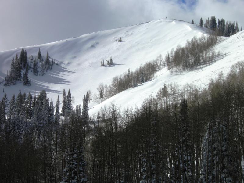
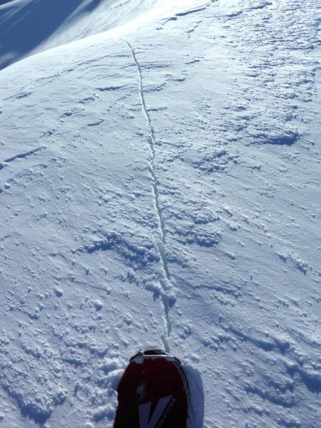
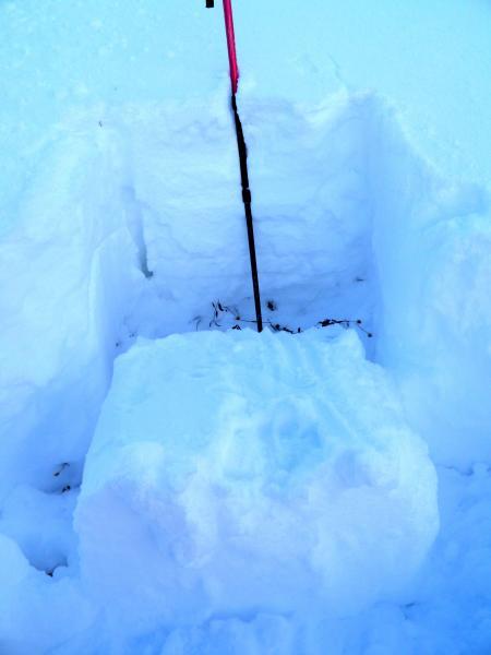
Went to take a look at what had happened during the storm to NE facing Reynolds peak. The slope was sill intact and has not avalanched, did note cracking and collapsing on the up track but not as sensitive as I was finding conditions yesterday. Total snow pack in the area is around 2ft with a couple different layers all resting on about 4 to 6 inches of rotten faceted snow at the ground. Snow pit revealed a clean, easy sheer in the facets, at the ground no big surprise there. Got a decent look at N facing BCC, and with what I saw yesterday on the PC Ridgeline noted a lack of natural activity at the end of the storm cycle, seems like most of the avalanches I've seen needed a trigger such as a person collapsing the snow pack in the vicinity to get things rolling. Snow pack structure still sucks, Slab on top of loose facets. Photos, Reynold's NE face, Cracking on the ridge line, snow pit.

Today's Observed Danger Rating
High
Tomorrows Estimated Danger Rating
Considerable