Observation: Colorado Bowl

Observation Date
11/14/2026
Observer Name
Trenbeath
Region
Moab » East Side of Geyser Pass » Colorado Bowl
Location Name or Route
Colorado Bowl
Weather
Sky
Obscured
Precipitation
Light Snowfall
Wind Direction
Southwest
Wind Speed
Light
Weather Comments
I can't really remember driving up to do field work while it was raining, but it was up to just above 8000'. Rain then turned to sleet, and then very wet snow at about 9000' and there was 6" of new at the trailhead (9600'). Light flurries continued most of the afternoon, and early morning moderate-strong SE winds backed off and shifted to the SW. Low visibility dominated most of the day, but some partial clearing occurred late in the afternoon. All said and done, 10" of new snow at 1.5" SWE fell at the Gold Basin study plot, and light snow turning to rain resumed on the drive down.
Snow Characteristics
New Snow Depth
10"
New Snow Density
Medium
Snow Surface Conditions
Dense Loose
Snow Characteristics Comments

Dense loose powder was the order of the day and skiing would be excellent if you could find a slope that had enough snow, or that you felt safe skiing. Moderate terrain is in short supply in the La Sals, especially up high where there is enough snow. There was some soft slab cohesion but overall quite minimal. I didn't observe any cracking or collapsing and it didn't behave like a storm slab. I observed mild wind affect just above treeline and some isolated drifting. I suspect higher experienced more wind loading.

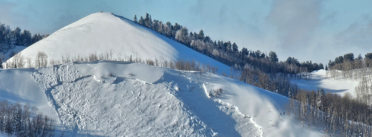
Dense powder snow with no cracking along the crest of Colorado Bowl, NE aspect, 11,400.

South facing slopes at mid and upper elevations just gained some snow. Many were bare or nearly so prior to this storm.

Red Flags
Red Flags
Heavy Snowfall
Wind Loading
Poor Snowpack Structure
Red Flags Comments
As previously noted, I did not observe any cracking or collapsing and only minimal wind loading just above treeline but I suspect there was more higher up. Generally speaking, I was surprised by the lack of reactivity within the new snow given the water amounts and pre-existing weak surface and I can only attribute it to a lack of cohesion or connectivity. At the end of the day, poor snowpack structure was the most glaring red flag. 10-12" of snow that sat around above the late October rain crust has faceted, and it is now forming a weak layer under the most recent storm snow. Although outward signs of instability such as cracking or collapsing were not observed, an ECT produced results of ECTP5 on top of the faceted layer at the new/old snow interface. The slab was soft, F+ in hardness and the weak layer was similar. This similarity in hardness also likely contributed to the lack of instability.
Avalanche Problem #1
Problem
Wind Drifted Snow
Trend
Decreasing Danger
Problem #1 Comments

Unstable areas of wind drifted snow remain a problem, primarily in wind exposed alpine terrain, and especially where they are overlying weak, near surface facets.

Avalanche Problem #2
Problem
Persistent Weak Layer
Trend
Increasing Danger
Problem #2 Comments

A persistent weak layer problem is developing. The most recent snow is not behaving like a storm slab but as it becomes more dense and more cohesive on top of the faceted layer, we will develop a persistent weak layer problem, likely within a day or two.

ECTP5 score on top of the faceted weak layer.

Today's Observed Danger Rating
Moderate
Tomorrows Estimated Danger Rating
Moderate
Coordinates