Observation Date
11/2/2026
Observer Name
Ryan Huels
Region
Moab » Laurel Highway
Location Name or Route
Laurel Highway
Weather
Sky
Obscured
Precipitation
Moderate Snowfall
Wind Direction
Southwest
Wind Speed
Moderate
Weather Comments
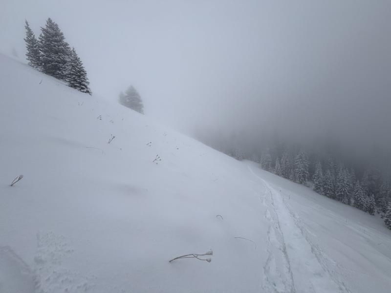
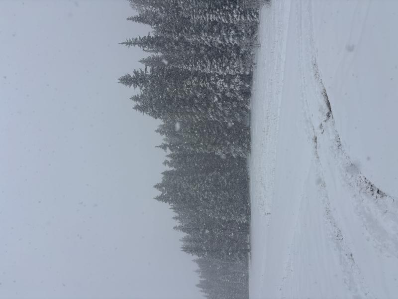
Sky was obscured with poor visibility throughout the entire day. Winds started from the NW and shifted to the SW increasing in intensity during the afternoon. Moderate snowfall from 830-1130 accumulating an additional 1-2 inches which subsided and light snow began again around 1400.
Snow Characteristics
New Snow Depth
12"
New Snow Density
Medium
Snow Surface Conditions
Powder
Snow Characteristics Comments
There was around 6” of new snow at the start of the laurel highway with around 12” of right side up snow above 10800’. New snow fell on old layers on northerly and west aspects. South facing aspects were essentially bare prior to this storm however the density of the snow made for supportable travel and great skiing on SE facing aspects. The snowpack is still thin and to access quality skiing you will need to climb to high elevations and seek out open grassy areas. Approaches, descents and egresses in wooded terrain and areas of deadfall is challenging and below 10800’ it is very easy to find the bottom of the snowpack. Overall, conditions were great for November 2nd and it felt more like late December up high.
Red Flags
Red Flags
Heavy Snowfall
Wind Loading
Collapsing
Red Flags Comments
There was 1-2” of new additional snowfall in the morning with light winds from the NW. Snow began again with moderate winds from the SW increasing the afternoon. With clear sky’s and warmer temperatures tomorrow I would anticipate the snowpack to become more saturated.
Avalanche Problem #1
Problem
New Snow
Trend
Same
Problem #1 Comments
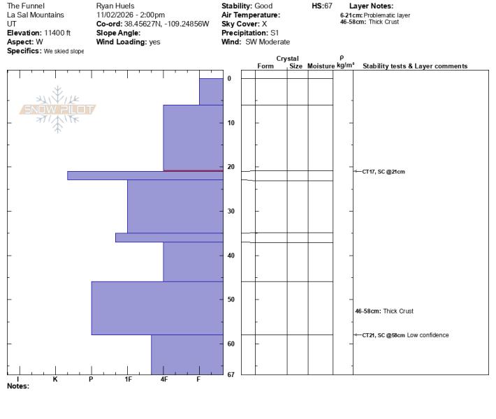
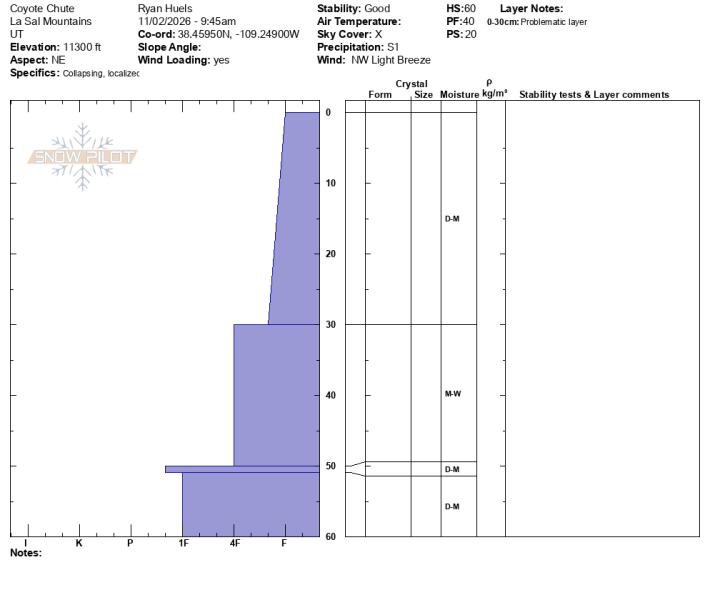
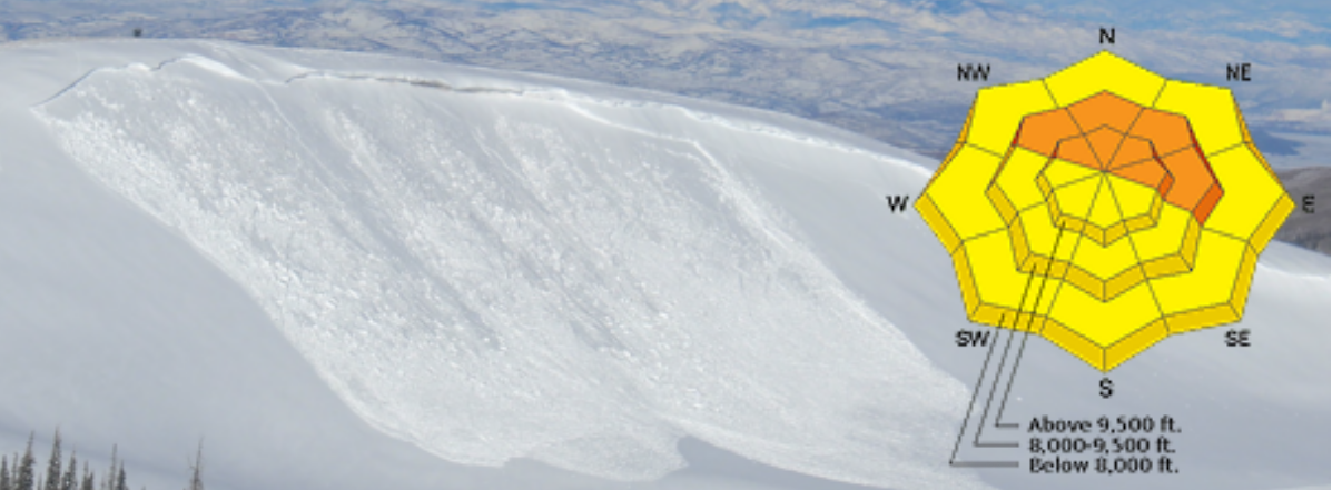
On E-N-W facing aspects where new snow has fallen on per-existing snow at the new snow/old snow interface. The snowpack on NE facing terrain did not show any obvious PWL’s but I would be suspect for such at very high elevations.
Avalanche Problem #2
Problem
Wet Snow
Trend
Increasing Danger
Problem #2 Comments
With a high rain/snow line and warmer temperatures at the beginning of the storm, the snowpack appears to gained some moisture. With sunny skies and warmer temperatures tomorrow, be aware of wet slides.
Comments
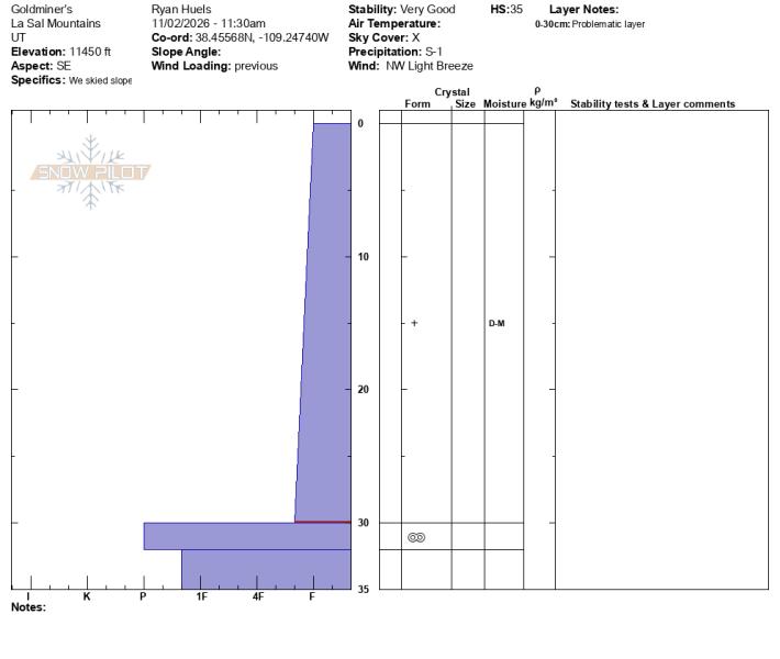
Snow profiles on W facing terrain at 11400’, SE facing terrain at 11450’ and NE facing terrain at 11300’
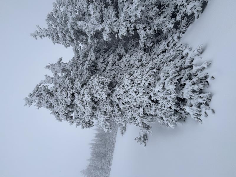
Heavy riming at upper elevations NTL
Supportable surfaces on SE and S facing terrain at high elevations
Moderate snowfall in the morning hours.
Today's Observed Danger Rating
Moderate
Tomorrows Estimated Danger Rating
Moderate
Coordinates