Observation: Laurel Highway

Observation Date
3/24/2026
Observer Name
Garcia
Region
Moab » Laurel Highway
Location Name or Route
Laurel Highway
Weather
Sky
Few
Wind Direction
West
Wind Speed
Light
Weather Comments
58°F at 10,000 feet.
Snow Characteristics
Snow Surface Conditions
Damp
Snow Characteristics Comments

I started my tour after 10 AM, and the snow was already damp. Travel was difficult both uphill and down as I experienced trap-door conditions while collapsing into the snowpack while skinning and skiing.

Red Flags
Red Flags
Collapsing
Rapid Warming
Poor Snowpack Structure
Red Flags Comments
Collapses were frequent, but limited to directly beneath my skis. No shooting cracks, no propagating failures. The thin slab beneath my feet was wet, and slab fracture prevented any sort of long-running failure.
Avalanche Problem #1
Problem
Wet Snow
Trend
Same
Problem #1 Comments

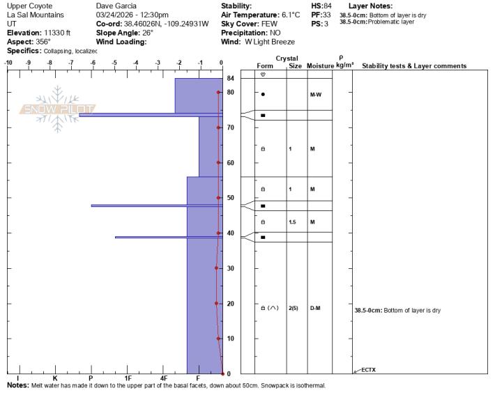
The snowpack is now isothermal, and we’re simply waiting on a solid overnight refreeze to lock things back up. In this profile, meltwater has percolated to roughly 50 cm below the surface. The upper portion of the basal facet layer is slightly moist, while the lower portion remains dry. At the base of the pack, facets and depth hoar are rounding but still dry. There isn’t much of a cohesive slab at this location.

My concern shifts to areas in the alpine where more developed slabs exist. In this pit, the faceted layers have weakened with the introduction of meltwater and are now quite loose. If capped by a more cohesive slab, these layers could still fail and produce an avalanche. Wet slab avalanches remain possible, though the terrain where they are most likely continues to shrink.

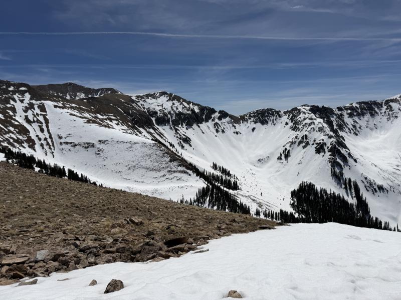
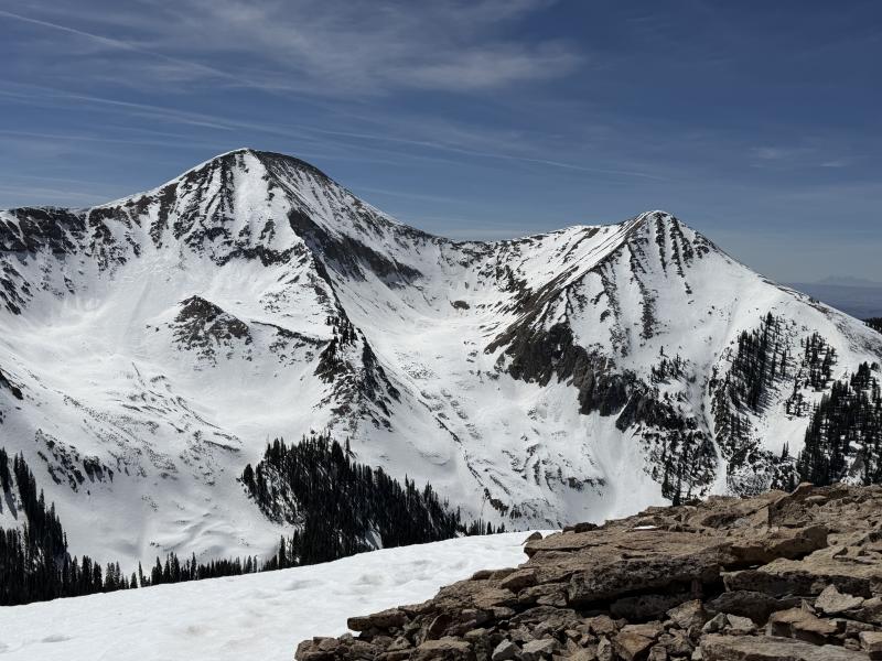
I remain most suspicious of large, well-connected slopes near and above treeline. I’ll continue to carry concern until we see several consecutive nights of below-freezing temperatures in the mountains.

Comments

I've included some photos below to show overall coverage:

Today's Observed Danger Rating
Moderate
Tomorrows Estimated Danger Rating
Moderate