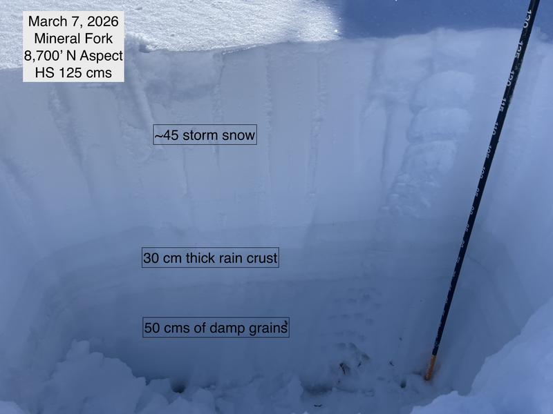
No specific avalanche problem to highlight: the new snow is settling into a cohesive slab and is bonded to the crusts that formed from rain events earlier this week. There is a solid crust layer underneath this storm snow, which is 5-10 cms thick above about 9,000 feet. Below this elevation, rain earlier this week apparently saturated the snowpack, and the crust is 30 cms thick, with damp grains below the crust to the ground.
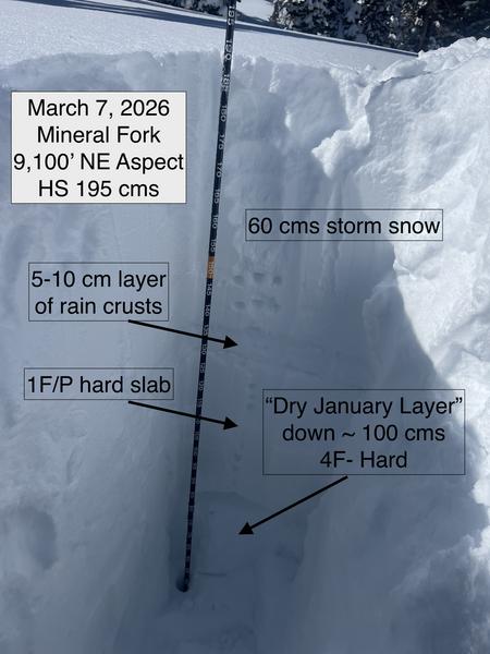
Above 9,000' the DJL (Dry January Layer) is now buried about a meter deep, even deeper in areas that received the most storm snow, such as upper Little Cottonwood. Not only are there strong and supportable crusts in the snowpack, but the slab just above the DJL is quite strong, 1F or P hard. Given the (1) depth of the DJL, (2) strong rain crusts, and (3) strong slab just above the DJL, it is becoming increasingly unlikely to trigger an avalanche failing on the DJL. The exception to this is in the upper elevations, in terrain where the snowpack may be thinner (ie due to having avalanched or in a steep, rocky terrain.
For Sunday, wet activity will likely be more common with strong sunshine. Also - slopes that were recently wind-loaded are more likely to avalanche.
Photos of
- Pit at 8,700 feet showing thick crust with damp grains to the ground. This is probably from a saturating rain event on Monday
- Pit at 9,100 feet showing shallower rain crusts with dry snow underneath
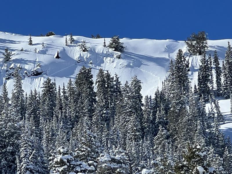
- Recent natural avalanche along the East Mineral Ridgeline
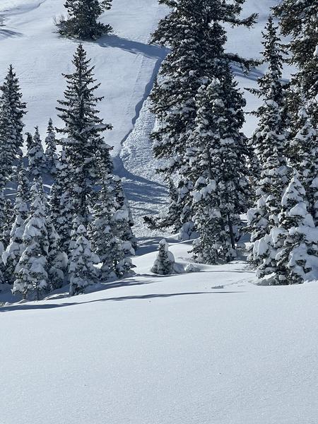
- Recent sluff from steep slope