Wandered up Grizzly Gulch this morning to get a sense of how the snowpack was handling the nearly 2" of water with some wind-loading.
Quite a difference above and below the ~9,200' rain/snow line:
- At or below the rain/snow line, I was seeing damp grains down ~90 cms from the snow surface, including the faceted Dry January Layer (DJL). ECTN23 on the DJL
- Above the rain/snow line, the top ~20 cms of the snowpack was damp, with dry snow underneath, including the DJL. The ~75 cm storm slab from last week is moving toward pencil-hardness, with a weaker, F-hard layer of facets at the DJL. Despite this strong-over-weak layer, results were ECTX, and this is similar to what Nikki was seeing yesterday in this same zone where upper LCC seems to have an overall stronger snowpack (as usual).
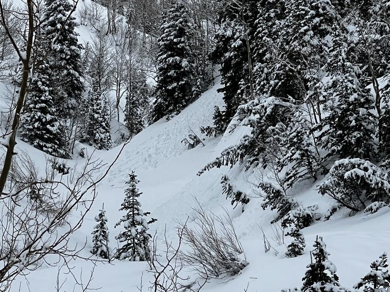
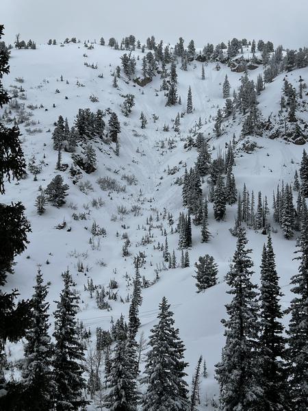
Below the rain/snow line, wet/loose activity was widespread on all aspects.
The DJL is weakened further with water percolation below ~9,200' or has a stronger slab on top above 9,200', with the dry DJL layer below. In both situations, a complex setup.
Photos of some minor wet-loose activity from today, including north-facing slopes up to 9,600'