Observation: Cutler Ridge

Observation Date
2/21/2026
Observer Name
Derek DeBruin, Cage Vigil, Bo Torrey
Region
Ogden » Ben Lomond » Cutler Ridge
Location Name or Route
Ben Lomond, Cutler Ridge
Weather
Sky
Clear
Wind Direction
Southwest
Wind Speed
Moderate
Weather Comments
12F at the trailhead this morning around 0800. A few wisps of cloud, but a fairly bluebird day. Quite calm, especially for Cutler. We only found significant wind today near the saddle, but it was evident across most of the high elevations with snow streaming off the ridges and summits.
Snow Characteristics
Snow Characteristics Comments

While it wasn't very windy today, there was clear evidence that it had been windy with the passage of this week's storm. The Cutler Headwall had signs of cross-loading, and the snow was otherwise scalloped and textured. The saddle harbored wind-affected snow as usual, allowing us to kick off a cornice and associated wind slab. The summit shoulder was wind-affected per normal, but was relatively well filled in and didn't have the sastrugi that is often present.

In the mid elevations, we found various wind effects, including surface wind crust, a few bare ice patches, and the usual zones stripped a bit thin, but mostly surface snow was simply cakey and very rideable. In protected terrain, soft snow was still well preserved and made for great turns.

Red Flags
Red Flags
Recent Avalanches
Wind Loading
Cracking
Collapsing
Poor Snowpack Structure
Red Flags Comments
Several red flags today. 1. Wind loaded zones, dominantly at upper elevations. 2. Recent avalanches, including about a dozen D2 slides across the headwall. (see photos below) 3. A couple of recent avalanches in Bailey's Bowl. See: https://utahavalanchecenter.org/avalanche/101809 4. We had 2 significant collapses, ca. 7600 feet in protected N/NE terrain that cracked a few hundred feet across. This is where the riding is good, but there is clear potential for avalanching, so terrain choice and slope angle are critically important. 5. Poor structure (more below).
Avalanche Problem #1
Problem
Persistent Weak Layer
Trend
Decreasing Danger
Problem #1 Comments

The blue card on the sidewall indicates the weak interface between the recent storm snow and the dry January layer of facets. The top 18 inches of the snopwack consists of right-side-up snow, fist hard at the surface and progressing to 1 finger hard snow just above the weak layer. The weak layer consisted of well-developed 2-2.5mm facets that were fist hard. Although the entire mid-pack consists of faceted snow, the top 2-4cm was much softer, looser, and had larger grain facets. We experienced a large collapse on this slope as soon as I took my skis off and sank into the layer of facets.

Avalanche Problem #2
Problem
Wind Drifted Snow
Trend
Same
Problem #2 Comments

Fresh wind drifts form mostly on upper elevation terrain but are also noted to a lesser extent on mid-elevation terrain features. 6-18 inches deep observed today.

Comments

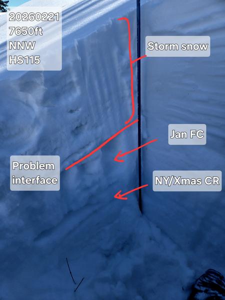
We dug NNW at 7650ft. HS 115 with about 35cm of rightsideup F to 4F storm snow layers. This sat atop a thin MF crust and 25cm of the Dry January Layer facets (with a smidge of crust thrown in). New Year's crust was 55cm off the ground with Christmas crust beneath, and then rounding, clustering, and damp basal facets to an ice lens underlying everything else.

ECTX, however, suspect this result was because we'd already had a collapse on this slope. Given the very soft January facet layer, avalanches 1-2ft deep still seem very much in play at the mid elevations.

Photo 1: Snow profile.

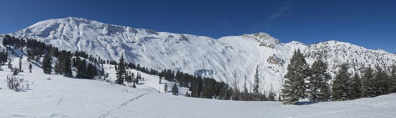
Photo 2: Headwall pano.

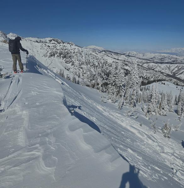
Photo 3: Cornice drop and wind slab at Saddle.

Photo 4: Large Natural avalanches on the Cutler headwall. Looked to have run during the storm on Wednesday.

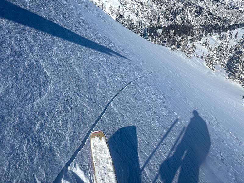
Photo 5: Large shooting crack on a recently wind-drifted slope.

Today's Observed Danger Rating
Considerable
Tomorrows Estimated Danger Rating
Considerable
Coordinates