The new snow old snow interface is the key player in the Ogden area backcountry right now.
At 8880 feet on a north aspect, test slopes were generally reactive, breaking as a soft consolidated slab at the interface on top of the January facets. Walking around earlier in the day, things were more reactive, but into the afternoon we were still seeing cracking and collapsing at the new snow old snow interface. This included areas that did not catch much wind.
When digging within the new snow, there was also a reactive graupel layer. It was easy to pull the new snow off on top, but while moving through terrain, the cracks and more consolidated snow were failing on the January facets.
In less consolidated terrain features, the primary concern is loose dry. The snow surface beneath the new snow remains weak, and even a small sluff can entrain a surprising amount of snow.
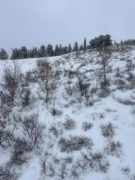
While the facets are widespread, as they are across much of the range, many aspects are capped by a crust of varying thickness. The primary PWL issue is isolated to mid and upper elevation north and northeast aspects, though facets exist all the way down to lower elevation true north. Add even a bit more solar tilt in either direction and you will find a crust with weak snow beneath it. As we add additional load, the areas where we are likely to see failure on the January facets will continue to expand into some of the more solar aspects.
True south now has a light dusting, but remains generally shallow.
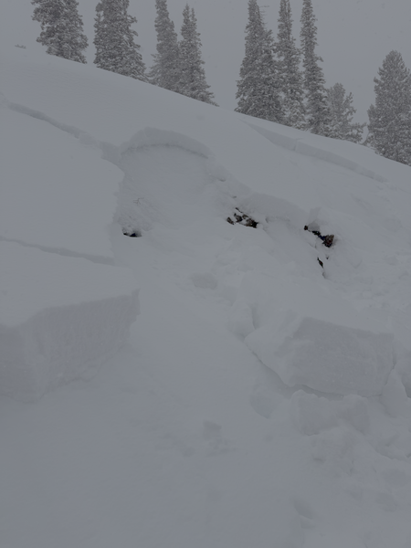
Test slope - N Aspect - 8880' - Reactive to skis at the new snow, old snow interface on old January facets
Same test slope, later with a bit more snow - a bit less reactive
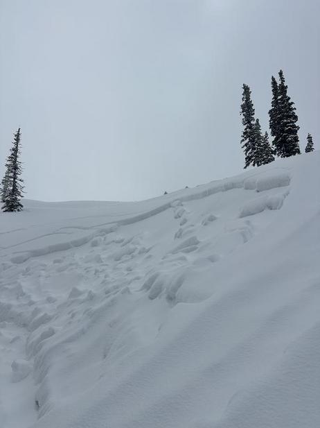
Quick bit parallel the test slope - N 8880'
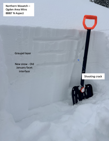
Graupel interface, easy to shear blocks off on
Low coverage solars