Observation: Snowbasin

Observation Date
2/9/2026
Observer Name
Maushund
Region
Ogden » Snowbasin
Location Name or Route
Snowbasin
Weather
Sky
Obscured
Precipitation
Light Snowfall
Wind Direction
West
Wind Speed
Moderate
Weather Comments
Skies were largely obscured above Needles during our outing from 12:00 until near 3:00, with periods of clearing later in the afternoon. Light snowfall (S1) turned off and on throughout, with snow falling quite warm and damp. Temperatures hovered around freezing near base level for much of the day, with temperatures cooling off just slightly in higher terrain above 8000' in the early afternoon.
Snow Characteristics
New Snow Depth
4"
New Snow Density
Medium
Snow Surface Conditions
Wind Crust
Rain-Rime Crust
Damp
Snow Characteristics Comments

Accumulations of up to 3" observed near upper elevations, with favored wind-blown areas seeing near 4 inches of new snow on top of the old surface. Above base level (8000' and above) new snow was primarily damp as due to warmer temperatures throughout much of the day. A mix of snow and rain at the base. On icy, crusty old surfaces on solar aspects, this helped new snow bond surprisingly well. On more faceted surfaces found on more polar aspects, this made for a denser layer of new snow atop 70-75cm of faceted snow from our period of high pressure. While this wasn't an issue in our travels, we were able to get localized cracking near the surface—a sign of what will come when more snow is added to create a larger slab over a very weak snowpack.

HS on a NNE-facing slope near 8750' in an unmitigated area was 145cm, with 10cm of new snow sitting atop 75cm of well-developed facets. This sat above the New Years rain crust, which was decomposing with facets on either side. This interface is most suspect for large, future slides once we load the weak spx with more of a slab. Below this sat 20cm of less-developed facets, overlying the Christmas rain crust (CERC), which was significantly stouter than the New Years crust above, with graupel above.

Coverage on solars at low and mid elevations was non-existent to meager, with even low elevation northerlies not harboring enough snow to warrant an persistent issue once more snow falls.

Red Flags
Red Flags
Poor Snowpack Structure
Red Flags Comments
It won't take much of a slab to see activity on mid and high elevation polars.
Comments

A huge thank you to Corey Kruse and Snowbasin Ski Patrol for the visit and partnership out in the field.

Photos:

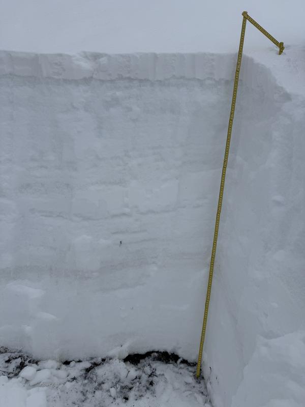
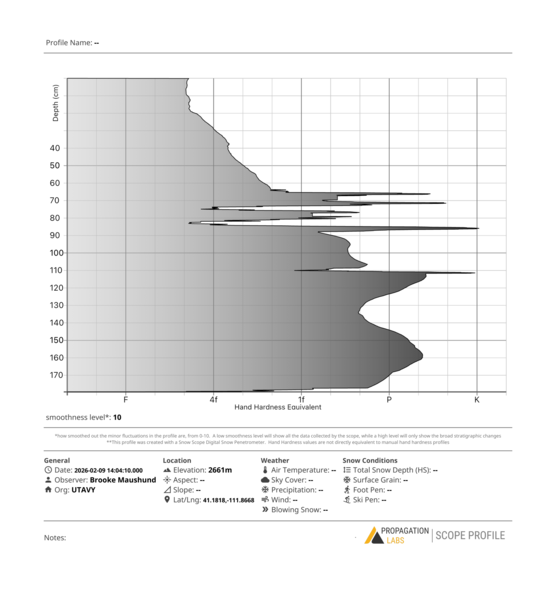
#1 Snowpack structure on a NNWE-facing slope near 8750'

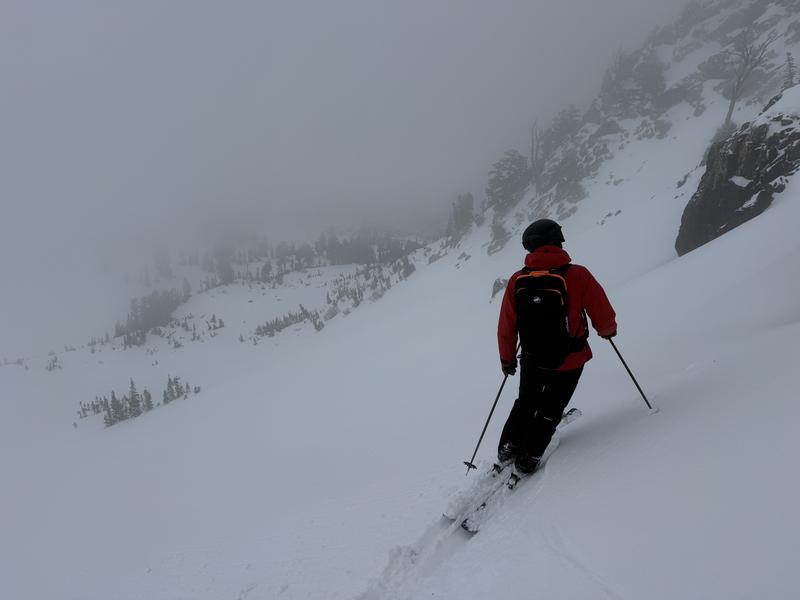
#2 Visibility at mid and upper elevations was limited until later in the afternoon

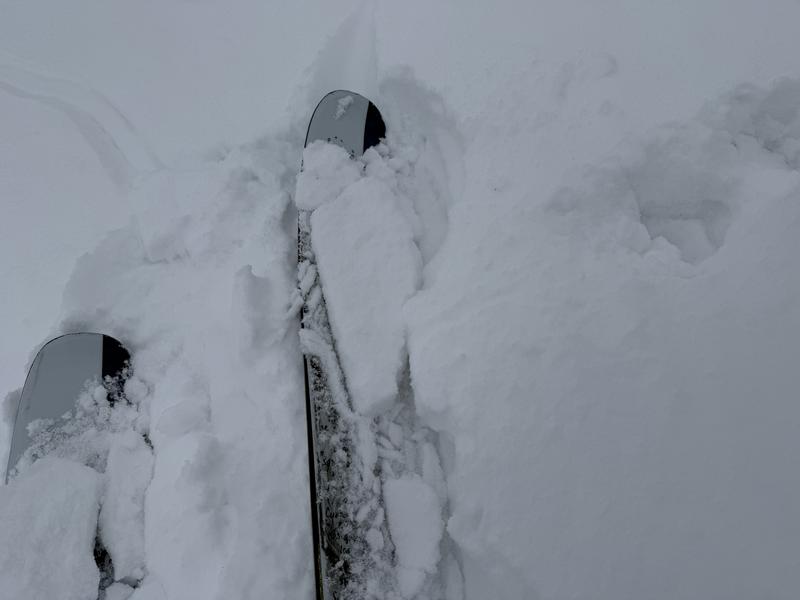
#3 2-4 inches of damp new snow fell, creating a thin but denser layer atop old weak snow on polars. We only experienced limited and very localized cracking, but this is a sign of what is to come with more of a load.

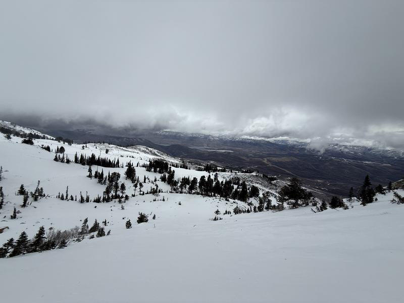
#4 Skies began to clear, and the cloud ceiling rose later in the afternoon.

Today's Observed Danger Rating
Low
Coordinates