The big picture is that slopes on the north half of the compass, starting around 8500 feet in elevation, are holding lots of weak faceted snow. In sheltered areas, the snow surface is loose facets. In exposed areas, there are various wind crusts with facets underneath them.
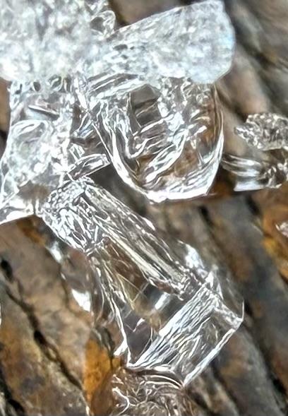
Photo below: N facing at 8500', the entire snowpack consists of large-grained facets. You can still make out the heat/rain crusts from December, but they are getting chewed up through the faceting process.
If you can find areas that don't have old tracks, wind crusts, or sun crusts, there is some ok riding conditions where you can cautiously carve around a bit. Surprisingly, the shallow snowpack is still mostly supportable which keeps you up off the ground. This is mainly due to the heat/rain crusts from December. I was noticing a number of places that would "trap door" on me where all of a sudden, I'd break through the Christmas heat/rain crusts while turning.
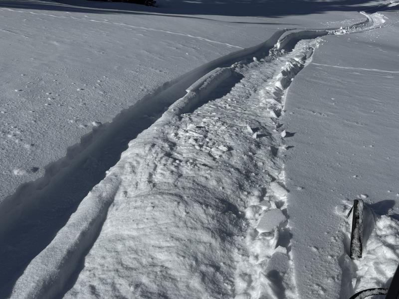
Photo below: The sled track churned up the facets, big time, revealing that basically the entire snowpack is facets with the Christmas heat/rain crust thrown into the middle of the pack.
The bottom line is that all the loose faceted snow around in the mid and upper elevation terrain on the north half of the compass will most likely act as a weak layer and produce avalanches if we ever load them up with new layers of snow. As of now, all we have is a big pile of loose snow that isn't currently dangerous.
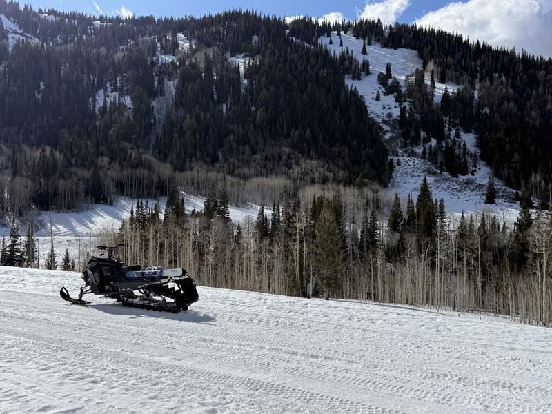
Photo below: A view of the shallow snow cover in the Bluebell zone. People are still driving vehicles up the road as high as Scotty's.