Observation Date
1/25/2026
Observer Name
Plante
Region
Salt Lake » Little Cottonwood Canyon » Red Pine
Location Name or Route
Red Pine
Comments
Went & booted up Red Pine towards the ridge, in doing so, temp was -15F without wind chill. Clouds were covering ~5/8 of the sky. At 25* slope, for ~200 feet, the snow pack crust varied from crusty as to where you can stand on it, and the foot sinking at the knee. As to what my main concern was the sound as you stepped sounded almost hollow underneath you. At about 1/3 way up the ridge I decided to test the snowpack structure, as booting up a mountain side with little snow pack & with a persistant weak layer thats still somewhat there, but with the fact that it's still there got to me.
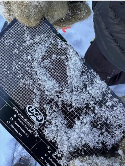
We dug a very rudimentary hole to the bottom of the snowpack. 2 layers concerned me which was the facets at 0-30 cm, & the ice layer 35-37. The first layer somewhat varied depending on if it was filling the gaps between the rocks, or if it were on the rocks. Most of it sure looked like a persistant weak layer, given that the crystals were as if it were glass shards; super fine when trying to hold it in the hands. As for the 35-37 cm layer, that was pure ice.
Most of the snow was fine, as for what I could tell, now I didn't look at the snow on the card, but for the most part looked rounded and well-bonded.
The 90-12 7 cm layer was also as what I could tell dense, being that I could still fist it, but I could also break that layer into large chunks. I did do a very rudimentary test & it did look like the 127-90 cm broke off. It did propagate with it being a massive chunk when I tapped on it ( Dont recall as to which test it was, it was on theset of the taps), but it did propagate. Given the fact that 1. booting up a mountainside in winter is 100% not a good idea whatsoever (Dom, you should've brought your skiis dmanit), and 2. with what looked to me a persistent layer, and the propagation on the 90 cm line we turned back with the main concern being that if we hit a shallow spot further up the mountainside.
1st Pic is the facets at the 0-30 cm line.
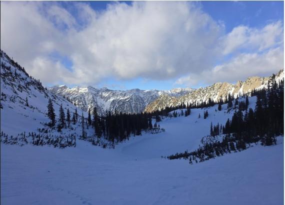
3rd pic is the view of Red Pine
Today's Observed Danger Rating
Low
Tomorrows Estimated Danger Rating
Low
Coordinates


