Observation: Gold Basin

Observation Date
1/24/2026
Observer Name
Nauman, Darling
Region
Moab » Gold Basin
Location Name or Route
Tele Gold
Weather
Sky
Scattered
Wind Direction
Northwest
Wind Speed
Light
Weather Comments
It was a gorgeous day with mixed sun and thin clouds. The wind was unexpectedly light and we had good visibility into the alpine.
Snow Characteristics
New Snow Depth
10"
New Snow Density
Low
Snow Surface Conditions
Powder
Snow Characteristics Comments

The snow was quite good with 8-12" new snow. The local variability in new snow depth was interesting, but the snow was largely not wind affected. It just seems like there was enough wind during the snow to fill in low sheltered spots a little more than short scale convexities without causing the snow to slab up. It was really fun to ski, but a bit slow in areas where you would dip into older faceted snow. There were also some areas where you could feel hard crusts underneath. We were probing 80-120+ cm in a north sheltered aspect at 10,600'. We could feel two crusts starting, the first down ~1.5' and another down around 2' below the surface. We found a lof of facets on top of the first crust and our pole pokes felt like there were more facets between the crusts and down at the bottom of the snowpack. Complicated snowpack.

Red Flags
Red Flags
Heavy Snowfall
Cracking
Collapsing
Poor Snowpack Structure
Red Flags Comments
We noted a few storm snow point releases out of cliffy alpine start zones, but nothing slabby. We had a couple localized collapses breaking track and one big collapse right at a shrubby treeline slope inflection point where things started getting steeper. An area ~20-30' collapsed with visible shooting cracks at the edges. If it were on a steep slope, it would have slid (see pic below). We didn't encounter any wind slabs, but saw some wind patterns in snow up higher in the alpine of Middle Cirque and Talking Mtn. Also did not see any active wind transport...
Avalanche Problem #1
Problem
New Snow
Trend
Same
Problem #1 Comments

Although the new snow is not reactive right now, a release of new snow could step down in an area like the one where we had a collapse. This new snow might still slab up iwith the sun/warmth we had, and it is on top of 1) facets and 2) a decent crust that seemed like a good bed surface. So, something to be aware of.

Avalanche Problem #2
Problem
Persistent Weak Layer
Trend
Same
Problem #2 Comments

Facets abound in our snow pack and are complicated to predict with our set up of multiple crusts on the north aspects. Nothing of note slid with this cycle that we observed, but it wasn't a huge load and there was enough collapsing that I'd tread with caution on these aspects. The bottom line is it's not a trustworthy snowpack structure. With any rapid warming and consolidation of new snow on top, the facets that formed on the old snow surface before this storm could be our next weak layer.

Snow Profile
Aspect
North
Elevation
10,800'
Slope Angle
25°
Comments

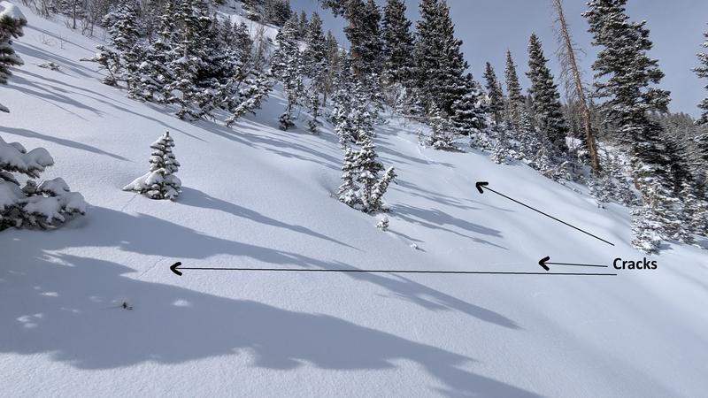
Pic 1) Cracking near treeline where we had a large collapse

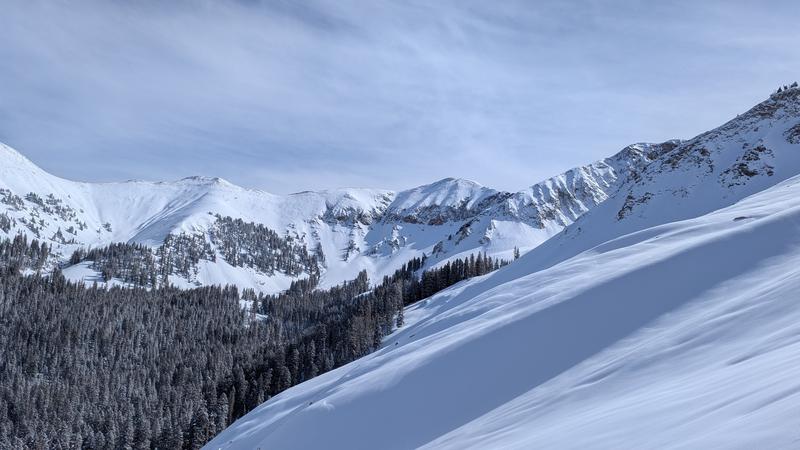
Pic 2) Looking up into Middle Cirque and TM where more wind impacts were observable

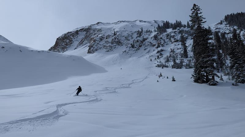
Pic 3) Fabulous Day!

Today's Observed Danger Rating
Moderate
Tomorrows Estimated Danger Rating
Moderate
Coordinates