Observation: South Fork

Observation Date
1/20/2026
Observer Name
Maushund, Kobernik, Kendall
Region
Skyline » Spring City Canyon » South Fork
Location Name or Route
S. Fork Spring City Canyon
Weather
Sky
Few
Wind Direction
Northwest
Wind Speed
Light
Weather Comments
Another day of high pressure with sun, a light NW wind at ridgeline, and few thin high clouds that moved in by the afternoon. Temps remained cool and below freezing.
Snow Characteristics
Snow Surface Conditions
Dense Loose
Faceted Loose
Wind Crust
Melt-Freeze Crust
Snow Characteristics Comments

The key takeaways are that (1) the snowpack is generally stable and (2) is weakening from the surface down due to the cold, clear weather, and will become a problem when buried. For now, the near surface faceting just means good, recycled facet pow skiing as we experienced today. With HS that varied between 50-90cm between 9000-10,400', the usual low coverage suspects—rocks, stumps, logs, etc.— were more of a safety concern than avalanches.

Looking ahead, the snowpack is generally composed of F to 4F facets, with one stouter crust from the December rain event near Christmas (see profile), and in some areas (particularly below 9700') a secondary, less stout crust from the warm temperatures early in December. Surfaces continue to be a "you can find it if you know what to look" game. In much high, alpine terrain, the sustained N winds have also hammered surfaces to make for the wind-hammered, wind crust, wind-scoured, wind-buffed variety pack.

Snow Profile
Aspect
Northeast
Elevation
10,300'
Comments

Photos:

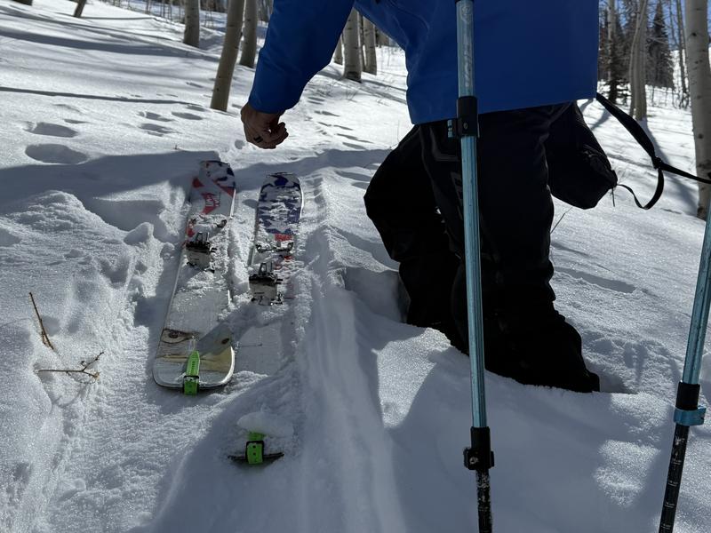
#1 Facets to the ground mean your boots also can hit the ground when you pop out of your skis. In a lot of locations, the crust can be supportable, but not here.

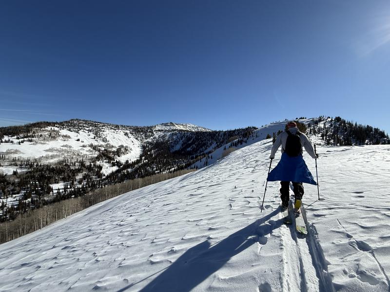
#2 Wind-textured surfaces near ridgeline

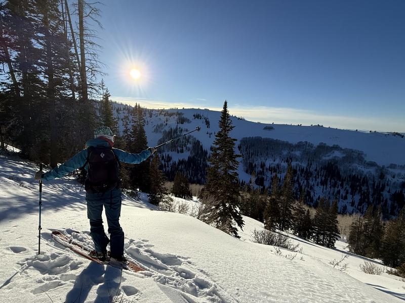
#3 On a WNW slope near 9100', with a thin zipper crust only if you hit the wrong side of the micro-aspect

Today's Observed Danger Rating
Low
Tomorrows Estimated Danger Rating
Low
Coordinates