Join us at our 2nd Annual Blizzard Ball

Forecast for the Skyline Area Mountains

Brett Kobernik
Issued by Brett Kobernik on
Thursday morning, January 2, 2025
The overall avalanche danger is CONSIDERABLE today on the Manti Skyline.
Continued avalanche activity on Wednesday confirms that the snowpack remains unstable.
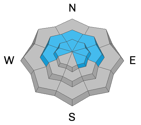
The danger is most pronounced above 8000 feet in elevation on west through north through east facing steep terrain.
The only sane choice right now is to avoid those steep slopes.
Low
Moderate
Considerable
High
Extreme
Learn how to read the forecast here
Weather and Snow
Current Conditions: We picked up 1 to 2 inches of new snow overnight and it's lightly snowing as of 6am. I'm guessing the new snow is dense. Temperatures have warmed overnight with most locations in the mid to upper 20s. It was breezy along the ridgetops on Wednesday and the wind from the west continued overnight with gusts into the 50s along the highest terrain. Riding conditions are a mixed bag. You can find areas with exceptional conditions. You can also find areas that have been beat on by the wind. You'll also find areas where you are punching deep into the weak sugary snow near the ground.
Mountain Weather: We'll see cloudy skies with light snowfall and light accumulations possible this morning. Wind from the west is going to remain breezy along the higher terrain through mid day then start to slow. Temperatures are going to get up around freezing. We should see some partial clearing this afternoon. There's a little break on Friday then another storm will move through on Saturday bringing a few inches of new snow.
Recent Avalanches
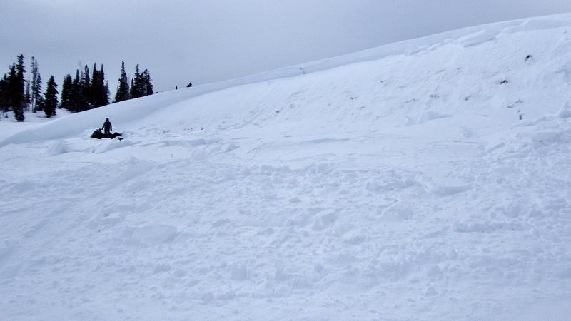
There were a couple of avalanches triggered on Wednesday in Ephraim Canyon. In both cases, they were triggered by riders from below who were able to avoid being caught. One of the slides engulfed the riders tracks. While these slides didn't run very far, either one could've easily buried a rider and ended his life.
AVALANCHE NEAR THE MEADOWS
AVALANCHE ON PHILLADELPHIA FLATS
The amount of reported avalanches around the state since Christmas is pretty amazing. Check them all out HERE.
Ad
Avalanche Problem #1
Persistent Weak Layer
Type
Location
Likelihood
Size
Description
Recent avalanches are the most clear sign of danger. The two avalanches that were triggered on Wednesday show us things remain unstable. During my travel on Wednesday, my partner and I noted that the majority of the avalanche paths in Manti Canyon, The Cove and Six Mile Canyon have not released yet. This means they are just waiting for a trigger. Don't let that trigger be you.
The bottom line message is simple. Avoid steep terrain.
General Announcements
This forecast is from the U.S.D.A. Forest Service, which is solely responsible for its content. This forecast describes general avalanche conditions and local variations always occur.