Join us at our 2nd Annual Blizzard Ball

Forecast for the Skyline Area Mountains

Brett Kobernik
Issued by Brett Kobernik on
Friday morning, January 3, 2025
The over all danger rating remains CONSIDERABLE today on the Manti Skyline.
The snowpack remains unstable in many locations and human triggered avalanches are still likely.
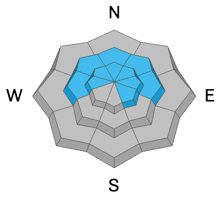
The most dangerous locations are steep slopes above 8000 feet in elevation that face west through north through east.
Conditions will eventually stabilize but for now and through the weekend, continue to avoid the terrain I just mentioned.
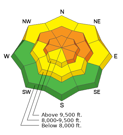
Low
Moderate
Considerable
High
Extreme
Learn how to read the forecast here
Weather and Snow
Current Conditions: Riding conditions are somewhat variable due to all the recent wind but my partner and I found great conditions for both snowmachines and skis on Thursday. The wind was still breezy until the afternoon and has continued to slow. It's from the southwest. Temperatures were quite mild on Thursday and remain relatively warm with many upper elevation stations right around freezing this morning. Valley bottoms are colder.
Mountain Weather: It looks like scattered clouds will increase as the day goes on today. Temperatures are going to be unseasonably mild again with many higher elevation locations well into the mid to upper 30s. Wind will be from the southwest in the light to moderate speed categories. It will probably feel a little breezy along the most exposed locations. A cold front moves through Saturday morning bringing a little refresher of snow with something like 3 to 5 inches. Wind will shift to the northwest with the frontal passage and it'll be a little breezy. Temperatures will cool back into the 20s and teens. It looks like we should get another little shot of snow Monday.
Ad
Avalanche Problem #1
Persistent Weak Layer
Type
Location
Likelihood
Size
Description
My partner and I experienced a few collapses while traveling around on machines on Thursday. The snowpack "whumpfed" underneath us and we could feel it drop. This is an undeniable sign of unstable snow.
Today and through the weekend, you will want to continue to avoid steep mid and upper elevation terrain that faces west, north and east. This is where the weak sugary faceted snow is most pronounced at the base of the snowpack. This weekend's expected wind and snow isn't going to drastically increase the avalanche danger but it will add some weight that will stress the weak snow a bit and keep things more dangerous than I like.
The good news is that I have seen some places where the snowpack is starting to gain some strength. If we can continue to get more new snow, we will continue to see slow improvement with the stability.
Bottom Line: for now, all bets are still off.
.
General Announcements
This forecast is from the U.S.D.A. Forest Service, which is solely responsible for its content. This forecast describes general avalanche conditions and local variations always occur.