Join us at our 2nd Annual Blizzard Ball

Forecast for the Uintas Area Mountains

Mark Staples
Issued by Mark Staples on
Sunday morning, December 17, 2023
Today the avalanche danger is LOW on all aspects and elevations. Hitting rocks and stumps is still a major hazard with an early season snowpack.
While great snow can be found in the Uintas, travel is still a bit limited. Consider doing some rescue practice with your partners.
Low
Moderate
Considerable
High
Extreme
Learn how to read the forecast here
Weather and Snow
Temperatures in the Uintas this morning are hovering around 29 degrees F, and winds are averaging 4-10 mph gusting to 15 mph from the west.
Today will have more sunshine and clear skies with temperatures in the mid to upper 30s and very light winds from the north-northwest.
Weather this upcoming week will mainly bring some clouds here and there, a chance for a dusting of snow, and a chance to blow out the valley inversions. Perhaps more snow closer to Christmas, but we'll see how that part of the forecast develops.
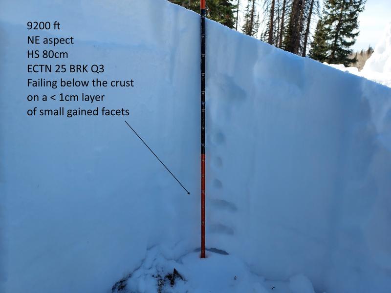
Snow conditions are generally crusty on south aspects with minimal snow, but nice recycled powder and decent coverage on north aspects. Regular observer Mike J found 80 cm (32 in) of snow on a north aspect at 9200 ft yesterday.

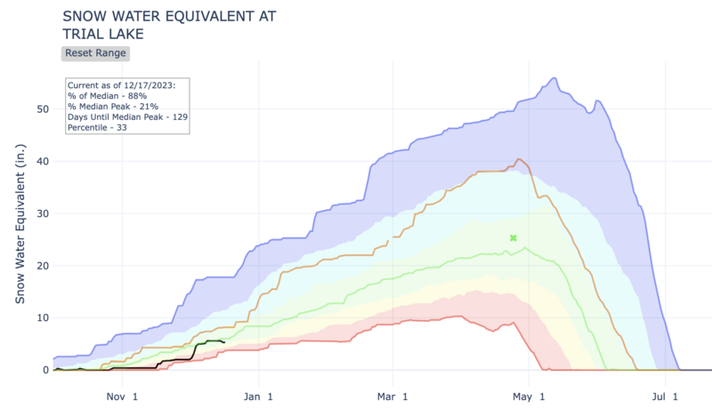
Below is a graph from the NRCS of precipitation at the Trial Lake SNOTEL site which has 24" snow (5.2" water). While it feels like a slow start to winter, the snowpack is just a little below average.
Green line = 30-year median
Brown line = last winter
Black line = this winter so far
Recent Avalanches
Ted Scroggin spotted a few old slides from the last storm (~Dec 8th) while walking around Bald Mountain and Reids Peak yesterday. He reported that the snowpack was shallower and weaker in this area than near Whitney Reservoir a little further north.
Trip reports and the latest observations are found HERE.
Ad
Avalanche Problem #1
Normal Caution
Type
Location
Likelihood
Size
Description
The way we evaluate the snowpack for good stability at a broad scale (the scale of the avalanche forecast) is by adding up a lack of red flags. The current situation across the Uintas is no recent avalanche activity, no recent collapsing or cracking, no recent loading from snowfall, no recent loading from winds, and snowpack test scores that have been generally increasing.
At a much smaller scale of individual slopes or drainages , any single red flag that pops up should cause us to change our plans.
Even when the threat of avalanches is very small, it is not zero. This is why we carry rescue gear, travel with a partner, and only expose one person at a time.
Additional Information
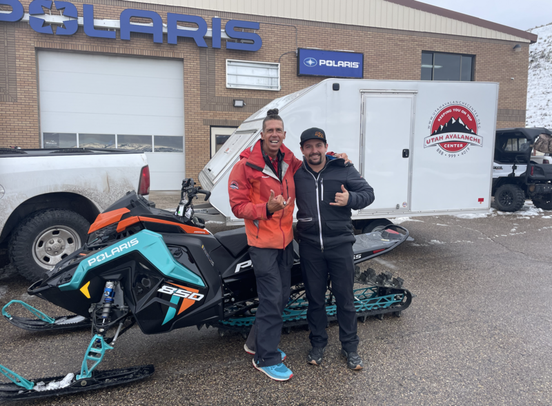
Huge thanks to Rylan from Young Powersports for trusting me with the keys to the backcountry kingdom as well the keys to this 2023 Polaris. The decades old "loaner sled" partnership with Polaris allows me to see more terrain, issue more accurate forecasts, and ultimately saves lives! Note to self... always remember to grab the keys to the sled before leaving the dealer :)

We are always looking for snow and avalanche observations or just general riding conditions. So... if you see something, say something. You can reach me directly at [email protected] or 801-231-2170.
Also, if you're looking for more avy education opportunities for yourself, your crew, or your club please don't hesitate to reach out to me and we'll find a presentation, class, or clinic for ya!
General Announcements

Issued at 07:00 on Saturday, December 17th this forecast will be updated by 0700 Monday, December 18th, 2023.
This forecast is from the U.S.D.A. Forest Service, which is solely responsible for its content. This forecast describes general avalanche conditions and local variations always occur.