Join us for the 17th Annual Professional Snow and Avalanche Workshop (PROSAW) on November 4 - Purchase tickets here!

Forecast for the Logan Area Mountains

Toby Weed
Issued by Toby Weed on
Wednesday morning, December 13, 2023
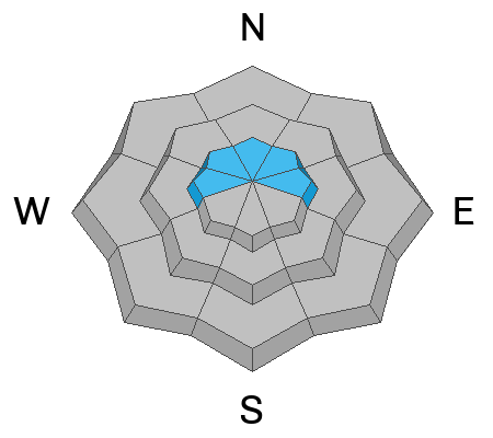
Areas of MODERATE danger exist in some terrain at upper elevations. People could encounter hard wind slabs in unexpected places because of drifting from strong winds blowing from the east. Dangerous avalanches failing on a persistent weak layer from November are unlikely but possible on slopes steeper than 30 degrees in isolated terrain with thin snow cover and poor snowpack structure.

Evaluate snow and terrain carefully, especially in high, drifted terrain.
Low
Moderate
Considerable
High
Extreme
Learn how to read the forecast here
Special Announcements
Join the UAC and Young Powersports in Centerville on Thursday, December 14, from 5 - 7 PM for a FREE avalanche transceiver training. Details here.
Weather and Snow
The Tony Grove Snotel at 8400' reports 52 inches of total snow, and it's 23 F. East winds are cranking on Logan Peak, with the CSI weather station reporting sustained average wind speeds around 46 mph and gusts of near 70 mph. The wind sensor on Paris Peak is still rimed or iced up and not reporting. Observers report encountering a thin rime crust near the surface of the powder in upper-elevation meadows in the Central Bear River Range, and we also found a very thin surface crust in east facing terrain near Logan Peak yesterday.

Expect mostly sunny weather in the mountains today, with 8500' high temperatures around 27 F and sustained winds blowing from the east. These should diminish significantly this evening.

High pressure is expected to dominate the weather pattern for a while, and no storms are in the current forecast. However, confidence is low, but some hope exists for early next week with a series of weak systems that may bring some snow.
Recent Avalanches
No avalanches were reported in the Logan Zone since the widespread natural cycle occurred on December 3 and 4.
Visit our avalanche page to check out this season's avalanche activity from the Bear River Mountains and across Northern Utah.
Ad
Avalanche Problem #1
Persistent Weak Layer
Type
Location
Likelihood
Size
Description
Up high and on slopes facing west, north, and east, avalanches failing on a persistent weak layer are possible in isolated outlying terrain where previously wind-drifted snow overlies weak, sugary snow from November. Dangerous hard slab avalanches are increasingly unlikely as the shallow, sugary snow from November is buried and pressed into terrain anchors by a deep layer of heavy, hardening snow.
  • Unlikely avalanches failing on a persistent weak layer might still be triggered remotely, from a distance, or below.
  • Cracking and collapsing (or whumpfs) are definite signs of instability, but they may not be present when avalanches occur.

On Tuesday, we found stable snow in most of the terrain we traveled in. However, we also found areas with poor snowpack structure and weak, sugary, faceted snow lurking near the ground.
Avalanche Problem #2
Wind Drifted Snow
Type
Location
Likelihood
Size
Description
We did not observe much drifting snow from the winds blowing from the east, even at upper elevations, yesterday afternoon. But the winds increased significantly overnight, and they probably created hard drifts or wind slabs in unusual or unexpected places. Some may have formed on slopes with weak surface snow or poor snow structure.
  • Avoid stiffer, drifted snow on the lee side of prominent ridges and in and around terrain features like gullies, sub-ridges, scoops, mid-slope rollovers, and rock outcroppings or cliff bands.
  • Hard wind slabs can allow people to get well out on them before releasing suddenly like a mouse trap.
Additional Information
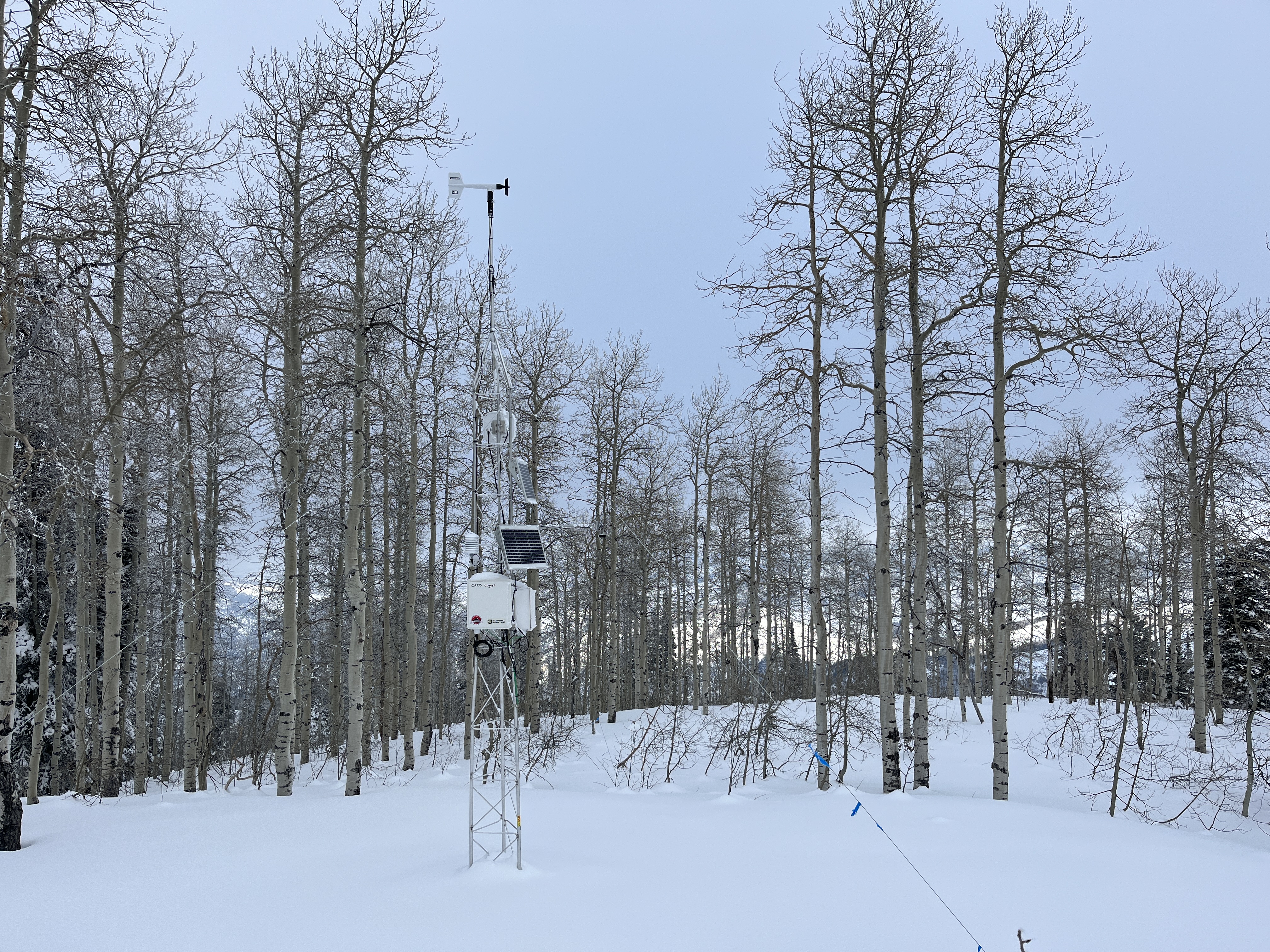
This fall, we installed two new weather stations in the Logan Zone. The Paris Peak Weather Station (available HERE) and the Card Canyon Weather Station (available HERE)
We visited the site on Tuesday, and the Card Canyon weather station looks good and appears to be working well!
General Announcements
  • Taking time to check your companion rescue gear and practice with your transceiver is essential. watch a short video here
  • IMPORTANT: Read Mark's blog about electromagnetic interference of avalanche transceivers HERE
  • Our 20th annual Pray For Snow fundraiser party was a huge success. Thanks for coming and showing your support!
  • We will update this forecast by 7:30 Friday morning.
This forecast is from the U.S.D.A. Forest Service, which is solely responsible for its content. This forecast describes general avalanche conditions, and local variations always occur.