A quick hitting but warm and wet storm system from the southwest is currently overhead, bringing additional rain and snow to the mountains.
As of 6am, the rain/snow line appears to be at or above 9000' with 2-3" of heavy dense snow reported across the central Wasatch. Snow-water-equivalents are roughly 0.5-.82". Mountain temperatures are in the mid-to-upper 30s; winds are from the southwest, blowing 20mph with gusts to 35. The highest elevations are gusting to 40mph.
The firehose has its sights set squarely on the Provo area mountains - upwards of 1.25"-1.75" of precipitation has been recorded already near Sundance resort on Timpanogos with at-times hourly rates of 0.41" liquid water per hour. In the highest elevations, you might find 8-12" of dense snow, but you'd have to suffer through heavy rain to get there. The Ogden mountains are reporting just an inch or two of new snow with 0.3" of snow-water equivalent.
For today, expect rain and snowfall to peak this morning with showers and flurries possibly continuing through early afternoon. The rain/snow line will gently drop to 8500' or so. The next storm arrives this weekend that will bring another good round of snow.
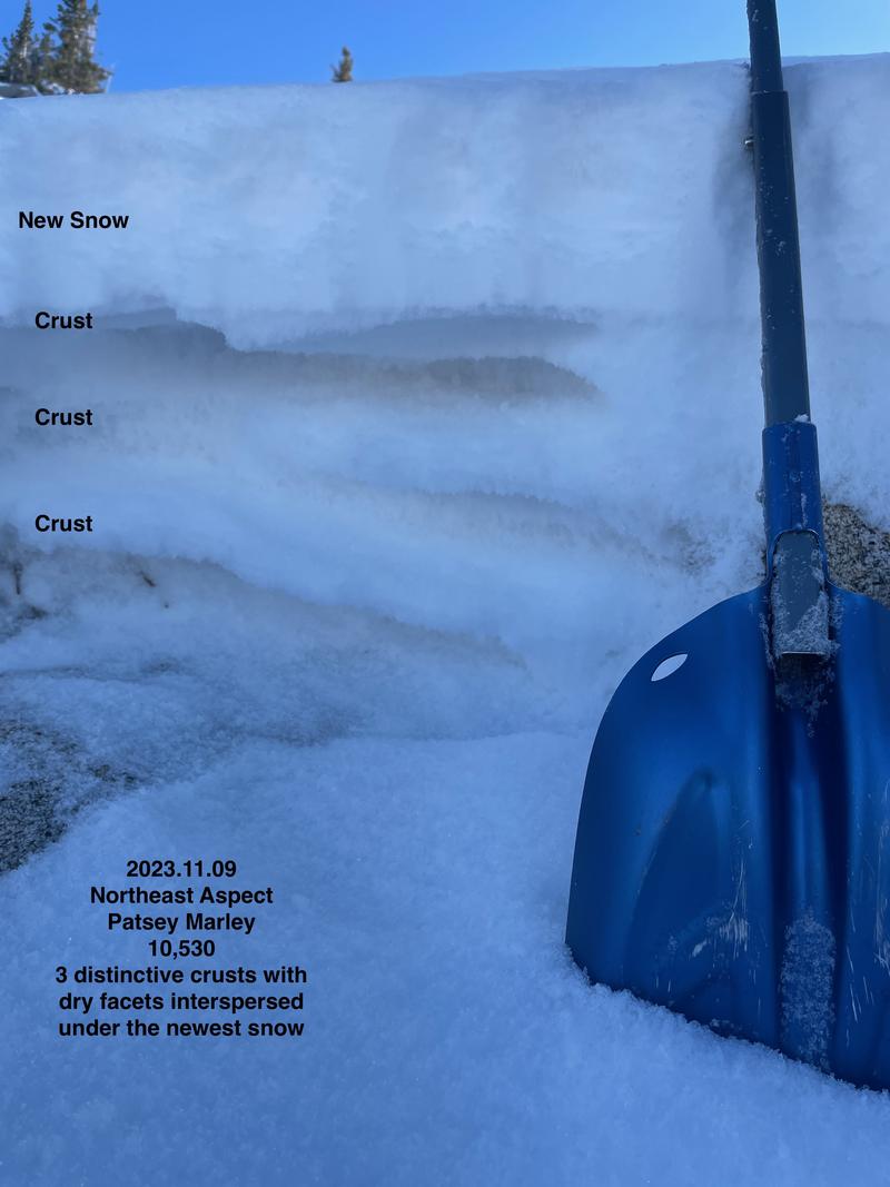
Prior to this storm, most of the southerly and westerly aspects were bone dry. The mid and upper elevation northerly aspects, however, held a mess of 12-18" of wind and temperature crusts interspersed with weak sugary snow (photo Kelly, Kelly, Grainger below). I would view this as a poor basal structure for a snowpack. Remember, anytime there is enough snow to ride, there is enough snow to slide.


