Join us at our 2nd Annual Blizzard Ball

Forecast for the Uintas Area Mountains

Craig Gordon
Issued by Craig Gordon on
Sunday morning, January 8, 2023
The snowpack is becoming comfortable in its own skin, but we're not out of the woods just yet-
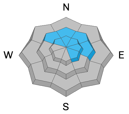
CONSIDERABLE avalanche danger is found on steep, upper elevation slopes in the wind zone at and above treeline. The danger is most pronounced in terrain facing the north half of the compass, particularly on slopes with an easterly component to their aspect. Human triggered avalanches are LIKELY. Pockety and a little more predictable, don't get surprised... steep, mid elevation terrain near treeline is a player as well. You'll find MODERATE avalanche danger and human triggered avalanches are POSSIBLE on steep, shady slopes. Generally LOW avalanche danger is found on west, south, and southwest facing slopes and all aspects below treeline.
My exit strategy... I'm shifting from mini golf to chip and putt.
Meaning... I'm still keeping it super conservative, but starting to step out into steeper terrain, especially mid and low elevation slopes facing the south half of the compass (where the avy danger is generally LOW), but doing so on slopes with little to no consequence.

Low
Moderate
Considerable
High
Extreme
Learn how to read the forecast here
Weather and Snow
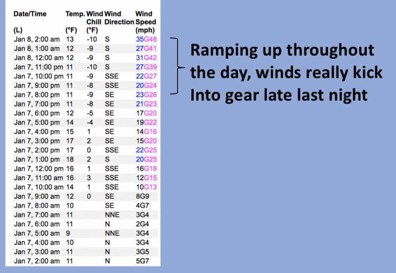
Nowcast- High pressure shifted east of our area overnight, opening the door to thickening clouds early this morning ahead of a weak storm slated to slide through the region later today. While we're waiting, temperatures are crisp and register in the mid teens. Southerly winds are doing their pre-storm thing and began ramping into the 30's right after supper time Saturday and continue in that spirit early this morning with gusts in the 40's near the high peaks. Our big open bowls are taking a hit from the strong winds, but lose some elevation and seek out wind sheltered terrain and you'll be rewarded with cold, creamy snow on a go-anywhere base.
Forecast- Look for increasing clouds along with southwest winds bumping into the 60's along the high ridges. High temperatures climb into the upper 20's with light snow developing late in the day. Nothing to get too excited about, just a trace or so by sunset.
Futurecast- Yet another warm, wet, and windy atmospheric river slides through the area late Monday into Wednesday. A southerly flow Monday night brings very strong winds along with dense, heavy snow which favors the Mirror Lake to Daniels zone. Colder air filters in late Tuesday into Wednesday which lights up the North Slope. In either case, a solid foot of snow is a good bet.
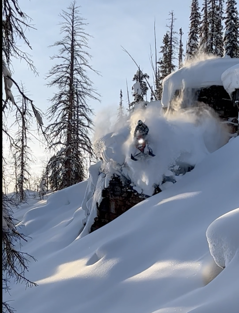
My Pillow Guy, Dan G, not gettin' much sleep while bustin' some pillowy, Utah rock-drops.

Huge thanks for all the great obs streaming in from the eastern front. Detailed trip reports and recent obs are found HERE.
Recent Avalanches
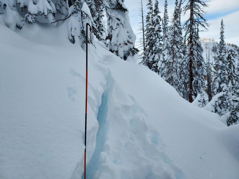
Micheal J was in lower Weber Canyon yesterday, experienced a large collapse, and notes... "I wasn't planning on writing a report today, however, on my way out of Weber Canyon I discovered this nasty collapse at 10k that failed 220 cms. to the ground and moved about 6 inches down slope before arresting." Big food for thought that not every slope has adjusted to the big New Years storm. MJ's writeup is found HERE.
No significant recent avy activity but a slew of Uinta avy obs are found HERE.
Ad
Avalanche Problem #1
Persistent Weak Layer
Type
Location
Likelihood
Size
Description
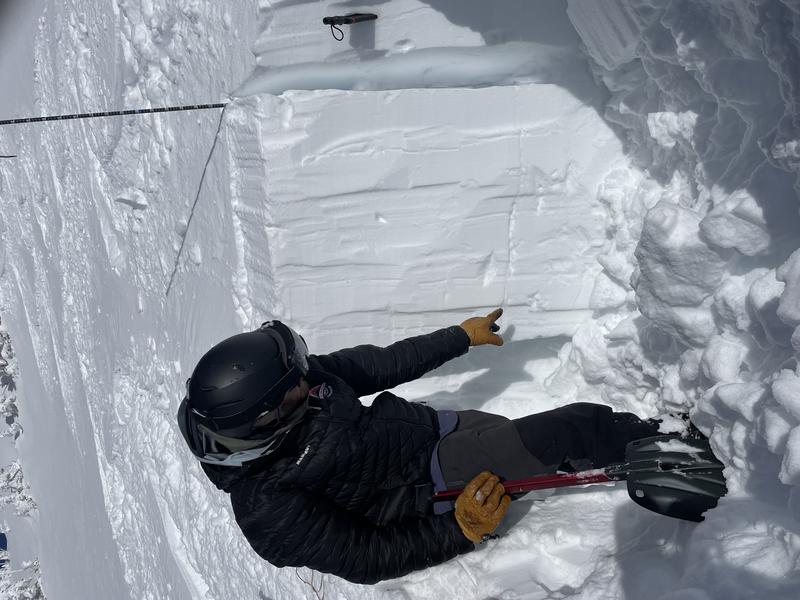
My colleague Andrew Nassetta (snow-pro, avy forecaster, and educator of all things avalanche extraordinaire) points to our PWL now deeply buried and getting harder to provoke.
We are trending towards equilibrium as our snowpack adjusts to the big New Years storm... good news. In fact, the lack of recent avalanche activity suggests each day we get closer to the snowpack becoming more comfortable in its own skin... more good news. Now for the buzz-kill... all we need to do is find one weakness in the pack, pull the rug out from underneath, and the entire roof crashes down on us. No, it's not like last weekend when the walls were caving in and that'll make today that much more deceptive. Now is the time to start stepping out cautiously, gathering as much snowpack intel we can along the way. Stomp on small steep test slopes and road cuts and see how they're reacting before setting your sights on a big, committing line. And if it isn't feeling right, pump the brakes and recalibrate your objectives, because with all the great low angle riding available, there's no reason to pull on the avalanche dragons tail.

Avalanche Problem #2
Wind Drifted Snow
Type
Location
Likelihood
Size
Description
A 24 hour data dump from Lofty Lake Peak (11,186') clearly shows winds ramping up in the past couple of hours.
There's no shortage of snow available to blow around and form fresh drifts that'll react to our additional weight. Found mostly on the leeward side of upper elevation ridges, I wouldn't be too surprised to find drifting around terrain features like chutes and gullies. In either case, the key to riding safely is simply avoiding fat rounded pillows of snow, especially if they're sounding hollow like a drum. Lose a little elevation, you lose the wind, and you lose the problem.... done, done, and done :)
Additional Information
Weather stations-
And... we were super busy this summer upgrading the western Uinta weather station network and this real-time winter info is found HERE (click weather stations, and then on the Western Uinta tab)
Observations-
Your observations are important, so please let me know what you're seeing... click HERE and contribute to this amazing community-based program
General Announcements
Issued at 03:41 on Sunday January 8th, this forecast expires 24 hours after the date and time posted, but will be updated by 07:00 Monday January 9th, 2023.
Before it gets too crazy, now is the time to book an avalanche awareness presentation for your group, club, or posse. You can reach Craig directly at 801-231-2170 or [email protected].

This forecast is from the U.S.D.A. Forest Service, which is solely responsible for its content. This forecast describes general avalanche conditions and local variations always occur.