Join us at our 2nd Annual Blizzard Ball

Forecast for the Uintas Area Mountains

Craig Gordon
Issued by Craig Gordon on
Saturday morning, January 7, 2023
The pow is deep, the skies are clear, and the stoke is high... it's days like this we do, what we do. It's also a trifecta of elements aligning for deceptively tricky avalanche conditions, because any slide that fails on weak, sugary, midpack snow is gonna be deep and dangerous, instantly ruining our day.
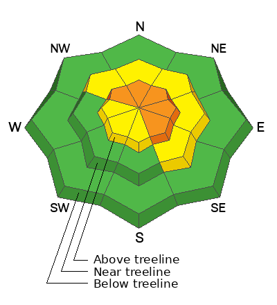
CONSIDERABLE avalanche danger is found on steep, upper elevation slopes in the wind zone at and above treeline. The danger is most pronounced in terrain facing the north half of the compass, particularly on slopes with an easterly component to their aspect. Human triggered avalanches LIKELY. Pockety and a little more predictable, don't get surprised... steep, mid elevation terrain near treeline is a player as well. You'll find MODERATE avalanche danger with human triggered avalanches involving the New Years storm snow POSSIBLE on steep, shady slopes. LOW avalanche danger is found on all aspects below treeline.
My exit strategy... I'm continuing my mini golf mindset.
Meaning, I'm keeping it super conservative and just starting to step out into steeper, lower elevation terrain (where the avy danger is LOW), but doing so on slopes with little to no consequence
Low
Moderate
Considerable
High
Extreme
Learn how to read the forecast here
Weather and Snow
Nowcast- Late night cold air delivered a two inch nightcap to yesterday's storm snow with region-wide snow totals topping off at 6" snow with .40 H2O in the past 24 hours. Westerly winds blowing less than 10 mph hardly spin ridgetop anemometers while temperatures register in the upper teens and low 20's. Skies cleared at the turn of the new day, as the first full moon of 2023 illuminates our mountains. On a go-anywhere base, riding and turning conditions are as good as they get!
Forecast- Look for partly cloudy skies with temperatures rising into the upper 20's and low 30's. Southwesterly winds bump into the 20's and 30's near the high peaks by sunset and overnight lows dip into the mid teens.
Futurecast- A weak storm clips northern Utah tomorrow, bringing light snow into the region late in the day, lingering into early Monday. A stronger storm is slated for midweek.
Thursday, Mark, Joey, and Weston D took to the North Slope, rode hard, and covered lotsa ground. A great writeup from this solid crew is found HERE.
Weston Shirey was near Wolf Creek yesterday and offers some great insight with his detailed trip report.

Lots of excellent trip reports and recent obs are found HERE.
Recent Avalanches
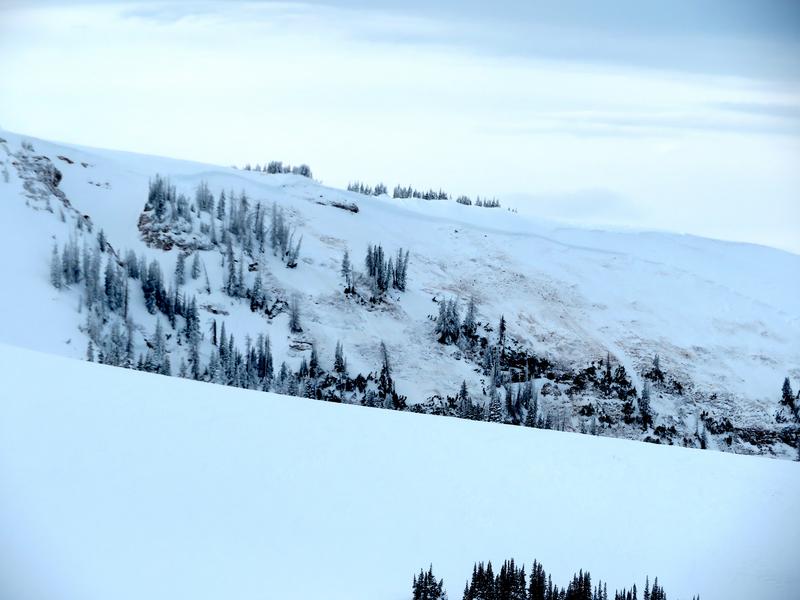
No significant avy activity from yesterday, though local avy-savvy snow-pro, forecaster extraordinaire, but more importantly, wonderful human, Bill Nalli checks in from Upper Weber Canyon on Thursday and reports... "Southwest wind picked up overnight Wed 1/4 and increased into the mid 30's at the most exposed ridgelines by early morning. It only took about 5-6 hours of this wind to add a new load big enough to trigger this slide. A significant sign that the lingering PWL problem is still alive and well, even if it's gotten more stubborn and difficult to trigger. A couple of trends were noting are that most recent big avalanches are failing in the alpine steepest terrain (39 deg and above) as well as very low on the slope along steep gully walls."
Additional avy activity and a slew of Uinta obs are HERE.
Ad
Avalanche Problem #1
Persistent Weak Layer
Type
Location
Likelihood
Size
Description
\
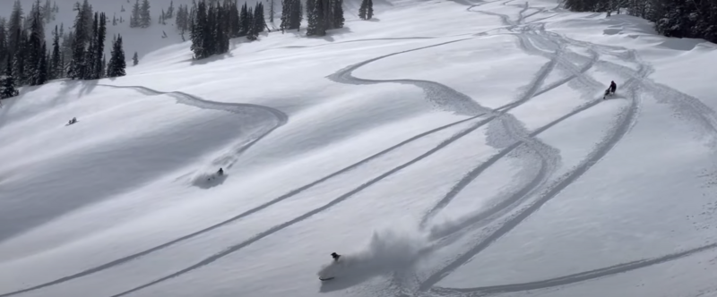
Mark Staples most excellent viddy above, very accurately describes our current snowpack setup.
We are trending towards equilibrium and the snowpack is becoming more comfortable as it adjusts to the big New Years storm... good news. But here's the problem... the range is fat and white, and offers riding on a go anywhere base. That combo often lures us into thinking we're good to go. However, let's not lose sight on the mid November weak snow (PWL) now buried deep in the midpack just yet. In fact, recent avalanche activity suggests all we need to do is find one weakness in the pack, pull the rug out from underneath, and the entire roof crashes down on us. No, it's not like last weekend when the walls were crashing in and that'll make today that much more deceptive.
Now is the time to start stepping out cautiously, gathering as much snowpack intel we can along the way. Stomp on small steep test slopes and road cuts and see how they're reacting before setting your sights on a big, committing line. And if it isn't feeling right, pump the brakes and recalibrate your objectives, because with all the great low angle riding available, there's no reason to pull on the avalanche dragons tail.

Avalanche Problem #2
Wind Drifted Snow
Type
Location
Likelihood
Size
Description
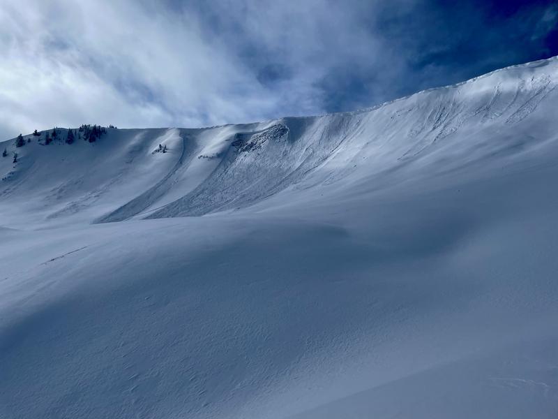
This image from midweek clearly illustrates a seemingly manageable wind drift breaking to weaker layers of snow buried deeper in the snowpack as it crashes down onto the slope below.
Found on the leeward side of upper elevation ridges, a few wind drifts linger from recent winds. No quite as sensitive as in recent days, they'll still react to our additional weight today. The key to riding safely is simply avoiding fat rounded pillows of snow, especially if they're sounding hollow like a drum. Lose a little elevation, you lose the wind, and you lose the problem.... done, done, and done :)
Additional Information
Weather stations-
And... we were super busy this summer upgrading the western Uinta weather station network and this real-time winter info is found HERE (click weather stations, and then on the Western Uinta tab)
Observations-
Your observations are important, so please let me know what you're seeing... click HERE and contribute to this amazing community-based program
General Announcements
Issued at 03:41 on Saturday January 7th, this forecast expires 24 hours after the date and time posted, but will be updated by 07:00 Sunday January 8th, 2023.
Before it gets too crazy, now is the time to book an avalanche awareness presentation for your group, club, or posse. You can reach Craig directly at 801-231-2170 or [email protected].

This forecast is from the U.S.D.A. Forest Service, which is solely responsible for its content. This forecast describes general avalanche conditions and local variations always occur.